


Get to know Hezheng County
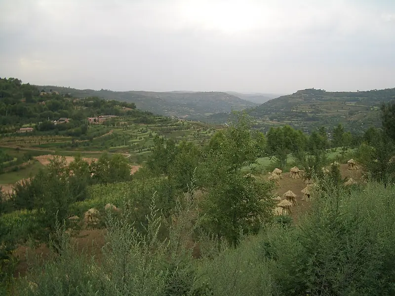
Photo adjustments
Full frame retained; EXIF orientation normalized, proportionally resized to at most 800 pixels and converted to WebP. No generated pixels or subject changes. Cards may crop the display.
- Administrative area
- County · 县
- Part of
- Linxia Hui Autonomous Prefecture
- Chinese name
- 和政县
- Local areas
- County guide
Area & population
- Area in the source
- 960.00 km²
- Population · 2020
- 204,529
- Administrative seat
- Chengguan
Source: cited geographic source, as of the dates shown.
What to see
The Hezheng Paleozoological Museum (和政古动物化石博物馆) in Chengguan town (城关镇) was founded in 2003 and is a national second-grade museum holding more than 30,000 fossils of ancient animals. The prefecture government credits the collection with six "world records", among them the Hezheng sheep (和政羊), known from nowhere else, the richest collection of shovel-tusked elephant (铲齿象) fossils and the earliest woolly rhinoceros skull.
At Hualin (桦林), 16 kilometres south of the county town, four fossil faunas lie one above another. Giant rhinoceroses about 30 million years old sit in red conglomerate at the base, followed by shovel-tuskers of about 16 million years, three-toed horses of about 12 million years in red clay, and true horses of about 2 million years in the loess on top. The site has an in-situ burial hall and an exposed geological section.
Songmingyan in Songming town (松鸣镇) is a provincial scenic area and a national forest park. Temples from the Chenghua (成化) reign of the Ming, including the Jade Emperor Pavilion (玉皇阁), the Holy Mother Palace (圣母宫) and Dugang Temple (独岗寺), are set into the cliffs. The name, "pine-sounding cliffs", comes from wind in the pines roaring along the gorge. The county annals date the founding of Songmingyan Temple (松鸣岩寺) to 1404-1437; the revolutionary martyr Leba Buddha (肋巴佛) took his monastic vows there.
The Leba Buddha Revolutionary Memorial (肋巴佛革命纪念馆) commemorates him as one of the main leaders of a peasant uprising in southern Gansu, and holds 82 graded relics.
The Songmingyan flower fair
Songmingyan is the traditional venue of Hezhou "hua'er" (河州花儿) folk songs, also called "shaonian" (少年). The fair, popularly called the "Fourth Month Eighth" (四月八) fair, begins on the 26th day of the fourth lunar month at Songmingyan, whose three peaks are named Nantianmen (南天门), Xifangding (西方顶) and Dugangling (独岗岭). It dates from the Ming, and some singers are accompanied by the mimi (咪咪), suona and other instruments. It entered the first national list of intangible cultural heritage in May 2006.
Food and local products
Hezhou baozi (河州包子) are steamed buns of leavened dough. One recipe mixes carrot, minced mutton, spring onion and spinach, then adds mutton fat melted over high heat; the greens change with the season, from yellow chives in winter to chive shoots in summer. The steamed buns are eaten dipped in chilli oil and aged vinegar. Hezheng's baozi family also includes hezi (合子), with an exposed filling mostly of sugar and walnut, and triangular or half-moon jiaomo (角馍).
Highlights
- Hezheng Paleozoological Museum 和政古动物化石博物馆: National second-grade museum founded in 2003 with more than 30,000 fossils, including the Hezheng sheep.
- Hualin fossil site 桦林: In-situ burial hall and geological section showing four fossil faunas from about 30 to 2 million years ago.
- Songmingyan 松鸣岩: National forest park with Ming-dynasty cliff temples and a flower fair listed as national intangible heritage in 2006.
- Leba Buddha Revolutionary Memorial 肋巴佛革命纪念馆: Memorial to a leader of a peasant uprising in southern Gansu, with 82 graded relics.
- Hezhou baozi 河州包子: Leavened steamed buns with mutton, carrot and seasonal greens, eaten with chilli oil and vinegar.
Sources for this guide
和政县 - 维基百科,自由的百科全书 · Wikipedia (Chinese) · CC BY-SA 4.0
和政县古动物化石博物馆(AAAA) · Linxia Hui Autonomous Prefecture People's Government
和政县松鸣岩景区(AAAA) · Linxia Hui Autonomous Prefecture People's Government
【国家级非物质文化遗产】松鸣岩花儿会 · Linxia Hui Autonomous Prefecture People's Government
和政县桦林万兽谷景区(AAAA) · Linxia Hui Autonomous Prefecture People's Government
和政县肋巴佛革命纪念馆简介 · Hezheng County People's Government
舌尖上的和政之【河州包子】 · Hezheng County People's Government
Original English written from the listed sources and checked sentence by sentence against quoted extracts by a separate reviewer. Updated 2026-09-23.
Explore Hezheng County
Core places to explore, with English and Chinese names.
Places to explore around Hezheng County
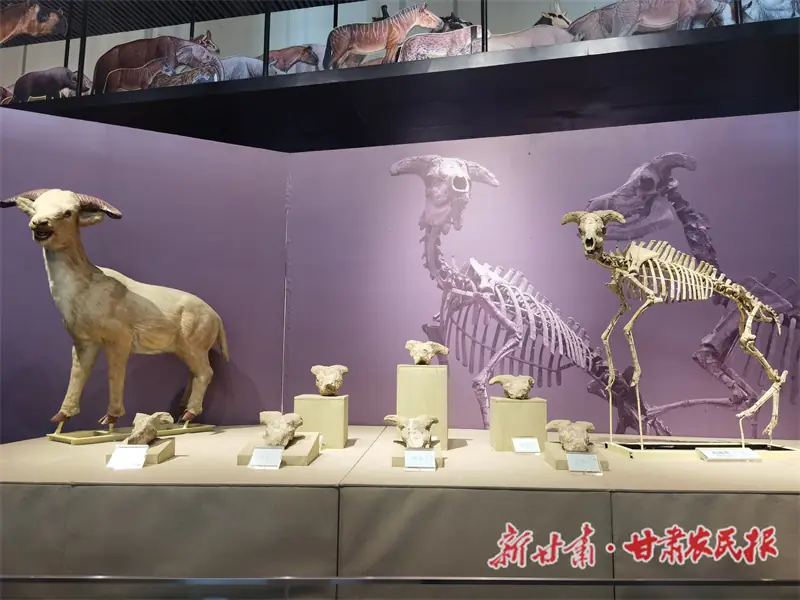 Hezheng Paleozoological Museum · 和政古动物化石博物馆
Hezheng Paleozoological Museum和政古动物化石博物馆
The Hezheng Ancient Animal Fossil Museum (和政古动物化石博物馆) stands in Liangjiazhuang village, Chengguan town, Hezheng County, Linxia Hui Autonomous Prefecture, Gansu, and its own website gives free admission with timed, real-name booking.
Read the place guide →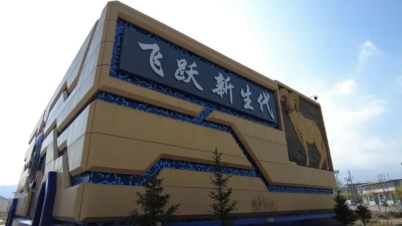 Songmingyan Scenic Area · 松鸣岩
Songmingyan Scenic Area松鸣岩
Songmingyan (松鸣岩) is a mountain scenic area in Hezheng County, Linxia Hui Autonomous Prefecture, Gansu, 23 km south of the county town, which the Linxia Daily page records as a national 4A-grade tourist scenic area.
Read the place guide →Plan your visit
Getting there
Hezheng County is about 25 km in a straight line from central Linxia Hui Autonomous Prefecture. Search for 和政县 in a map app to find stations and your accommodation.
Where to stay →Build your route
Hezheng Paleozoological Museum and Songmingyan Scenic Area are both listed here. The linked place guides have entrance and visit details.
Continue with Linxia Hui Autonomous Prefecture →More in Linxia Hui Autonomous Prefecture
Sources & geographic information
Administrative names and parent areas: Official geographic directory · Reference date 2026-09-06.
Some facts checked against 和政县 — Wikipedia contributors, CC BY-SA 4.0.
Photo: Hezheng Paleozoological Museum · Source photographer · License not provided. EXIF orientation normalized; resized without changing aspect ratio; converted to WebP. No subject edits.
Photo: Songmingyan Scenic Area · Source photographer · License not provided. EXIF orientation normalized; resized without changing aspect ratio; converted to WebP. No subject edits.
Map data © OpenStreetMap contributors. Pins mark approximate centres, not entrances or boundaries.