


Get to know Liwan District
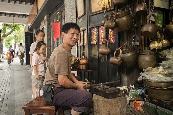
Photo adjustments
Full frame retained; proportionally resized and converted to WebP. No retouching or changes to the photographed subject. Card displays may crop the view.
- Administrative area
- District · 市辖区
- Part of
- Guangzhou
- Chinese name
- 荔湾区
- Local areas
- District guide
Area & population
- Area in the source
- 62.40 km²
- Population · 2023
- 1,113,000
Source: cited geographic source, as of the dates shown.
History
The district takes its name from Lychee Bay (荔枝湾). The area was the old western suburb of the walled city, known as Xiguan (西关), where wealthy merchants lived. It holds the site of the Huaiyuan Hostel (怀远驿), a Ming dynasty office for overseas trade, and the site of the Thirteen Factories (十三行), which between 1757 and 1842 were China's only port open to foreign trade. In the ninth year of the Xianfeng (咸丰) reign, Shamian (沙面) was leased to Britain and France as a concession.
The West District was renamed Liwan in August 1960. In May 2005 the former Fangcun District (芳村区) was merged into Liwan, and Liwan now spans both banks of the river.
What to see
The Chen Clan Ancestral Hall (陈家祠), also called the Chen Clan Academy (陈氏书院), was built between 1888 and 1894 with money from Chen lineages across Guangdong, as lodging for clansmen coming to the provincial capital for the imperial examinations and other business. It is laid out on three axes with nine halls and six courtyards, and houses the Guangdong Folk Arts Museum (广东民间工艺博物馆), with Shiwan pottery, Canton porcelain and Cantonese embroidery.
On Shamian, 53 buildings of high heritage value survive, in styles ranging from early British and French colonial to eclectic revival. Yongqingfang (永庆坊) is a historic Xiguan block on Enning Road (恩宁路), an arcade-house street, renovated into a commercial quarter. Lychee Bay was the setting of "Fishermen's Songs at Liwan" (荔湾渔唱), one of the old Eight Views of Guangzhou. The district government also lists the Renwei Temple (仁威祖庙), a Taoist temple, the Cantonese opera guild hall Bahe Huiguan (八和会馆) and the ancestral home of Bruce Lee (李小龙祖居).
Food and local customs
The district government's motto for its food is "eat in Guangzhou, taste in Xiguan, from Pantang" (食在广州、味在西关、源自泮塘). Pantang (泮塘) was known in the Ming for its "five shoots" (五秀): lotus root, water chestnut, water caltrop, arrowhead and water bamboo. Boat congee (艇仔粥) began on small boats that sold bowls to visitors on the Lychee Bay waterways; it is cooked to order with fresh river shrimp or sliced fish, later joined by jellyfish, fried peanuts, spring onion and ginger. Other local names include Nanxin (南信) double-skin milk, Pantang water chestnut cake and Yinji (银记) rice-noodle rolls.
Kengkou village (坑口村) in former Fangcun holds a Lettuce Fair (生菜会) from the 25th to the 27th day of the first lunar month, listed as city-level intangible heritage in 2007.
Highlights
- Chen Clan Ancestral Hall 陈家祠: Joint clan hall of Guangdong's Chen lineages, built 1888-1894; home of the Guangdong Folk Arts Museum.
- Shamian 沙面: Former British and French concession with 53 buildings of high heritage value.
- Yongqingfang 永庆坊: Historic Xiguan block on the arcade-house street Enning Road, renovated into a commercial quarter.
- Lychee Bay 荔枝湾: The waterway that gave Liwan its name and the setting of one of the old Eight Views of Guangzhou.
- Boat congee 艇仔粥: Congee first sold from small boats on Lychee Bay, made with river shrimp or fish.
Sources for this guide
荔湾概述 广州市荔湾区人民政府门户网站 · Liwan District People's Government, Guangzhou
陈家祠 广州市荔湾区人民政府门户网站 · Liwan District People's Government, Guangzhou
沙面建筑群 广州市荔湾区人民政府门户网站 · Liwan District People's Government, Guangzhou
永庆坊 广州市荔湾区人民政府门户网站 · Liwan District People's Government, Guangzhou
荔湾艇仔粥 广州市荔湾区人民政府门户网站 · Liwan District People's Government, Guangzhou
荔湾区 - 维基百科,自由的百科全书 · Wikipedia · CC BY-SA 4.0
Original English written from the listed sources and checked sentence by sentence against quoted extracts by a separate reviewer. Updated 2026-09-25.
Explore Liwan District
Core places to explore, with English and Chinese names.
Places to explore around Liwan District
 Yongqingfang and Enning Road · 永庆坊与恩宁路
Yongqingfang and Enning Road永庆坊与恩宁路
Yongqingfang and Enning Road (永庆坊与恩宁路) form a quarter in the Xiguan district of Liwan, Guangzhou, where the city's best-preserved arcade street has been repaired block by block rather than redeveloped.
Read the place guide →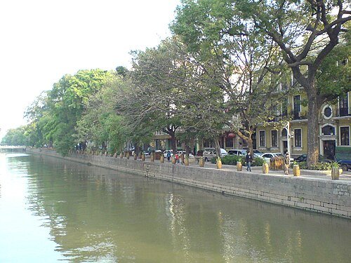 Shamian Island · 沙面
Shamian沙面
Shamian is a small island in Guangzhou’s Liwan district whose streets preserve the physical setting of the former British and French concessions. Tree-lined avenues and European-style buildings give the area a different rhythm…
Read the place guide →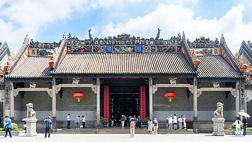 Chen Clan Ancestral Hall · 陈家祠
Chen Clan Ancestral Hall陈家祠
The Chen Clan Ancestral Hall was built by related Chen families as a place for education and preparation for the imperial examinations. Its southern-facing complex is arranged along a north–south axis, with halls and courtyards…
Read the place guide →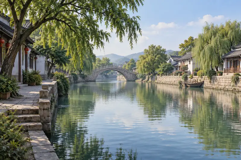 AI illustration · AI 示意图(仅供参考,非该地点实拍)
Lychee Bay荔枝湾
Creek network in western Guangzhou that named Liwan District: a Southern Han garden site and Ming scenic spot, reopened in 2010 with rebuilt bridges.
Read the place guide →Plan your visit
Getting there
Liwan District covers the centre of Guangzhou. Search for 荔湾区 in a map app to find stations and your accommodation.
Where to stay →Build your route
Yongqingfang and Enning Road and Shamian are both listed here. The linked place guides have entrance and visit details.
Continue with Guangzhou →More in Guangzhou
Sources & geographic information
Administrative names and parent areas: Official geographic directory · Reference date 2026-09-06.
Some facts checked against 荔湾区 — Wikipedia contributors, CC BY-SA 4.0.
Photo: Yongqingfang and Enning Road · PQ77wd · CC BY-SA 4.0. EXIF orientation normalized; resized without changing aspect ratio; converted to WebP. No subject edits.

Photo: Shamian · David Wong · CC BY-SA 3.0. Wikimedia thumbnail; fitted to the ranking-card frame.

Photo: Chen Clan Ancestral Hall · Shujianyang · CC BY-SA 4.0. Wikimedia thumbnail; fitted to the ranking-card frame.

Map data © OpenStreetMap contributors. Pins mark approximate centres, not entrances or boundaries.