


Get to know Nanxiong
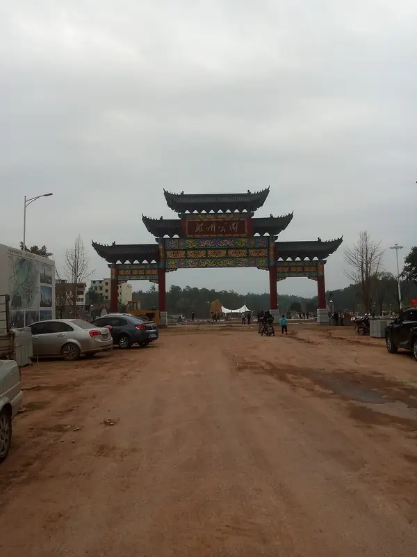
Photo adjustments
EXIF orientation normalized; resized without changing aspect ratio; converted to WebP. No subject edits.
- Administrative area
- County-level city · 县级市
- Part of
- Shaoguan
- Chinese name
- 南雄市
- Local areas
- County-level city guide
Area & population
- Area in the source
- 2,361.40 km²
- Population · 2020
- 353,916
Source: cited geographic source, as of the dates shown.
Setting and landscape
Mountain ranges run along the north and south of the city, with hills and a basin between. The main peaks of the northern range are Guanyindong (观音栋), the highest point at 1,429 metres, Maozi Peak (帽子峰) and Youshan (油山). The Zhen River (浈江) cuts diagonally across the centre, forming the long, narrow basin geologists call the Nanxiong Basin (南雄盆地). Its red beds, the "Nanxiong red strata", cover some 1,800 square kilometres and are rich in dinosaur and other fossils.
History
The Southern Han set up Xiongzhou (雄州) here in 920, and in 971 the Song renamed it Nanxiong Prefecture, "southern" to tell it apart from a Xiongzhou in Hebei. In 1930 the area came under the Central Soviet Area; after the Long March Xiang Ying (项英) and Chen Yi (陈毅) waged three years of guerrilla war here, and Chen Yi wrote his "Three Poems of Meiling" (梅岭三章) in Nanxiong. The Guangdong provincial Communist Party committee moved to Yaokeng (瑶坑) in the winter of 1939. Nanxiong became a city in 1996.
What to see
The Meiguan Ancient Road (梅关古道) in Meiling village (梅岭村), Zhuji town, climbs to the pass called "the first pass of Lingnan"; beside the road are stone steles, the Laiyan Pavilion (来雁亭), Guajiao Temple (挂角寺) and a Sixth Patriarch temple, and it is a 4A scenic area with plum blossom in winter. Zhuji Lane in Zhuji village is also in Zhuji town, as is Daxiong Chan Temple (大雄禅寺), first built in 1275. The Sanying Pagoda (三影塔) is described as the only Song pagoda in Guangdong with a firmly known date.
The Maozi Peak provincial forest park was set up in 2011 on the state-owned Maozi Peak Forest Farm (帽子峰林场). In Pingtian (坪田), 58 kilometres east of the city, a grove of ancient ginkgos has an oldest tree put at more than 1,680 years. Kongjiang (孔江) national wetland park in Wujing (乌迳) is a reservoir said to hold 263 islands, nicknamed "Hundred-Island Lake".
Food and local products
Nanxiong pressed duck (南雄板鸭) is a national geographical-indication product. Yellow tobacco (黄烟) has been grown for over 300 years, and the city calls itself Guangdong's only main ginkgo-growing area.
Highlights
- Meiguan Ancient Road 梅关古道: Post road across the Guangdong-Jiangxi border opened by Zhang Jiuling; 4A scenic area with plum blossom in winter.
- Zhuji Lane 珠玑巷: Regarded as the place of origin of many Cantonese and Hakka families, in Zhuji village.
- Sanying Pagoda 三影塔: Described as Guangdong's only Song pagoda with a firmly known date.
- Maozi Peak Forest Farm 帽子峰林场: State forest farm made a provincial forest park in 2011.
- Pingtian ancient ginkgo grove 坪田古银杏群: Oldest tree put at over 1,680 years; 58 km east of the city.
- Nanxiong pressed duck 南雄板鸭: National geographical-indication product.
Sources for this guide
南雄市 - 维基百科,自由的百科全书 · Wikipedia · CC BY-SA 4.0
南雄概况 - 南雄市人民政府公众信息网 · Nanxiong City People's Government
Original English written from the listed sources and checked sentence by sentence against quoted extracts by a separate reviewer. Updated 2026-09-25.
Explore Nanxiong
Core places to explore, with English and Chinese names.
Places to explore around Nanxiong
 The Meiguan gate on the ancient Meiguan road, Nanxiong · 南雄梅关古道梅岭雄关关楼 Source-recorded photograph date: 2014-01-12 13:57:42.
Meiguan Ancient Road梅关古道
Meiguan Gudao (梅关古道) is the surviving stretch of the old post road over Meiling, also known as Dayuling, in the north of Nanxiong, Shaoguan, Guangdong, on the boundary with Jiangxi. The pass, at over 700 metres, was for centuries the main land link between the Yangtze and Pearl River systems.
Read the place guide →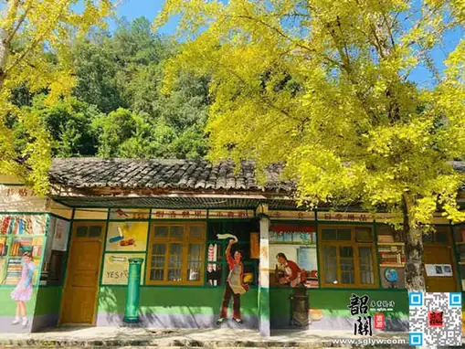 Maozifeng Forest Farm · 帽子峰林场
Maozifeng Forest Farm帽子峰林场
Maozifeng Forest Farm (帽子峰林场) is a state forest unit in Nanxiong, Shaoguan, Guangdong, whose grounds form the Maozifeng provincial forest park. It is best known for the ginkgo trees that turn gold in late autumn.
Read the place guide →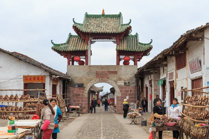 The gate tower of Zhuji Ancient Lane (Zhu Ji Gu Xiang), Nanxiong, over the historic street lined with vendors · 韶关市南雄市珠玑古巷门楼及老街 Source-recorded photograph date: 2014-01-12 10:28:38.
Zhuji Ancient Lane珠玑古巷
Zhuji Ancient Lane (珠玑古巷) is a cobbled street in Zhuji town, Nanxiong, Shaoguan, Guangdong, remembered as the staging point from which families who had crossed the Meiling pass moved on into the Pearl River Delta. It is regarded as an ancestral home of the Guangfu, the Cantonese-speaking people of the delta.
Read the place guide →Plan your visit
Getting there
Nanxiong is about 80 km in a straight line from central Shaoguan. Search for 南雄市 in a map app to find stations and your accommodation.
Where to stay →Build your route
Meiguan Ancient Road and Maozifeng Forest Farm are both listed here. The linked place guides have entrance and visit details.
Continue with Shaoguan →More in Shaoguan
Sources & geographic information
Administrative names and parent areas: Official geographic directory · Reference date 2026-09-06.
Some facts checked against 南雄市 — Wikipedia contributors, CC BY-SA 4.0.
Photo: Meiguan Ancient Road · Zhangzhugang · CC BY-SA 3.0. Full frame retained; proportionally resized and converted to WebP. No retouching or changes to the photographed subject. Card displays may crop the view.

Photo: Maozifeng Forest Farm · Source photographer · License not provided. EXIF orientation normalized; resized without changing aspect ratio; converted to WebP. No subject edits.
Photo: Zhuji Ancient Lane · Zhangzhugang · CC BY-SA 4.0. Full frame retained; proportionally resized and converted to WebP. No retouching or changes to the photographed subject. Card displays may crop the view.

Map data © OpenStreetMap contributors. Pins mark approximate centres, not entrances or boundaries.