


Get to know Ruyuan Yao Autonomous County
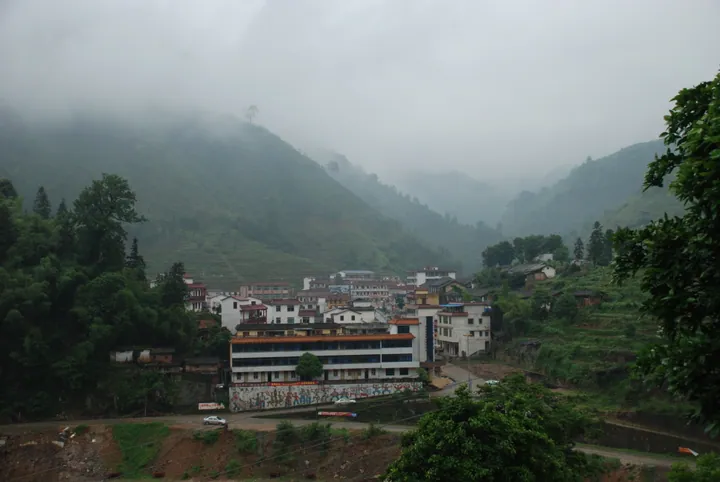
Photo adjustments
Full frame retained; proportionally resized and converted to WebP. No retouching or changes to the photographed subject. Card displays may crop the view.
- Administrative area
- Autonomous county · 自治县
- Part of
- Shaoguan
- Chinese name
- 乳源瑶族自治县
- Local areas
- Autonomous county guide
Area & population
- Area in the source
- 2,227.00 km²
- Population · 2020 census
- 187,276
- Administrative seat
- Rucheng
Source: cited geographic source, as of the dates shown.
Setting and landscape
The land is high in the northwest and falls to the southeast, down to hills and plains below 300 metres from the northeast to the southeast. On the Hunan border stands Mengkengshi (猛坑石), also called Shikengkong (石坑崆), at 1,902 metres Guangdong's highest peak. The Wu River (武江) enters from Lechang (乐昌) and passes Guitou (桂头镇) on its way to Shaoguan; the Nanshui River (南水河) flows east into the Nanshui Reservoir (南水水库) and through the county town. The county government ranks the reservoir fourth in Guangdong by storage capacity, with 38 square kilometres of water surface.
History
The Xijing Ancient Road (西京古道), opened under the Eastern Han to link the Central Plains with the coast, survives in a fairly complete stretch at Daqiao (大桥). The Chan master Wenyan (文偃) founded Yunmen Temple (云门寺) in 923 under the Southern Han. Ruyuan County was created in 1167, under the Southern Song, from parts of Qujiang (曲江) and Lechang, and in 1931 Deng Xiaoping (邓小平), Zhang Yunyi (张云逸) and Li Mingrui (李明瑞) led the Red Seventh Army through the county and across the Wu River. The autonomous county was set up in October 1963.
Ruyuan's Yao belong to the Guoshan Yao (过山瑶) and live mainly in the towns of Bibei (必背), Youxi (游溪) and Dongping (东坪). Yao who emigrated to Europe, America and Southeast Asia regard Ruyuan as their ancestral home. The county holds a Yao "Shiyuechao" (十月朝) culture and tourism festival.
What to see
Scenic areas named by the county government include Nanling National Forest Park (南岭国家森林公园), the Guangdong Ruyuan Grand Canyon (广东乳源大峡谷), the Yunmen Temple Buddhist culture area, Yunmen Gorge rafting (云门峡漂流), Tianjingshan National Forest Park (天井山国家森林公园), the Bibei Guoshan Yao eco-tourism area (必背过山瑶之乡生态旅游景区) and the Xijing Ancient Road. The county has four national 4A scenic areas.
Food and local products
County products include Yaoshan smoked pork (瑶山熏肉), Yaoshan kushuang liquor (瑶山苦爽酒), huanyuan bamboo shoots (还原笋), taro, Dabu tofu skin (大布腐竹), mountain-stream snails (山坑螺), Jinzhufeng dancong tea (金竹峰单丛茶) and wild freshwater fish from the Nanshui Reservoir.
Getting oriented
Wujiang (武江区) and Zhenjiang (浈江区) districts of Shaoguan lie to the east, Yangshan County (阳山县) of Qingyuan to the west, Qujiang and Yingde (英德) to the south, and Lechang and Hunan's Yizhang County (宜章县) to the north. The county government puts Shaoguan station on the Beijing–Hong Kong high-speed railway 27 kilometres away; Shaoguan Danxia Airport (韶关丹霞机场) is in Guitou, and the Lechang–Guangzhou and Beijing–Hong Kong–Macau expressways cross the county.
Highlights
- Yunmen Temple 云门寺: Founded in 923 by the Chan master Wenyan under the Southern Han.
- Guangdong Ruyuan Grand Canyon 广东乳源大峡谷: One of the main scenic areas named by the county government.
- Xijing Ancient Road 西京古道: Eastern Han road to the Central Plains; a fairly complete stretch survives at Daqiao.
- Nanshui Reservoir 南水水库: Ranked fourth in Guangdong by storage, with 38 square kilometres of water.
- Mengkengshi 猛坑石: Guangdong's highest peak, 1,902 metres, on the Hunan border.
Sources for this guide
乳源瑶族自治县基本概况 - 乳源瑶族自治县人民政府门户网站 · Ruyuan Yao Autonomous County People's Government
自然地理 - 乳源瑶族自治县人民政府门户网站 · Ruyuan Yao Autonomous County People's Government
历史沿革 - 乳源瑶族自治县人民政府门户网站 · Ruyuan Yao Autonomous County People's Government
Original English written from the listed sources and checked sentence by sentence against quoted extracts by a separate reviewer. Updated 2026-09-23.
Explore Ruyuan Yao Autonomous County
Core places to explore, with English and Chinese names.
Places to explore around Ruyuan Yao Autonomous County
 Yunmen Temple (云门寺), Ruyuan Yao Autonomous County. Photograph: "Yunmen Temple front".
Yunmen Temple云门寺
Yunmen Temple (云门寺), properly Yunmenshan Dajue Chan Temple, sits at Yunmen village in Yucheng town, Ruyuan Yao Autonomous County, Shaoguan, Guangdong. It is the birthplace and root monastery of the Yunmen school, one of the five houses of Chan Buddhism, and a working monastery rather than a museum.
Read the place guide →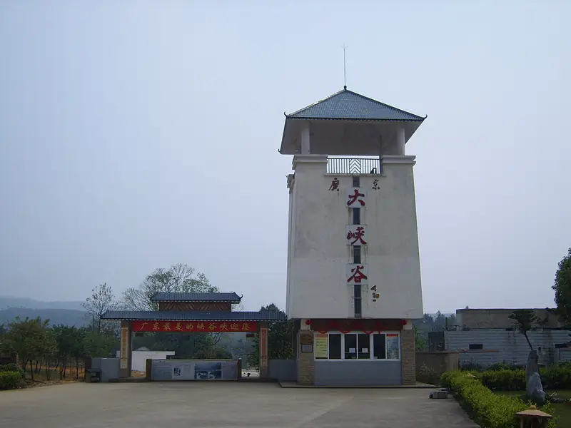 Guangdong Grand Canyon · 广东大峡谷
Guangdong Grand Canyon广东大峡谷
Guangdong Grand Canyon (广东大峡谷), also called Ruyuan Grand Canyon, is a steep-sided gorge in the hills of south-western Ruyuan Yao Autonomous County, Shaoguan, Guangdong. It is protected as the Guangdong Ruyuan Grand Canyon Provincial Nature Reserve, which covers 4,021.9 hectares.
Read the place guide →Plan your visit
Getting there
Ruyuan Yao Autonomous County is about 45 km in a straight line from central Shaoguan. Search for 乳源瑶族自治县 in a map app to find stations and your accommodation.
Where to stay →Build your route
Yunmen Temple and Guangdong Grand Canyon are both listed here. The linked place guides have entrance and visit details.
Continue with Shaoguan →More in Shaoguan
Sources & geographic information
Administrative names and parent areas: Official geographic directory · Reference date 2026-09-06.
Photo: Yunmen Temple · No machine-readable author provided. Nat Krause assumed (based on copyright claims). · Public domain. Full frame retained; EXIF orientation normalized, proportionally resized to at most 800 pixels and converted to WebP. No generated pixels or subject changes. Cards may crop the display.

Photo: Guangdong Grand Canyon · Source photographer · License not provided. EXIF orientation normalized; resized without changing aspect ratio; converted to WebP. No subject edits.

Map data © OpenStreetMap contributors. Pins mark approximate centres, not entrances or boundaries.