


Get to know Wujiang District
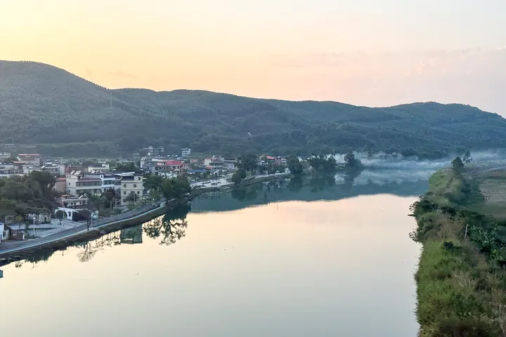
Photo adjustments
Full frame retained; proportionally resized and converted to WebP. No retouching or changes to the photographed subject. Card displays may crop the view.
- Administrative area
- District · 市辖区
- Part of
- Shaoguan
- Chinese name
- 武江区
- Local areas
- District guide
Area & population
- Area in the source
- 682.00 km²
- Population · 2020
- 373,686
Source: cited geographic source, as of the dates shown.
Setting and landscape
The Wu River rises at Sanfengling (三峰岭) in Linwu County (临武县), Hunan, passes Pingshi (坪石), Lechang (乐昌) and Guitou (桂头), and meets the Zhen River (浈江) below the Beijiang Bridge in Shaoguan to form the Bei River. The land rises to the north and west; Dadongshan (大东山) in Jiangwan, at 1,390 metres, is the district's highest peak, and most of the land is hills and small alluvial plains. Among the hills, the district government notes closed hollows, underground rivers and many caves.
History
Qujiang County (曲江县) was set up here in 111 BC, after the Han conquest of Nanyue. In 280 its seat moved to Xihe, which became the county's political, economic and cultural centre. The seat returned to Xihe under the Liang (552–555) and again in 618, before the prefectural and county offices moved in 911 to Zhongzhou (中洲), a small island in today's urban Shaoguan. The district government describes the area as Shaoguan's northwestern stronghold, with Xihe, Xilian and Longgui long used as garrison grounds. Wujiang District was formally created on 28 September 1984, and Longgui, Chongyang and Jiangwan were transferred from Qujiang in August 2004.
Cantonese is the main language across town and countryside; Hakka is spoken in Longgui and four other towns, the local Shiposheng (虱婆声) dialect in Chongyang, Xilian and parts of Longgui and Xihe, and the Yao Mian language in the Yao village of Jiangwan.
What to see
The district government lists the family tomb of the Tang chancellor Zhang Jiuling (张九龄家族墓), the tomb of the Song minister Yu Jing (余靖墓), the Rongshan old temple (蓉山古刹), the old Xianqiao ferry (仙桥古渡), Furongshan National Mine Park (芙蓉山国家矿山公园), Muxi Reservoir (沐溪水库) and the Jiangwan hot springs (江湾温泉). Among 24 revolutionary sites are the former quarters of Zhu De's (朱德) Nanchang Uprising troops, the Eighth Route Army's Shaoguan office and the wartime seat of the Communist Party's Guangdong committee. Han to Eastern Jin artefacts excavated in the district are held by the Shaoguan Museum.
Food and local products
Wujiang simao ginger (武江丝茅姜) was already grown here in the Guangxu reign, according to the Qujiang local gazetteer of that period, and is known for its aroma, heat and little fibrous residue.
Highlights
- Family tomb of Zhang Jiuling 张九龄家族墓: Tomb of the Tang chancellor's family, listed among the district's main sights.
- Tomb of Yu Jing 余靖墓: Tomb of a Song dynasty minister.
- Furongshan National Mine Park 芙蓉山国家矿山公园: National mine park named among the district's natural sights.
- Wujiang simao ginger 武江丝茅姜: Ginger recorded in the Guangxu-era Qujiang gazetteer, known for aroma, heat and little residue.
Sources for this guide
武江概况 - 武江区人民政府网 · Wujiang District People's Government, Shaoguan
历史沿革 - 武江区人民政府网 · Wujiang District People's Government, Shaoguan
Original English written from the listed sources and checked sentence by sentence against quoted extracts by a separate reviewer. Updated 2026-09-23.
Explore Wujiang District
Core places to explore, with English and Chinese names.
Wujiang District 武江区
Plan your visit
Getting there
Wujiang District covers the centre of Shaoguan. Search for 武江区 in a map app to find stations and your accommodation.
Where to stay →More in Shaoguan
Sources & geographic information
Administrative names and parent areas: Official geographic directory · Reference date 2026-09-06.
Map data © OpenStreetMap contributors. Pins mark approximate centres, not entrances or boundaries.