


Get to know Xinfeng County
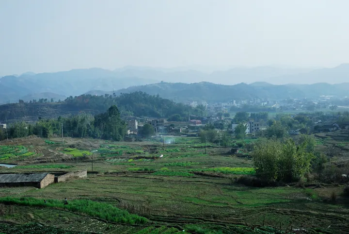
Photo adjustments
Full frame retained; proportionally resized and converted to WebP. No retouching or changes to the photographed subject. Card displays may crop the view.
- Administrative area
- County · 县
- Part of
- Shaoguan
- Chinese name
- 新丰县
- Local areas
- County guide
Area & population
- Area in the source
- 1,987.00 km²
- Population · 2020
- 195,430
Source: cited geographic source, as of the dates shown.
Setting and landscape
The Jiulian Mountains (九连山脉) in the east and the Qingyun Mountains (青云山脉) in the west cross the county from northeast to southwest, and 67 peaks top 1,000 metres. The highest is Yunji Mountain (云髻山), also called Apoji (阿婆髻), a provincial nature reserve about 8 kilometres from the county town; the county government calls its 1,438-metre summit the highest peak around the Pearl River Delta. The Qingyun range is the watershed. East of it, the Xinfeng River rises at the foot of Yunji Mountain and runs 77.4 kilometres through the county towards Wanlü Lake (万绿湖), the Xinfeng River Reservoir; west of it, streams flow into the Weng River (翁江) and join the Bei River (北江) south of Yingde (英德). Forest covers 81.15 percent of the land.
History
Xinfeng County was carved out of Longchuan County (龙川县) in 483 under the Southern Qi, its name taken to mean abundant produce. It was renamed Xiuji (休吉县) in 598 and absorbed into Heyuan in 607. In 1569 the Ming created Changning County (长宁县) here, and in 1573 its seat moved to the site of today's county town. The old name Xinfeng returned in 1914, because Jiangxi and Sichuan also had a Changning. The county was placed under Guangzhou in 1975 and returned to Shaoguan in 1988. Natives include Gu Chengzhi (古成之), the first Lingnan scholar to pass the imperial jinshi examination in the early Song, and the early Red Army leader Li Renyu (李任予).
What to see
Yuntianhai (云天海) is a national 4A scenic area and Yunji Mountain a 3A scenic area. At the foot of Yunji Mountain an old town has been assembled from 300 relocated Ming and Qing houses. The Wild Goose Pagoda (雁塔), built in 1739 under the Qing Qianlong emperor, is a Guangdong provincial protected site. Local folk arts include the fire dragon dance (舞火龙), the paper horse dance (纸马舞), Zhangtian cake moulds (张田饼印) and root carving.
Food and local products
Xinfeng chayote (新丰佛手瓜) is a national geographical-indication product, and Xinfeng eggs, pigeons, sweet potatoes, winter melon and chayote are on the national list of distinctive farm produce. Chayote noodles have Greater Bay Area certification.
Getting oriented
Conghua (从化) and Longmen (龙门) lie to the south, Wengyuan (翁源) to the north, Lianping (连平) to the east and Fogang (佛冈) to the west. Guangzhou is about 150 kilometres away, Shenzhen 180 and Shaoguan 160. The Daqing–Guangzhou, Wuhan–Shenzhen and Shaoguan–Xinfeng expressways meet in the county.
Highlights
- Yunji Mountain 云髻山: Provincial nature reserve and 3A scenic area, 1,438 metres, the county's highest peak.
- Yuntianhai 云天海: National 4A scenic area.
- Wild Goose Pagoda 雁塔: Built in 1739; a Guangdong provincial protected site.
- Xinfeng chayote 新丰佛手瓜: National geographical-indication product.
Sources for this guide
新丰县基本情况 - 新丰县人民政府网 · Xinfeng County People's Government
新丰县 - 维基百科,自由的百科全书 · Wikipedia (Chinese) · CC BY-SA 4.0
Original English written from the listed sources and checked sentence by sentence against quoted extracts by a separate reviewer. Updated 2026-09-23.
Explore Xinfeng County
Core places to explore, with English and Chinese names.
Places to explore around Xinfeng County
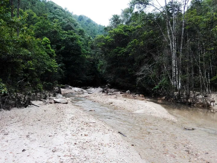 A forest stream in the Yunji Mountain nature reserve, Xinfeng County ·
 Plan your visit
Getting there
Xinfeng County is about 105 km in a straight line from central Shaoguan. Search for 新丰县 in a map app to find stations and your accommodation.
Where to stay →Build your route
Start with Yunji Mountain. The linked place guides have entrance and visit details.
Continue with Shaoguan →More in Shaoguan
Sources & geographic information
Administrative names and parent areas: Official geographic directory · Reference date 2026-09-06.
Some facts checked against 新丰县 — Wikipedia contributors, CC BY-SA 4.0.
Photo: Yunji Mountain · Qiu Mao · CC BY 3.0. Full frame retained; proportionally resized and converted to WebP. No retouching or changes to the photographed subject. Card displays may crop the view.

Map data © OpenStreetMap contributors. Pins mark approximate centres, not entrances or boundaries.