


Get to know Pingshan District
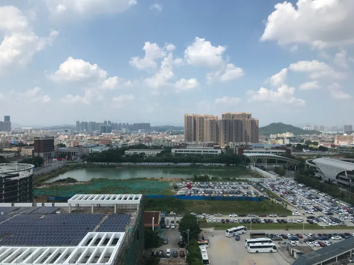
Photo adjustments
Full frame retained; proportionally resized and converted to WebP. No retouching or changes to the photographed subject. Card displays may crop the view.
- Administrative area
- District · 市辖区
- Part of
- Shenzhen
- Chinese name
- 坪山区
- Local areas
- District guide
Area & population
- Area in the source
- 168.00 km²
- Population · 2020
- 551,333
Source: cited geographic source, as of the dates shown.
Setting and landscape
The land is made of shallow hills and basins, higher in the southwest and lower in the northeast, with low mountains to the west and a continuous upland to the south. The Pingshan River (坪山河), one of Shenzhen's five main rivers, rises at Meishajian (梅沙尖) in Sanzhoutian (三洲田) and flows into Huiyang as a tributary of the Danshui River (淡水河) in the East River system. The whole district lies on karst, with limestone buried under loose deposits in places and caves and underground streams below ground.
History
For centuries the area belonged to Guishan County (归善县) of Huizhou. Between 1684 and 1780 Hakka families named Zeng, Zhang, Huang and Dai moved here from Xingning (兴宁), Shaoguan (韶关) and Fujian, settling around today's Dawan Shiju and Liulian (六联); the district government explains the name "Pingshan" (level hills) by the flat land they found. The area passed to Bao'an County in 1958 and to Longgang District in 1993, became the Pingshan New Area in 2009 and a full district in 2016.
What to see
Dawan Shiju (大万世居), begun around 1763 by the Hakka Zeng Chuanzhou (曾传周), is a square compound of about 16,000 square metres with inner and outer walls, three-storey corner towers and a clan ancestral hall at its core; it has been a Guangdong protected site since 2002. Longtian Shiju (龙田世居), Xinqiao Shiju (新乔世居) and other walled houses survive across the district. Red-history sites include the East River Column Memorial Hall (东江纵队纪念馆) and the former home of Zeng Sheng (曾生故居). In the hills, the waterfalls of Maluan Mountain (马峦山) are described by the district government as Shenzhen's largest group of natural falls.
Food and local customs
Pingshan's qilin dance (坪山麒麟舞), on the Guangdong intangible-heritage list, flourished in the 1920s and 1930s, when more than thirty qilin troupes performed as far afield as Danshui (淡水), Hong Kong and Dongguan. The Dawan ancestral rites (大万祭祖), held for more than 200 years, joined Shenzhen's heritage list in 2021. Pingshan keeps the main Hakka customs, and festival foods mark the calendar, from mung-bean congee on the sixth day of the sixth lunar month to tea-fruit cakes (茶果饼) on the first day of the tenth.
Highlights
- Dawan Shiju 大万世居: Square Hakka walled compound begun around 1763, with corner towers and a central ancestral hall; Guangdong protected site since 2002.
- East River Column Memorial Hall 东江纵队纪念馆: Red-history site on the wartime East River Column, alongside Zeng Sheng's former home.
- Maluan Mountain waterfalls 马峦山: Described by the district government as Shenzhen's largest group of natural waterfalls.
- Pingshan qilin dance 坪山麒麟舞: Hakka qilin dance on the Guangdong intangible-heritage list.
Sources for this guide
坪山概况-坪山区人民政府 · Pingshan District People's Government, Shenzhen
大万世居 - 维基百科,自由的百科全书 · Wikipedia · CC BY-SA 4.0
坪山区 - 维基百科,自由的百科全书 · Wikipedia · CC BY-SA 4.0
Original English written from the listed sources and checked sentence by sentence against quoted extracts by a separate reviewer. Updated 2026-09-23.
Explore Pingshan District
Core places to explore, with English and Chinese names.
Places to explore around Pingshan District
 At night, the long crenellated grey stone wall of a Hakka walled compound with a central gate house under a tiled roof and lit doorways, the compound's buildings visible behind; lit high-rise residential towers stand at the right, and a wide dark paved plaza with two figures fills the foreground under a dark cloudy sky.
Plan your visit
Getting there
Pingshan District is about 35 km in a straight line from central Shenzhen. Search for 坪山区 in a map app to find stations and your accommodation.
Where to stay →Build your route
Start with Dawan Hakka Walled Village. The linked place guides have entrance and visit details.
Continue with Shenzhen →More in Shenzhen
Sources & geographic information
Administrative names and parent areas: Official geographic directory · Reference date 2026-09-06.
Some facts checked against 大万世居 — Wikipedia contributors, CC BY-SA 4.0.
Some facts checked against 坪山区 — Wikipedia contributors, CC BY-SA 4.0.
Photo: Dawan Hakka Walled Village · Lhzss8 · CC BY-SA 4.0. Full frame retained; proportionally resized and converted to WebP. No retouching or changes to the photographed subject. Card displays may crop the view.

Map data © OpenStreetMap contributors. Pins mark approximate centres, not entrances or boundaries.