


Get to know Yantian District

Photo adjustments
Full frame retained; resized proportionally to a maximum dimension of 960 pixels and converted to WebP quality 88. No crop, retouch, generated elements, or subject alteration. Final website rendition: full frame retained, proportionally resized to at most 720 pixels and converted to WebP. No additional retouching or subject alteration. Card displays may crop the view.
- Administrative area
- District · 市辖区
- Part of
- Shenzhen
- Chinese name
- 盐田区
- Local areas
- District guide
Area & population
- Area in the source
- 72.63 km²
- Population · 2020
- 214,225
Source: cited geographic source, as of the dates shown.
Setting and landscape
The ground is high in the north and low in the south: the Wutong range and Meishajian (梅沙尖) back the district, with a highest summit of 885 metres, and their slopes are mostly bare rock and forest. Below them the district faces a 250-square-kilometre stretch of Dapeng Bay along 19.5 kilometres of coast, of which 6.7 kilometres are suited to deep-water berths. In 2012 a seaside boardwalk from Xiaomeisha (小梅沙) to Beizaijiao (背仔角) was completed, joining up 19.5 kilometres of coastal path.
History
Excavation of a sand-dune site on Dameisha (大梅沙) bay shows people living here in the Neolithic. The name goes back to the Guanfu salt works (官富盐场), set up in 971 under the Song, which had a branch at Yantian, 'salt field'. When the Eastern Jin created Dongguan commandery (东官郡) in 331, part of the area belonged to its Bao'an County (宝安县). After Shenzhen became a city in 1979 it fell under Luohu, until the State Council approved a separate Yantian District on 7 November 1997, carved from Sha Tau Kok town and the Meisha and Yantian subdistricts; the new district was inaugurated on 30 March 1998.
What to see
Chung Ying Street (中英街), the border street of "one street, two systems", is run by its own management bureau within the Sha Tau Kok special border zone. Its boundary markers were listed among the eighth batch of national key cultural relics in 2019, it was named a famous historic and cultural street of China in 2012, and a history museum opened there in 1999. In 2004 the street, "Wutong clouds" (梧桐烟云) and "waves at Meisha" (梅沙踏浪) were chosen as three of the Eight Views of Shenzhen (深圳八景).
Other well-known sights in the district include Dameisha and Xiaomeisha, the Yantian seaside boardwalk (盐田海滨栈道), the Yantian seafood street (盐田海鲜街), Wutong Mountain National Forest Park (梧桐山国家森林公园) and OCT East (东部华侨城).
Highlights
- Chung Ying Street 中英街: Border street of 'one street, two systems'; its boundary markers became a national key cultural relic in 2019.
- Yantian seaside boardwalk 盐田海滨栈道: Its last section, from Xiaomeisha to Beizaijiao, opened in 2012 and completed the 19.5-kilometre route.
- Dameisha 大梅沙: Bay whose sand-dune site shows Neolithic settlement; "waves at Meisha" is one of the Eight Views of Shenzhen.
Sources for this guide
盐田区 - 维基百科,自由的百科全书 · Chinese Wikipedia · CC BY-SA 4.0
2019-时间走廊-深圳盐田政府在线 · Yantian District People's Government, Shenzhen
2012-时间走廊-深圳盐田政府在线 · Yantian District People's Government, Shenzhen
1999-时间走廊-深圳盐田政府在线 · Yantian District People's Government, Shenzhen
2004-时间走廊-深圳盐田政府在线 · Yantian District People's Government, Shenzhen
Original English written from the listed sources and checked sentence by sentence against quoted extracts by a separate reviewer. Updated 2026-09-25.
Explore Yantian District
Core places to explore, with English and Chinese names.
Places to explore around Yantian District
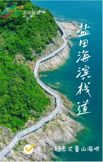 Yantian Seaside Boardwalk · 盐田海滨栈道
Yantian Seaside Boardwalk盐田海滨栈道
The Yantian Seaside Boardwalk (盐田海滨栈道) is a 19.5-kilometre coastal walking route along the shoreline of Yantian District in eastern Shenzhen. It runs from Guta Park beside Zhongying Street in the west to Beizijiao in the east, stringing together the district's harbours, beaches and seafront parks.
Read the place guide →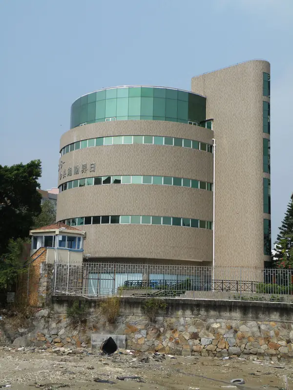 Chung Ying Street (中英街), Yantian District. Photograph: "ShaTauKok ZhongYingStreet Historical Museum".
Chung Ying Street中英街
Border street at Sha Tau Kok split between Hong Kong and Shenzhen by 1899 boundary stones, with a history museum and a commemorative warning bell.
Read the place guide →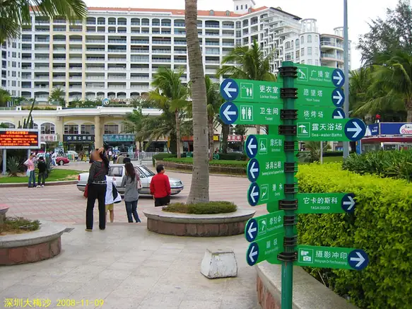 Dameisha Beach · 大梅沙海滨
Dameisha Beach大梅沙海滨
Dameisha (大梅沙海滨) is the beach and seaside park at Meisha Subdistrict in Shenzhen's Yantian District, facing Dapeng Bay on the eastern edge of the special economic zone. Its 1.4-kilometre strand is the centrepiece of a laid-out municipal park rather than an undeveloped shore.
Read the place guide →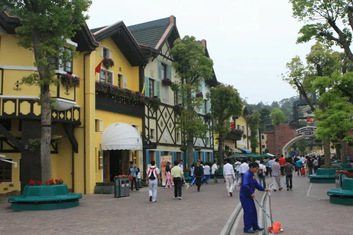 The Interlaken-style Bavarian village street at OCT East, Yantian District, Shenzhen. · 深圳市盐田区东部华侨城茵特拉根小镇风情街。 Source-recorded photograph date: Taken on 21 March 2009.
OCT East东部华侨城
Hillside resort and theme park above Dapeng Bay in Shenzhen's Yantian District, opened in 2007, with themed valleys and a 1900 uprising memorial park.
Read the place guide →Plan your visit
Getting there
Yantian District is about 20 km in a straight line from central Shenzhen. Search for 盐田区 in a map app to find stations and your accommodation.
Where to stay →Build your route
Yantian Seaside Boardwalk and Chung Ying Street are both listed here. The linked place guides have entrance and visit details.
Continue with Shenzhen →More in Shenzhen
Sources & geographic information
Administrative names and parent areas: Official geographic directory · Reference date 2026-09-06.
Some facts checked against 盐田区 — Wikipedia contributors, CC BY-SA 4.0.
Photo: Yantian Seaside Boardwalk · Source photographer · License not provided. EXIF orientation normalized; resized without changing aspect ratio; converted to WebP. No subject edits.
Photo: Chung Ying Street · Tksteven · CC BY 3.0. Full frame retained; EXIF orientation normalized, proportionally resized to at most 800 pixels and converted to WebP. No generated pixels or subject changes. Cards may crop the display.

Photo: Dameisha Beach · wanghongliu · CC BY-SA 3.0. EXIF orientation normalized; resized without changing aspect ratio; converted to WebP. No subject edits.

Photo: OCT East · 张元柏 · CC BY-SA 3.0. Full frame retained; proportionally resized and converted to WebP. No retouching or changes to the photographed subject. Card displays may crop the view.
.jpg)
Map data © OpenStreetMap contributors. Pins mark approximate centres, not entrances or boundaries.