


Get to know Leye County
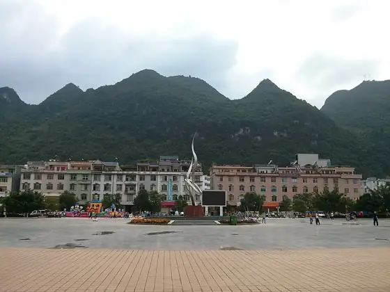
Photo adjustments
Resized and WebP compressed; subject not altered.
- Administrative area
- County · 县
- Part of
- Baise
- Chinese name
- 乐业县
- Local areas
- County guide
Area & population
- Area in the source
- 2,617.00 km²
- Population · 2020
- 146,397
- Administrative seat
- Tongle
Source: cited geographic source, as of the dates shown.
What to see
Dashiwei Tiankeng (大石围天坑), in Shuaba village (刷把村) 23 kilometres from the county town, is 613 metres deep, 600 metres from east to west and 420 metres from north to south. Its floor holds 96,000 square metres of primeval forest, which the county government, citing a field survey by karst specialists of the Ministry of Land and Resources (国土资源部), ranks first in the world. Dozens of other sinkholes lie around it.
Chuandong Tiankeng (穿洞天坑), 18 kilometres from the county town in the same village, is ringed by six peaks and reaches 312 metres at its deepest. The county government says it is the only one of the opened sinkholes where visitors walk to the floor through a cave; a skylight in a cave chamber at the bottom lets in a shaft of light from 108 metres up, named "Angel's Kiss".
Inside the county town, Luomei Lotus Cave (罗妹莲花洞) at Luomei Square (罗妹广场) was listed as a key county-level protected site in 1984. It holds 296 "lotus basins" (莲花盆), which the county government calls the largest group of these cave formations in the world; the biggest is about nine metres long. The Buliu River (布柳河) rises on Cenwanglao Mountain (岑王老山) in Lingyun County (凌云县) and winds between karst peaks to join the Hongshui River (红水河) at the Longtan reservoir (龙滩库区). Bamboo rafts run a stretch of about 9.35 kilometres from Moli village (磨里村), and downstream a natural stone arch, the Xianren Bridge (仙人桥), spans 177 metres.
History
In October 1930 the Chinese Red Army's Seventh Army, led by Zhang Yunyi (张云逸) and Li Mingrui (李明瑞), reached the county town, and on 23 October it met a column of the Eighth Army there. A memorial hall to this meeting (中国红军第七军第八军乐业会师纪念馆) on Tongle North Road opened on 28 October 2016 with five exhibition halls and more than 600 items. The present county was re-established in August 1961, when Lingle County (凌乐县) was split.
Food and local products
Leye kiwifruit (乐业猕猴桃) and Yachang (雅长) tiepi dendrobium (铁皮石斛) are both listed as Chinese geographical-indication products.
Highlights
- Dashiwei Tiankeng 大石围天坑: 613 metres deep, with 96,000 square metres of forest on its floor.
- Chuandong Tiankeng 穿洞天坑: Reached on foot through a cave; the "Angel's Kiss" skylight lights a chamber from 108 metres up.
- Luomei Lotus Cave 罗妹莲花洞: 296 lotus basins in a cave inside the county town, a county protected site since 1984.
- Xianren Bridge 仙人桥: Natural stone arch spanning 177 metres over the Buliu River.
Sources for this guide
百色乐业大石围天坑群景区 · Leye County People's Government, Baise
穿洞天坑景区 · Leye County People's Government, Baise
罗妹莲花洞景区 · Leye County People's Government, Baise
布柳河仙人桥景区 · Leye County People's Government, Baise
乐业县红七红八军纪念馆景区 · Leye County People's Government, Baise
乐业县 · Chinese Wikipedia · CC BY-SA 4.0
Leye County · English Wikipedia · CC BY-SA 4.0
Original English written from the listed sources and checked sentence by sentence against quoted extracts by a separate reviewer. Updated 2026-09-23.
Explore Leye County
Core places to explore, with English and Chinese names.
Places to explore around Leye County
 Dashiwei Tiankeng ·
 Plan your visit
Getting there
Leye County is about 100 km in a straight line from central Baise. Search for 乐业县 in a map app to find stations and your accommodation.
Where to stay →Build your route
Start with Dashiwei Tiankeng. The linked place guides have entrance and visit details.
Continue with Baise →More in Baise
Sources & geographic information
Administrative names and parent areas: Official geographic directory · Reference date 2026-09-06.
Some facts checked against 乐业县 — Wikipedia contributors, CC BY-SA 4.0.
Some facts checked against Leye County — Wikipedia contributors, CC BY-SA 4.0.
Photo: Dashiwei Tiankeng · Source photographer · License not provided. EXIF orientation normalized; resized without changing aspect ratio; converted to WebP. No subject edits.
Map data © OpenStreetMap contributors. Pins mark approximate centres, not entrances or boundaries.