


Get to know Xilin County
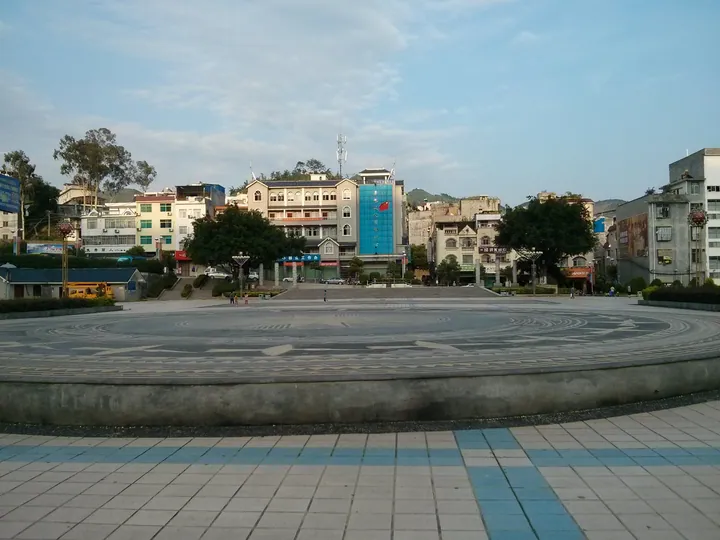
Photo adjustments
Full frame retained; proportionally resized and converted to WebP. No retouching or changes to the photographed subject. Card displays may crop the view.
- Administrative area
- County · 县
- Part of
- Baise
- Chinese name
- 西林县
- Local areas
- County guide
Area & population
- Area in the source
- 2,955.00 km²
- Administrative seat
- Bada
Source: cited geographic source, as of the dates shown.
Setting and landscape
The Tuoniang River rises in Guangnan County (广南县) in Yunnan and runs for 122 kilometres through Xilin, winding between high mountains with forest and bamboo on its banks. Wanfeng Lake has a water surface of 800 square kilometres, scattered with islands. The climate is subtropical monsoon, with an average temperature of 19.1°C and 363 frost-free days a year. The county government is in Bada (八达镇).
History
The county government traces the Juding kingdom (句町国) to Zhuang ancestors on the Tuoniang River. In 1969 an early Western Han burial in a bronze coffin was found at Puhe Miao Township (普合苗族乡), and in 1972 a bronze-drum burial was found 30 metres away; experts identified both as tombs of Juding kings or their relatives.
In the late Qing and early Republic three members of the Cen family (岑氏) of Xilin became governors-general: Cen Yuying (岑毓英) of Yunnan and Guizhou, Cen Yubao (岑毓宝) as acting governor-general there, and Cen Chunxuan (岑春煊) of Guangdong and Guangxi.
What to see
The Gongbao Mansion scenic area (宫保府景区), the Cen family buildings at Nalao (那劳镇), 43 kilometres from the county town, is the family home of Cen Yuying and his son Cen Chunxuan. The Gongbao Mansion, Nanyang Academy (南阳书院), an ancestral hall and other old buildings stand at different levels on the village hillside. The group became a major national protected site in 2013 and a national 4A scenic area in 2017.
Nayan old village (那岩古寨) in Mabang (马蚌乡) keeps rows of century-old Zhuang ganlan stilt houses (干栏) linked to one another, built with traditional methods on a hilltop. The Jinggui Old Road eco-tourism area (京桂古道生态旅游区) at the Huangguoyuan forest farm in Guzhang (古障镇) offers tea-garden sightseeing, tea-culture activities and cycling on the tea hills.
Festivals include the Zhuang Sanyuesan song festival (三月三歌节), the Miao Tiaopo festival (跳坡节), the Yao Panwang festival (盘王节) and the Yi Torch Festival (火把节).
Food and local products
Pounded chilli and fish paste (辣椒捣鱼酱) is a Zhuang dish: river fish are slow-smoked over qinggang oak wood, rice husk and citrus branches until golden, then pounded in a small stone mortar with fire-roasted chillies and garlic and seasoned with salt and Sichuan pepper. Xilin shatangju mandarins (沙糖桔), Xilin ma duck (麻鸭), ginger candy (姜晶) and Xilin fire ginger (火姜) are national geographical indication products, and the county is also a tea producer.
Highlights
- Gongbao Mansion scenic area 宫保府景区: Cen family buildings at Nalao; major national protected site since 2013, 4A since 2017.
- Nayan old village 那岩古寨: Hilltop village of linked Zhuang ganlan stilt houses in Mabang.
- Wanfeng Lake 万峰湖: Lake with an 800-square-kilometre water surface on the Guangxi–Yunnan–Guizhou border.
- Pounded chilli and fish paste 辣椒捣鱼酱: Smoked river fish pounded with roasted chillies and garlic in a stone mortar.
Sources for this guide
西林县概况 - 西林概况 - 广西百色西林县人民政府门户网站 · Xilin County People's Government
西林县宫保府景区--国家AAAA级旅游景区 - 广西百色西林县人民政府门户网站 · Xilin County People's Government
那岩古寨--广西壮族干栏建筑文化第一村 - 广西百色西林县人民政府门户网站 · Xilin County People's Government
京桂古道生态旅游区--广西五星级乡村旅游区 - 广西百色西林县人民政府门户网站 · Xilin County People's Government
辣椒捣鱼酱 - 西林美食 - 广西百色西林县人民政府门户网站 · Xilin County People's Government
Original English written from the listed sources and checked sentence by sentence against quoted extracts by a separate reviewer. Updated 2026-09-23.
Explore Xilin County
Core places to explore, with English and Chinese names.
Xilin County 西林县
Plan your visit
Getting there
Xilin County is about 170 km in a straight line from central Baise. Search for 西林县 in a map app to find stations and your accommodation.
Where to stay →More in Baise
Sources & geographic information
Administrative names and parent areas: Official geographic directory · Reference date 2026-09-06.
Map data © OpenStreetMap contributors. Pins mark approximate centres, not entrances or boundaries.