


Get to know Lingyun County
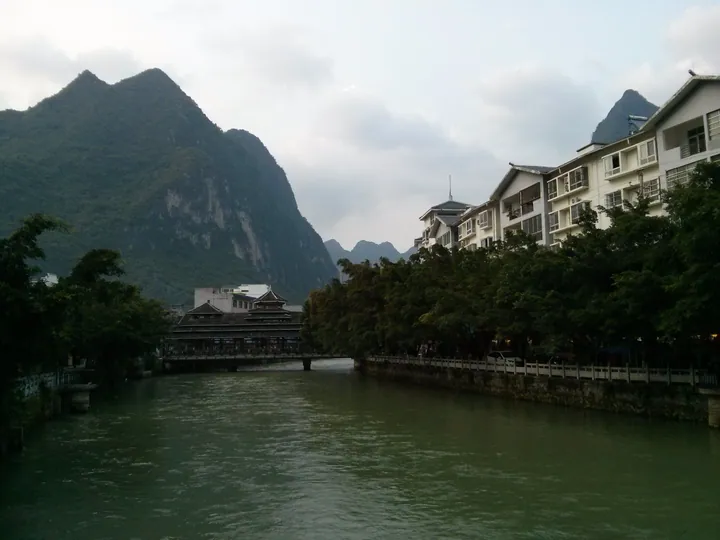
Photo adjustments
Full frame retained; proportionally resized and converted to WebP. No retouching or changes to the photographed subject. Card displays may crop the view.
- Administrative area
- County · 县
- Part of
- Baise
- Chinese name
- 凌云县
- Local areas
- County guide
Area & population
- Area in the source
- 2,306.00 km²
- Population · 2020
- 188,194
Source: cited geographic source, as of the dates shown.
Setting and landscape
Rocky mountain areas make up 93.6 per cent of the county. Two main rivers, the Sishui (泗水河) and the Buliu (布柳河), drain it, and the county government counts it among the sources of the Pearl River. The county has three national AAAA scenic areas, Haokun Lake (浩坤湖) among them, and seven rated AAA, among them Duxiu Peak (独秀峰) and Naling Cave (纳灵洞).
History
The Song set up Sicheng Prefecture (泗城州) here in 1053. In 1373 the hereditary chief Cen Shanzhong (岑善忠) moved its seat to Gukan Cave (古堪洞), the site of today's county town, and under the Ming it became Guangxi's largest directly administered prefecture. In 1658 it was raised to a native fu (泗城土府), a higher grade of prefecture; Lingyun County was created in 1740 and shared the town with the prefecture until the prefecture was abolished in 1913. The Sicheng prefectural seat (泗城州府) in the county town is now an AAAA scenic area. The Zhuang "72 wu tunes" (壮族72巫调) of Lingyun, wu meaning shamanic, are on the national intangible heritage list, and the Yao dragon-and-phoenix dance (瑶族龙凤舞) is on the Guangxi list.
What to see
Haokun Lake (浩坤湖), where Xiajia (下甲镇) and Lingzhan (伶站乡) meet, formed where the Chengbi River (澄碧河) is blocked; it is six kilometres long and 50 to 1,500 metres wide. The river gushes from Shuiyuan Cave (水源洞), crosses the county town and runs five kilometres underground before reaching the lake. Once called East Lake, it drew Xie Zijia (谢子嘉) of Guilin (桂林) in 1630, and his essay on the trip is still carved in stone at Xiajia. In 2015 the State Forestry Administration approved a national wetland park pilot here. Five cave fish found only in Guangxi live in the lake, including the Lingyun golden-line barbel (凌云金线鲃), and through-caves and sinkholes cluster around it.
The Tea Mountain Pyramid (茶山金字塔景区), 24 kilometres from the county town in Jiayou (加尤镇), is a tea farm founded in 1992 that rises to 1,164 metres and is usually wrapped in cloud.
Food and local products
Lingyun Baihao tea (凌云白毫) comes from a local tea variety that the county government says is the only one in Asia that can be made into all six main tea types. It won a Panama award in 1915, became one of China's first 30 national improved tea varieties in 1984 and received a geographical-indication trademark in 2016.
Highlights
- Haokun Lake 浩坤湖: Six-kilometre lake on the Chengbi River with five cave fish found only in Guangxi.
- Sicheng prefectural seat 泗城州府: AAAA scenic area in the county town, seat of Sicheng from 1373.
- Tea Mountain Pyramid 茶山金字塔景区: Tea farm founded in 1992 in Jiayou, rising to 1,164 metres.
- Lingyun Baihao tea 凌云白毫: Local tea variety awarded in Panama in 1915, with a geographical-indication trademark from 2016.
Sources for this guide
凌云县简介 · Lingyun County People's Government, Baise
浩坤湖简介 · Lingyun County People's Government, Baise
茶山金字塔景区(4A) · Lingyun County People's Government, Baise
泗城州府景区(4A) · Lingyun County People's Government, Baise
Original English written from the listed sources and checked sentence by sentence against quoted extracts by a separate reviewer. Updated 2026-09-24.
Explore Lingyun County
Core places to explore, with English and Chinese names.
Places to explore around Lingyun County
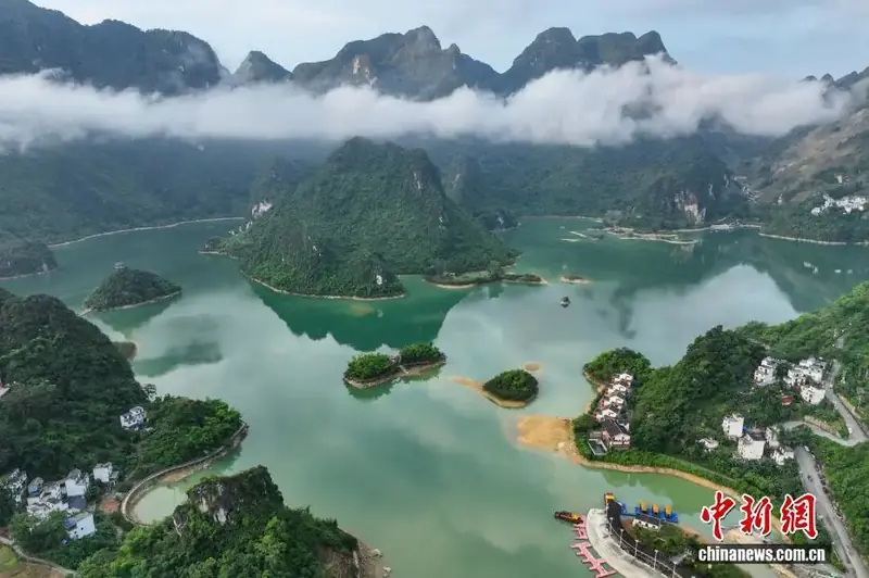 Haokun Lake ·
 Plan your visit
Getting there
Lingyun County is about 55 km in a straight line from central Baise. Search for 凌云县 in a map app to find stations and your accommodation.
Where to stay →Build your route
Start with Haokun Lake. The linked place guides have entrance and visit details.
Continue with Baise →More in Baise
Sources & geographic information
Administrative names and parent areas: Official geographic directory · Reference date 2026-09-06.
Photo: Haokun Lake · Source photographer · License not provided. EXIF orientation normalized; resized without changing aspect ratio; converted to WebP. No subject edits.
Map data © OpenStreetMap contributors. Pins mark approximate centres, not entrances or boundaries.