


Get to know Longlin Various Nationalities Autonomous County
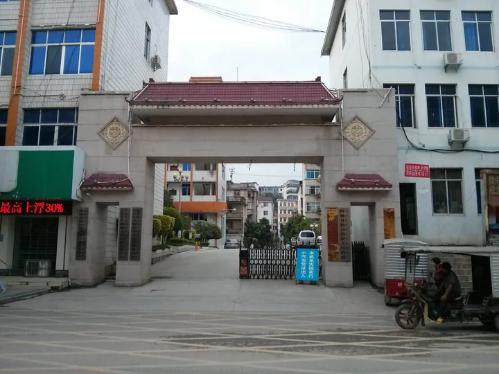
Photo adjustments
Full frame retained; proportionally resized and converted to WebP. No retouching or changes to the photographed subject. Card displays may crop the view.
- Administrative area
- Autonomous county · 自治县
- Part of
- Baise
- Chinese name
- 隆林各族自治县
- Local areas
- Autonomous county guide
Area & population
- Area in the source
- 3,452.00 km²
- Population · 2019
- 437,907
- Administrative seat
- Xinzhou
Source: cited geographic source, as of the dates shown.
Setting and landscape
Soil-covered hills make up about 69 per cent of the county and rocky mountain areas the rest. Rice grows mainly on valley terraces along rivers such as the Shali (沙梨河) and Xinzhou (新州河), and the county drains to two river systems, the Nanpan (南盘江) and the You (右江). The climate is subtropical, with a mean temperature of 19.1°C and about 1,145 millimetres of rain a year. The county seat is Xinzhou (新州镇).
History
In 1984 staff of the Guangxi Zhuang Autonomous Region Museum found two fossil human teeth in Nalai Cave (那来洞) near the Xiangbo (祥播乡) township government, evidence, the county government says, that people lived here about 50,000 years ago. The area's first administrative unit, Anlong (安隆峒), was created in 1253 under Sicheng (泗城州). The line of units that followed became Xilong Department (西隆州) in 1666, moved its seat to Lirentang (里仁塘), today's Xinzhou, in 1729, and became Xilong County in 1912. The county was liberated twice, on 1 March 1950 and 15 April 1951, making it the last in Guangxi to be liberated. Autonomy came in 1953, and the present name dates from 18 September 1955.
What to see
The county government names Jinzhong Mountain (金钟山), Zhayun Mountain (扎云山), Wanfeng Lake (万峰湖), the Leigong Rapids (雷公滩) and Gebu Bay (革步湾) as the core of its tourism, together with local folk customs. Sanchong village (三冲村) is listed as one of China's beautiful leisure villages, and De'e (德峨镇) is a Guangxi summer-retreat town; most of the county's Yi live around De'e. East of the county town, Tonggu Bridge (铜鼓桥), the "bronze drum bridge", is about 260 years old.
The Miao here belong to six branches: the Pian Miao (偏苗) are named for the women's hair buns worn to the right, the Red-headed Miao (红头苗) for their liking for red, the White Miao (白苗) for the women's white skirts and the Flower Miao (花苗) for the women's embroidered clothes. Eleven customs are on the Guangxi list, including the Miao tiaopo hill festival (苗族跳坡节), the Yi rite of seeing off the cuckoo (彝族祭送布谷鸟), the Gelao tree-worship festival (仡佬族拜树节) and Zhuang song gatherings (壮族歌会).
Food and local products
The making of black-rice zongzi (黑米粽子), sticky rice parcels, is one of 24 Longlin items on Guangxi's eighth intangible heritage list, together with Miao embroidery and the making of the Zhuang "three-storey" costume. Farms raise black pigs, black goats and yellow cattle.
Highlights
- Wanfeng Lake 万峰湖: Named by the county government, with Jinzhong and Zhayun mountains, as the core of its tourism.
- De'e 德峨镇: Guangxi summer-retreat town where most of the county's Yi live.
- Nalai Cave 那来洞: Two human teeth found here in 1984, taken as evidence of people here about 50,000 years ago.
- Black-rice zongzi 黑米粽子: Its making technique is on Guangxi's eighth intangible heritage list.
Sources for this guide
隆林概况 · Longlin Various Nationalities Autonomous County People's Government, Baise
自然地理 · Longlin Various Nationalities Autonomous County People's Government, Baise
人文景观 · Longlin Various Nationalities Autonomous County People's Government, Baise
历史沿革 · Longlin Various Nationalities Autonomous County People's Government, Baise
隆林各族自治县 · Chinese Wikipedia · CC BY-SA 4.0
Original English written from the listed sources and checked sentence by sentence against quoted extracts by a separate reviewer. Updated 2026-09-24.
Explore Longlin Various Nationalities Autonomous County
Core places to explore, with English and Chinese names.
Longlin Various Nationalities Autonomous County 隆林各族自治县
Plan your visit
Getting there
Longlin Various Nationalities Autonomous County is about 160 km in a straight line from central Baise. Search for 隆林各族自治县 in a map app to find stations and your accommodation.
Where to stay →More in Baise
Sources & geographic information
Administrative names and parent areas: Official geographic directory · Reference date 2026-09-06.
Some facts checked against 隆林各族自治县 — Wikipedia contributors, CC BY-SA 4.0.
Map data © OpenStreetMap contributors. Pins mark approximate centres, not entrances or boundaries.