


Get to know Longsheng Various Nationalities Autonomous County
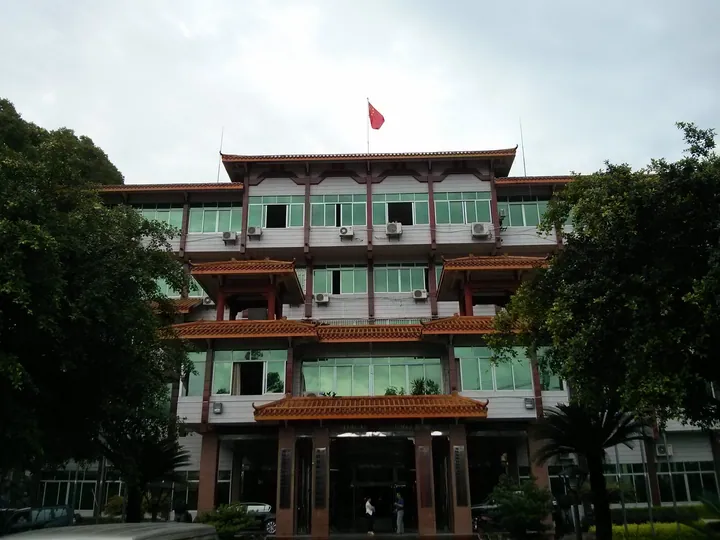
Photo adjustments
Full frame retained; proportionally resized and converted to WebP. No retouching or changes to the photographed subject. Card displays may crop the view.
- Administrative area
- Autonomous county · 自治县
- Part of
- Guilin
- Chinese name
- 龙胜各族自治县
- Local areas
- Autonomous county guide
Area & population
- Area in the source
- 2,537.00 km²
- Administrative seat
- Longsheng Town
Source: cited geographic source, as of the dates shown.
Setting and landscape
The county covers 2,538 square kilometres, with an average altitude of 700 to 800 metres. The Yuecheng Range (越城岭) runs through it from north-east to south-west, and its highest point, Fupingbao (福平包) at 1,916 metres, is listed by the county as the second-highest peak in Guangxi. The ground is high on the east, south and north and falls to the west. More than 80 streams gather into the Sang River (桑江), which flows west into Sanjiang Dong Autonomous County (三江侗族自治县); the Heping (和平河), Pingdeng (平等河) and Sanmen (三门河) rivers are the other main streams. Protected areas include the Nanshan pastures (南山牧场), the Huaping forest (花坪林区) and Longsheng Hot Springs National Forest Park (龙胜温泉国家森林公园).
History
The name first appears in 1741, when the Qing set up the Longsheng sub-prefecture (龙胜厅) under Guilin prefecture, named after Longsheng Stockade (龙胜寨), a village facing Qinglong Hill where the county town now stands, at the meeting of the Sang and Heping rivers. It became Longsheng County in 1912. Regional autonomy was introduced on 19 August 1951 and the present name dates from December 1956; the county describes itself as the first ethnic autonomous county set up in south-central China.
What to see
The Longji terraces were recognised by the UN Food and Agriculture Organization as a Globally Important Agricultural Heritage System in 2017. Ping'an village (平安村), on the mountainside above the valley at Jinjiang village (金江村) in Longji town (龙脊镇), was the first part of the terraces opened to tourism, in the 1990s. Its Zhuang stilt houses step up the slope so that each roof props the next house's foundation, and viewpoints carry names such as "Seven Stars Around the Moon" (七星伴月). Longsheng Hot Springs and the Longji terraces are the county's two national AAAA scenic areas. Other sights listed by the county include Dong drum towers and wind-and-rain bridges, and the Huangluo Yao long-hair village (黄洛瑶族长发村). The Pingdeng drum-tower group (平等鼓楼群), the Red Army building at Longping (龙坪红军楼) and the Red Army Bridge at Weijiang (伟江红军桥) are protected at autonomous-region level.
Food and local products
The "four treasures of Longji" (龙脊四宝) are Longji tea, Longji chilli, Longji fragrant glutinous rice and Longji rice wine; the tea and chilli are national geographical-indication products. The county also lists camellia oil, shiitake mushrooms, luohan guo (罗汉果), Nanshan pears, dried bamboo shoots and Lejiang black pigs among its local products.
Highlights
- Longji Rice Terraces 龙脊梯田: Recognised by the FAO as a Globally Important Agricultural Heritage System in 2017; a national AAAA scenic area.
- Ping'an Village 平安村: Zhuang village of stilt houses in Longji town, the first part of the terraces opened to tourism.
- Longsheng Hot Springs 龙胜温泉: National AAAA scenic area and national forest park.
- Weijiang Red Army Bridge 伟江红军桥: Autonomous-region-level protected heritage site.
Sources for this guide
龙胜县概况 · Longsheng Various Nationalities Autonomous County People's Government (county civil affairs bureau)
【寻找龙胜最美地名故事】平安:美美的平安和幸福 · Longsheng Various Nationalities Autonomous County People's Government (county civil affairs bureau)
Original English written from the listed sources and checked sentence by sentence against quoted extracts by a separate reviewer. Updated 2026-09-24.
Explore Longsheng Various Nationalities Autonomous County
Core places to explore, with English and Chinese names.
Places to explore around Longsheng Various Nationalities Autonomous County
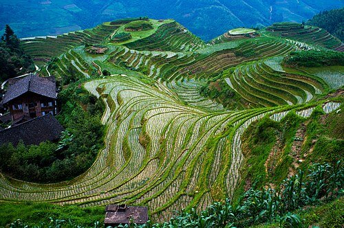 Longji Rice Terraces · 龙脊梯田
Longsheng Rice Terraces龙脊梯田
The Longji terraces wrap around mountain contours in a pattern of narrow fields and curving embankments. Their appearance changes with cultivation: flooded plots reflect the sky, growing rice turns the slopes green, and harvest…
Read the place guide →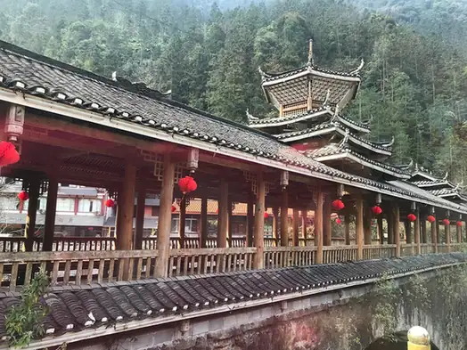 Longsheng Hot Springs · 龙胜温泉
Longsheng Hot Springs龙胜温泉
Longsheng Wenquan (龙胜温泉) is a national 4A-grade scenic area in Longsheng Various Nationalities Autonomous County, Guilin, which the county government names alongside the Longji Terraces as the county's two scenic areas of that grade; the same overview lists Longsheng Hot Springs National Forest Park (龙胜温泉国家森林公园) among the county's nature reserves, and names Red Army Rock, where the Red Third Army Corps met local Yao leaders in December 1934, among the county's sights and historic monuments.
Read the place guide →Plan your visit
Getting there
Longsheng Various Nationalities Autonomous County is about 65 km in a straight line from central Guilin. Search for 龙胜各族自治县 in a map app to find stations and your accommodation.
Where to stay →Build your route
Longsheng Rice Terraces and Longsheng Hot Springs are both listed here. The linked place guides have entrance and visit details.
Continue with Guilin →More in Guilin
Sources & geographic information
Administrative names and parent areas: Official geographic directory · Reference date 2026-09-06.
Photo: Longsheng Rice Terraces · severin.stalder · CC BY-SA 3.0. Wikimedia thumbnail; fitted to the ranking-card frame.

Photo: Longsheng Hot Springs · Source photographer · License not provided. EXIF orientation normalized; resized without changing aspect ratio; converted to WebP. No subject edits.
Map data © OpenStreetMap contributors. Pins mark approximate centres, not entrances or boundaries.