


Get to know Xifeng County
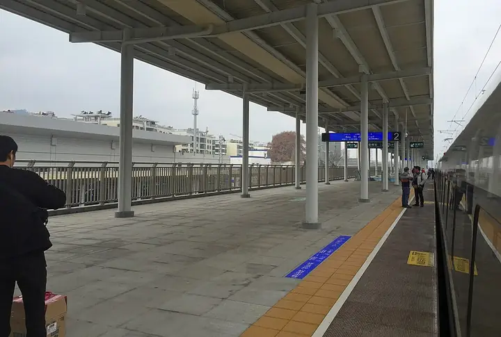
Photo adjustments
Full-frame source proportionally resized and converted to WebP for display. No subject alteration. Source-supplied marks and edits remain; cards may crop the view.
- Administrative area
- County · 县
- Part of
- Guiyang City
- Chinese name
- 息烽县
- Local areas
- County guide
Area & population
- Area in the source
- 1,037.00 km²
- Population · 2010
- 212,879
- Administrative seat
- Yongjing
Source: cited geographic source, as of the dates shown.
Setting and landscape
The land is higher in the south than the north, mostly 1,000 to 1,200 metres up, with carbonate rock giving peak clusters, depressions, karst caves, underground rivers and sinkholes; along the northern edge the Wu River and its tributaries have cut deep valleys. The highest point is Nanji Summit (南极顶) on Nanwang Mountain (南望山), 1,749.6 metres, 5 kilometres east of the county town, with Xuantian Cave (玄天洞) on its slopes; the lowest is Datangkou (大塘口), 609 metres, where the Wu River leaves the county. Xiwang Mountain (西望山), 15 kilometres west of town, rises to 1,616.2 metres.
History
Stone axes and adzes from the Chetian River (车田河) at Dizhai (底寨) show Neolithic settlement. From 975 the area was ruled by the Song clan of Shuidong (水东宋氏), and in the Wanli reign it fell to the An clan of Shuixi (水西安氏). After Zhu Xieyuan (朱燮元) subdued Shuixi in 1630, the Chongzhen emperor approved new garrison posts here, and the name Xifeng, meaning 'quelling the beacon fires', dates from then. The posts were merged into Xiuwen County (修文县) in 1687; Xifeng County itself was set up in 1914 and moved from Anshun prefecture to Guiyang in 1996.
What to see
The Xifeng Concentration Camp Revolutionary History Memorial (息烽集中营革命历史纪念馆) is a national patriotic education base. On the Long March the Red Army crossed south over the Wu River and feinted towards Guiyang, spending six days and five nights in Xifeng; sites from that time include Datangdu (大塘渡), Meiliangkeng (没良坑) and Zushiguan (祖师观).
Xifeng Hot Spring (息烽温泉) is classed as a calcium-bicarbonate radon spring containing metasilicic acid and strontium, with water at 53–56°C all year; the county government calls it one of the world's three great radon springs. Xiwang Mountain is known as a Buddhist mountain of central Guizhou, and the Wu River gorge is nicknamed the 'Little Three Gorges'. The county government describes Baozi village (堡子村) in Yanglongsi (养龙司镇) as China's first village to pay men and women equally for equal work. Local intangible heritage includes dragon lanterns, flower-lantern (花灯) and yangxi (阳戏) opera, the Qingshan 'Eighth of the Fourth Month' (四月八) festival and Miao embroidery.
Highlights
- Xifeng Concentration Camp Revolutionary History Memorial 息烽集中营革命历史纪念馆: A national patriotic education base.
- Xifeng Hot Spring 息烽温泉: Radon spring with water at 53–56°C all year.
- Nanwang Mountain 南望山: Highest peak in the county at 1,749.6 metres, with Xuantian Cave on its slopes.
- Baozi village 堡子村: Described as China's first village to pay men and women equally for equal work.
Sources for this guide
息烽县人民政府门户网站-息烽简介 · Xifeng County People's Government
息烽县人民政府门户网站-历史沿革 · Xifeng County People's Government
息烽县人民政府门户网站-自然地理 · Xifeng County People's Government
Original English written from the listed sources and checked sentence by sentence against quoted extracts by a separate reviewer. Updated 2026-09-24.
Explore Xifeng County
Core places to explore, with English and Chinese names.
Places to explore around Xifeng County
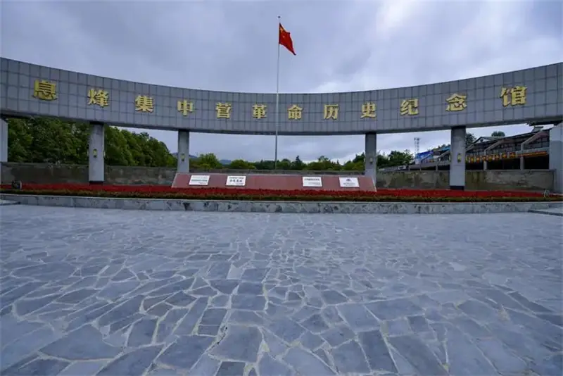 Xifeng Concentration Camp Memorial Hall ·
 Plan your visit
Getting there
Xifeng County is about 50 km in a straight line from central Guiyang City. Search for 息烽县 in a map app to find stations and your accommodation.
Where to stay →Build your route
Start with Xifeng Concentration Camp Memorial Hall. The linked place guides have entrance and visit details.
Continue with Guiyang City →More in Guiyang City
Sources & geographic information
Administrative names and parent areas: Official geographic directory · Reference date 2026-09-06.
Photo: Xifeng Concentration Camp Memorial Hall · Source photographer · License not provided. EXIF orientation normalized; resized without changing aspect ratio; converted to WebP. No subject edits.
Map data © OpenStreetMap contributors. Pins mark approximate centres, not entrances or boundaries.