


Get to know Danzhai County
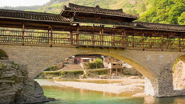
Photo adjustments
Full-frame source proportionally resized and converted to WebP for display. No subject alteration. Source-supplied marks and edits remain; cards may crop the view.
- Administrative area
- County · 县
- Part of
- Qiandongnan Miao and Dong Autonomous Prefecture
- Chinese name
- 丹寨县
- Local areas
- County guide
Area & population
- Area in the source
- 937.70 km²
- Population · 2010
- 122,410
- Administrative seat
- Longquan
Source: cited geographic source, as of the dates shown.
Setting and landscape
Danzhai lies on the watershed between the upper Qingshui River (清水江), which drains to the Yangtze, and the Duliu River (都柳江), which drains to the Pearl. Elevations run from 600 to 1,700 metres, forest covers about 70% of the county, and summers average 22.8°C. The county government describes its soils as rich in selenium and zinc and names selenium-rich rice and selenium-zinc tea among its products.
History
The first formal administration came in 1353, when the Yuan set up the Yaoba chieftaincy (夭坝长官司) at Bagan (坝干) to manage Miao affairs. In 1730 the Qing created Bazhai sub-prefecture (八寨厅), first seated at Lao Bazhai (老八寨) and later moved about 5 kilometres west to Longjingtang (龙井塘), today's county seat.
What to see
The county is mainly Miao, with branches such as the Bazhai, Qingjiang (清江) and Jinji (锦鸡) Miao, and holds eight national intangible-heritage items, among them the Miao golden-pheasant dance (锦鸡舞) and traditional papermaking. At Shiqiao (石桥) in the north, villagers make white bark paper by hand through thirteen steps, from soaking and boiling the bark to lifting, pressing and drying sheets; the craft entered the first national heritage list in 2006. Kala (卡拉), 3 kilometres from the county seat, is known for woven bird cages.
The Gaoyao terraces (高要梯田) climb from 643 to 866 metres, some 400 mu of fields. Longquan Mountain (龙泉山), 2 kilometres west of town and 1,474.8 metres high, turns red, white and purple with rhododendrons from late April to early May. Paiting Falls (排廷大瀑布), south of Longquan town, drops in two tiers of 45 and 20 metres and is called the "first waterfall of eastern Guizhou". The Danzhai mercury mine site (丹寨汞矿工业遗址), where Duyun prefecture set up a mercury works in 1751 and production stopped in 1990, keeps its smelting workshops and a building once used by Soviet experts.
Getting oriented
The county seat is 110 kilometres from Guiyang (贵阳), 50 kilometres from Kaili and 40 kilometres from Duyun.
Highlights
- Shiqiao papermaking 石桥古法造纸: Hand-made bark paper; national intangible heritage since 2006.
- Kala village 卡拉村: Miao village known for woven bird cages.
- Gaoyao terraces 高要梯田: About 400 mu of terraces between 643 and 866 metres.
- Longquan Mountain 龙泉山: Rhododendrons in flower from late April to early May.
- Paiting Falls 排廷大瀑布: Two-tier waterfall of 45 and 20 metres.
Sources for this guide
丹寨县人民政府门户网-丹寨概况 · Danzhai County People's Government
丹寨县人民政府门户网-历史沿革 · Danzhai County People's Government
丹寨旅游资源及旅游景点简介 · Danzhai County People's Government
Original English written from the listed sources and checked sentence by sentence against quoted extracts by a separate reviewer. Updated 2026-09-24.
Explore Danzhai County
Core places to explore, with English and Chinese names.
Danzhai County 丹寨县
Plan your visit
Getting there
Danzhai County is about 45 km in a straight line from central Qiandongnan Miao and Dong Autonomous Prefecture. Search for 丹寨县 in a map app to find stations and your accommodation.
Where to stay →More in Qiandongnan Miao and Dong Autonomous Prefecture
Sources & geographic information
Administrative names and parent areas: Official geographic directory · Reference date 2026-09-06.
Map data © OpenStreetMap contributors. Pins mark approximate centres, not entrances or boundaries.