


Get to know Shibing County
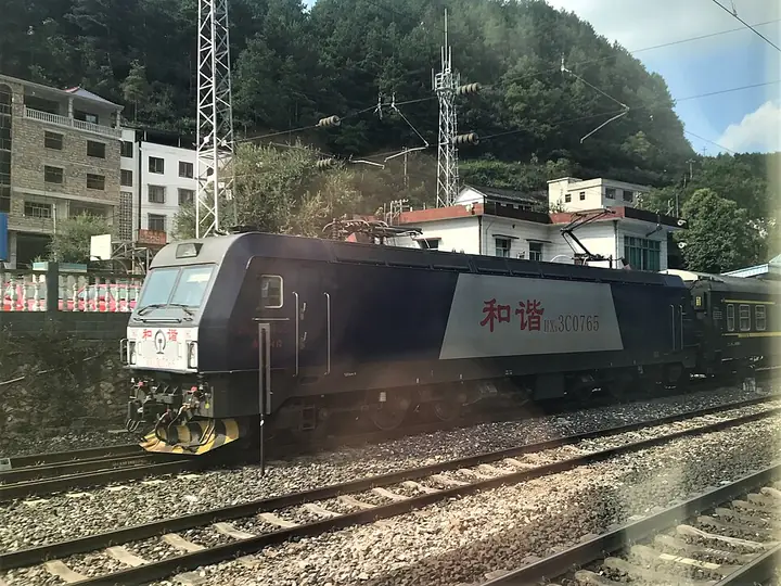
Photo adjustments
Full-frame source proportionally resized and converted to WebP for display. No subject alteration. Source-supplied marks and edits remain; cards may crop the view.
- Administrative area
- County · 县
- Part of
- Qiandongnan Miao and Dong Autonomous Prefecture
- Chinese name
- 施秉县
- Local areas
- County guide
Area & population
- Area in the source
- 1,543.83 km²
- Population · 2021
- 170,000
- Administrative seat
- Chengguan
Source: cited geographic source, as of the dates shown.
Setting and landscape
The county is longer north to south than east to west. It meets Shiqian (石阡) to the north, Zhenyuan (镇远) to the north-east and east, Jianhe (剑河) at its south-eastern corner, Huangping (黄平) and Yuqing (余庆) to the west, and Taijiang (台江) to the south, where the Qingshui River (清水江) forms the boundary. The county seat is 76 km from the prefecture seat at Kaili (凯里) and 230 km from Guiyang (贵阳).
In 2014 the Shibing karst was inscribed with Guilin and Jinfo Mountain (金佛山) in Chongqing as the second phase of the South China Karst World Heritage site. Its three core zones are Yuntai Shan (云台山), Heichong (黑冲) and the Shanmu River (杉木河).
What to see
Yuntai Shan is a karst peak forest rising to 1,066 metres, known for its rock peaks, seas of cloud, old trees and waterfalls; visitors stop at the old Xugong Hall (徐公殿) or view the peaks from the summit. Heichong, a core zone of the Yuntai Shan dolomite karst, holds the site of a battle fought by the Red Army's Sixth Army Corps (红六军团黑冲战斗遗址).
The Shanmu River runs for 44 km and is promoted as "China's number one rafting river" (中华第一漂) for its clear water and gentle course; rafting began here in 1996, and the rafting run follows the river for 9 km through a gorge. Both Yuntai Shan and the Shanmu River are national 4A scenic areas, and the upper Wuyang River (㵲阳河) is a 3A site.
History
The name joins Bashi Mountain (巴施山) and the Bing River (秉水), both in the county. Written records of Shibing go back to 1283, and the Ming made it a county in 1443. In 1687 the Pianqiao garrison (偏桥卫) was merged into the county and the seat moved to the garrison town. Shibing was split between Huangping and Jianhe in 1958 and re-established in 1962. Kedao (刻道), a Miao wedding song cycle of more than ten thousand lines kept with notches cut in wood, was placed on the first national intangible-heritage list in 2006.
Food and local products
The county calls itself China's home of taizishen (太子参), the medicinal root of Pseudostellaria. Dishes named by the county government include sour-soup fish (酸汤鱼), river fish in a soup fermented from wild tomatoes and distillers' grains; shefan (社饭), glutinous rice cooked with cured pork, peanuts, tofu, artemisia and wild onion; and huangba (黄粑), a soft, sweet festival cake with the fragrance of zongzi leaves.
Highlights
- Yuntai Shan 云台山: Karst peak forest rising to 1,066 metres; a core zone of the Shibing karst World Heritage site and a 4A scenic area.
- Shanmu River 杉木河: 44 km clear river with rafting since 1996; a World Heritage core zone and 4A scenic area.
- Heichong 黑冲: Dolomite karst core zone with the site of a Red Army Sixth Army Corps battle.
- Kedao 刻道: Miao wedding song cycle recorded with notched wood; national intangible heritage since 2006.
Sources for this guide
施秉简介 · Shibing County People's Government
施秉县历史沿革 · Shibing County People's Government
施秉交通地理 · Shibing County People's Government
施秉本地特色美食 · Shibing County People's Government
白天漂·晚上嗨!施秉杉木河正式开启属于“你”的24℃夏日 · Shibing County Media Centre (Shibing County People's Government portal)
世界自然遗产地里的“绿色银行” · Shibing County People's Government
刻道 - 中国非物质文化遗产网·中国非物质文化遗产数字博物馆 · China Intangible Cultural Heritage Network (ihchina.cn)
Original English written from the listed sources and checked sentence by sentence against quoted extracts by a separate reviewer. Updated 2026-09-24.
Explore Shibing County
Core places to explore, with English and Chinese names.
Places to explore around Shibing County
 AI illustration · AI 示意图(仅供参考,非该地点实拍)
Yuntai Mountain云台山
Yuntaishan is a karst mountain scenic area in the north of Shibing County, Qiandongnan, Guizhou, part of the Shibing Karst World Natural Heritage site and the Wuyanghe National Scenic Area. It is built on 570-million-year-old Cambrian dolomite strata forming a rare cone-shaped peak-cluster and canyon landform, inscribed on the World Heritage List in 2014 as part of the 'China South Karst' nomination.
Read the place guide →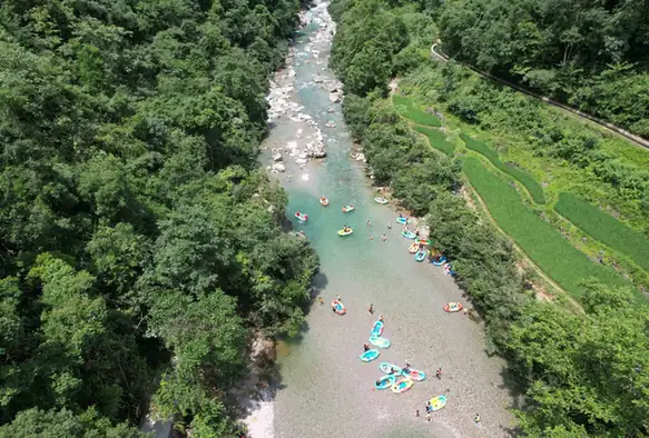 Shanmu River · 杉木河
Shanmu River杉木河
Shanmuhe is a river and canyon scenic area in Shibing County, Qiandongnan, Guizhou, part of the Shibing Karst World Natural Heritage site. Its main channel runs 44.7 kilometres through a catchment of 250 square kilometres, lying mainly within the heritage site's core and buffer zones.
Read the place guide →Plan your visit
Getting there
Shibing County is about 50 km in a straight line from central Qiandongnan Miao and Dong Autonomous Prefecture. Search for 施秉县 in a map app to find stations and your accommodation.
Where to stay →Build your route
Yuntai Mountain and Shanmu River are both listed here. The linked place guides have entrance and visit details.
Continue with Qiandongnan Miao and Dong Autonomous Prefecture →More in Qiandongnan Miao and Dong Autonomous Prefecture
Sources & geographic information
Administrative names and parent areas: Official geographic directory · Reference date 2026-09-06.
Photo: Shanmu River · Source photographer · License not provided. EXIF orientation normalized; resized without changing aspect ratio; converted to WebP. No subject edits.
Map data © OpenStreetMap contributors. Pins mark approximate centres, not entrances or boundaries.