


Get to know Huangping County
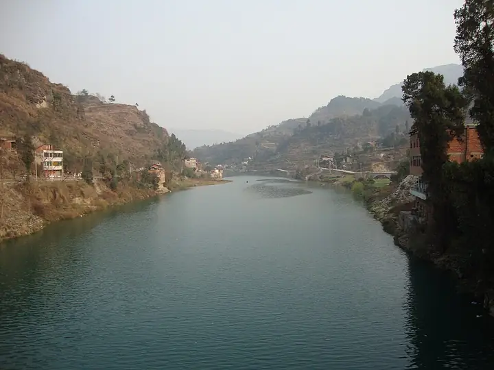
Photo adjustments
Full-frame source proportionally resized and converted to WebP for display. No subject alteration. Source-supplied marks and edits remain; cards may crop the view.
- Administrative area
- County · 县
- Part of
- Qiandongnan Miao and Dong Autonomous Prefecture
- Chinese name
- 黄平县
- Local areas
- County guide
Area & population
- Area in the source
- 1,669.00 km²
- Population · 2010
- 263,123
- Administrative seat
- Xinzhou
Source: cited geographic source, as of the dates shown.
Setting and landscape
The climate is subtropical and monsoonal, mild and wet with four distinct seasons. Close to 100 rivers cross the county. The main ones, the Wuyang (舞阳河), the Chong'an (重安江) and the Miaoli (苗里河), drain to the Dongting Lake (洞庭湖) system of the Yangtze and cover about three quarters of the county; in the north the Yuqing River (余庆河) belongs to the Wu River (乌江) system.
History
The county government traces the name to the Miao word "Wangqie" (王且), the Miao name for Jiuzhou (旧州), read as "imperial plain" and later written Huangping. After the Han subdued Qielan, the Zangke commandery (牂牁郡) was set up with its seat at Jiuzhou. The name Huangping first appears in the records in 1258. In 1687 the Xinglong garrison (兴隆卫) was merged into Huangping department (黄平州) and the seat moved there: the garrison town became Xinzhou (新州, "new seat") and the old seat Jiuzhou ("old seat"). The department became a county in 1914 and joined Qiandongnan in 1956.
During the war against Japan, the Jiuzhou airfield (旧州机场) was a base of the US 76th Fighter Squadron, 23rd Fighter Group, flying P-51s.
What to see
Four sites are national key protected sites: the Feiyun Cliff ancient buildings (飞云崖古建筑群) east of Dongpo village in Xinzhou town, listed in 2006; the Jiuzhou ancient buildings (旧州古建筑群); the Qing-dynasty town of the Yanmen chieftain (岩门长官司城); and the Ming-dynasty water mills on the Chong'an River (重安江水碾群). Provincial listings include the Qing iron-chain bridge west of Chong'an town (重安江铁索桥) and the Huangping section of the old Hunan–Guizhou post road (湘黔驿道) through Jiuzhou and Shangtang.
Crafts and local products
Huangping calls itself a home of modern folk painting, clay whistles and batik, and of seedless watermelons. Huangping batik made by Gejia women entered the national intangible-heritage list in 2011. It uses only blue and white or black and white, with white patterns on a dark ground, and most designs centre on the sun. Miao ancient songs (苗族古歌) are also on the national list for the county.
Getting oriented
The county seat is Xinzhou town (新州镇). The Shanghai–Kunming railway (沪昆铁路) crosses the county, and Kaili Huangping Airport (凯里黄平机场) is 14 km from the county town.
Highlights
- Feiyun Cliff ancient buildings 飞云崖古建筑群: National key protected site east of Dongpo village, Xinzhou town, listed in 2006.
- Jiuzhou ancient buildings 旧州古建筑群: National key protected site in the former department seat.
- Chong'an River water mills 重安江水碾群: Ming-dynasty water mills listed as a national key protected site.
- Huangping batik 黄平蜡染: Gejia batik in blue-white or black-white, on the national intangible-heritage list since 2011.
Sources for this guide
黄平县情简介 · Huangping County People's Government
黄平县历史沿革 · Huangping County People's Government
蜡染技艺(黄平蜡染技艺) · China Intangible Cultural Heritage Network (ihchina.cn)
黄平县 - 维基百科,自由的百科全书 · Wikipedia (Chinese) · CC BY-SA 4.0
黄平县各级文物保护单位列表 - 维基百科,自由的百科全书 · Wikipedia (Chinese) · CC BY-SA 4.0
Original English written from the listed sources and checked sentence by sentence against quoted extracts by a separate reviewer. Updated 2026-09-24.
Explore Huangping County
Core places to explore, with English and Chinese names.
Huangping County 黄平县
Plan your visit
Getting there
Huangping County is about 35 km in a straight line from central Qiandongnan Miao and Dong Autonomous Prefecture. Search for 黄平县 in a map app to find stations and your accommodation.
Where to stay →More in Qiandongnan Miao and Dong Autonomous Prefecture
Sources & geographic information
Administrative names and parent areas: Official geographic directory · Reference date 2026-09-06.
Some facts checked against 黄平县 — Wikipedia contributors, CC BY-SA 4.0.
Some facts checked against 黄平县各级文物保护单位列表 — Wikipedia contributors, CC BY-SA 4.0.
Map data © OpenStreetMap contributors. Pins mark approximate centres, not entrances or boundaries.