


Get to know Taoshan District

Photo adjustments
Full frame retained; proportionally resized and converted to WebP. No retouching or changes to the photographed subject. Card displays may crop the view.
- Administrative area
- District · 市辖区
- Part of
- Qitaihe
- Chinese name
- 桃山区
- Local areas
- District guide
Area & population
- Area in the source
- 74.00 km²
- Population · 2020 census
- 204,111
- Administrative seat
- Taonan Subdistrict
Source: cited geographic source, as of the dates shown.
Setting and landscape
The district describes its landscape as three hills, two lakes and one river. Taoshan (桃山), Xiandong Mountain (仙洞山) and Wanbao Mountain (万宝山) stand in a triangle, like the three boxes of the character pin ("品"); Wanbao Lake (万宝湖) and Taoshan Lake (桃山湖) lie between them; and the Wuken River (倭肯河) runs the length of the district. The Qitaihe government lists the Wuken as a first-order tributary of the Songhua River (松花江) and says that the Wuken and its tributaries, the Wanbao River (万宝河) and the New and Old Qitaihe rivers (新七台河, 老七台河), flow through the city's urban area.
What to see
The district counts 16 parks and squares and 66 small street gardens. Taoshan Lake is the stage for Qitaihe's winter "Ice Super League" (冰超) series: the city government reports an 11-kilometre ice course planned and built on the lake, with snow hikes, dragon boats on ice, tai chi on ice and whipping spinning tops on the ice among the events.
Getting oriented
Taoshan is made up of six urban subdistricts and one town, Wanbaohe (万宝河镇). The Qitaihe city government's address is on Datong Street (大同街) in the district.
Highlights
- Taoshan Lake 桃山湖: One of the district's two lakes and the venue for the city's ice events, with an 11-kilometre ice course planned and built on it.
- Wuken River 倭肯河: Tributary of the Songhua that runs through the district.
Sources for this guide
七台河市桃山区人民政府—投资环境—桃山区区情概况 · Taoshan District People's Government, Qitaihe
七台河市人民政府—文旅事业 · Qitaihe Municipal People's Government
七台河市人民政府—地理资源 · Qitaihe Municipal People's Government
桃山区 - 维基百科,自由的百科全书 · Wikipedia (Chinese) · CC BY-SA 4.0
Original English written from the listed sources and checked sentence by sentence against quoted extracts by a separate reviewer. Updated 2026-09-24.
Explore Taoshan District
Core places to explore, with English and Chinese names.
Places to explore around Taoshan District
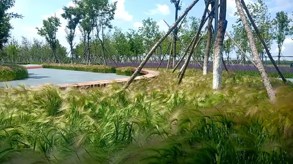 Taoshan Lake and Taoshan Park ·
 Plan your visit
Getting there
Taoshan District covers the centre of Qitaihe. Search for 桃山区 in a map app to find stations and your accommodation.
Where to stay →Build your route
Start with Taoshan Lake and Taoshan Park. The linked place guides have entrance and visit details.
Continue with Qitaihe →More in Qitaihe
Sources & geographic information
Administrative names and parent areas: Official geographic directory · Reference date 2026-09-06.
Some facts checked against 桃山区 — Wikipedia contributors, CC BY-SA 4.0.
Photo: Taoshan Lake and Taoshan Park · Source photographer · License not provided. EXIF orientation normalized; resized without changing aspect ratio; converted to WebP. No subject edits.
Map data © OpenStreetMap contributors. Pins mark approximate centres, not entrances or boundaries.