


Get to know Tongxu County
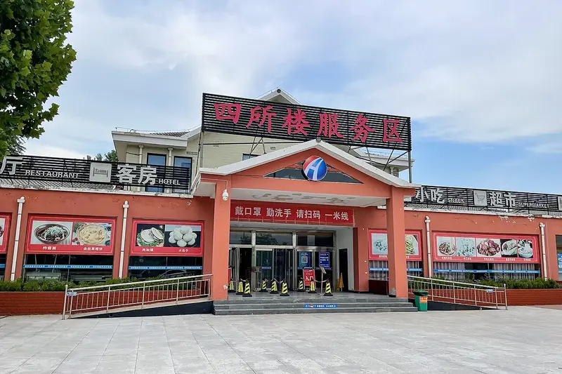
Photo adjustments
Full frame retained; EXIF orientation normalized, proportionally resized to at most 800 pixels and converted to WebP. No generated pixels or subject changes. Cards may crop the display.
- Administrative area
- County · 县
- Part of
- Kaifeng
- Chinese name
- 通许县
- Local areas
- County guide
Area & population
- Area in the source
- 767.00 km²
- Population · 2019
- 518,400
Source: cited geographic source, as of the dates shown.
Setting and landscape
The county sits on the southern part of the great fan of sediment the Yellow River spread eastward from Mengjin (孟津), and forms part of the Huang-Huai plain built up by the river's southern floods. The land tilts from north-west to south-east. Its rivers belong to the Guo River (涡河) system of the Huai basin, and the Guo itself runs 52 kilometres through the county.
History
In the Spring and Autumn period the area belonged to the State of Xu (许国). In 960, the first year of the Song dynasty, a town called Tongxu was founded here; the county government explains the name as the route running from the capital Bianjing (汴京) straight through to the old lands of Xu. The town became Xianping County (咸平县) in 1002, named after the reign era, and in 1189 the Jin renamed it Tongxu County because it shared its name with Xianping Prefecture (咸平府) in present-day Liaoning. Under the Later Zhou, Emperor Shizong (周世宗, reigned 954–959) built granaries here, the Upper and Lower Granary Cities (上仓城, 下仓城), to store grain and army supplies.
What to see
Many of the historic sites the county government lists are tombs linked to famous names. The tomb of the poet Cao Zhi (曹植墓), prince of the Three Kingdoms state of Wei, lies at Qianqibu village in Changzhi town (长智镇); a stele from 1580 survives, and the tomb became a provincial protected site in 2000. The tomb of Ziyu (子羽墓), a diplomat of the State of Zheng, is shaded by cypresses and has a Qing stele set up in 1716. The Northern Song official Kou Zhun (寇准) has a tomb west of Kou village in Dagangli township (大岗李乡), with a small shrine holding his portrait.
Local culture and food
Luo opera (锣戏), a rare Henan drama form kept alive in Xizhuzhuang village of Liancheng township (练城乡), entered Henan's first provincial intangible-heritage list in April 2007. Yugu daoqing (渔鼓道情), which the county also describes as a rare Henan performing form, reached Tongxu in 1825. Today the county promotes itself as China's "capital of hot and sour noodles" (中国酸辣粉之都), and has built a dedicated industrial park for the dish.
Getting oriented
Three expressways, the Rizhao–Nanyang, Daqing–Guangzhou and Shangqiu–Dengfeng, cross and link in the county, and national roads G240 and G343 skirt the county town.
Highlights
- Tomb of Cao Zhi 曹植墓: Tomb of the Wei poet-prince at Qianqibu village, Changzhi town; provincial protected site since 2000.
- Tomb of Ziyu 子羽墓: Tomb of a Zheng-state diplomat on a cypress-covered mound, with a Qing stele of 1716.
- Tomb of Kou Zhun 寇准墓: County-protected tomb of the Northern Song official west of Kou village, Dagangli township.
- Luo opera 锣戏: Rare Henan drama form listed as provincial intangible heritage in April 2007.
- Tongxu hot and sour noodles 酸辣粉: The county's promoted food industry; it calls itself China's capital of hot and sour noodles.
Sources for this guide
通许概况 · Tongxu County People's Government (通许县人民政府)
历史文化 · Tongxu County People's Government (通许县人民政府)
通许县 · Chinese Wikipedia · CC BY-SA 4.0
Original English written from the listed sources and checked sentence by sentence against quoted extracts by a separate reviewer. Updated 2026-09-24.
Explore Tongxu County
Core places to explore, with English and Chinese names.
Tongxu County 通许县
Plan your visit
Getting there
Tongxu County is about 35 km in a straight line from central Kaifeng. Search for 通许县 in a map app to find stations and your accommodation.
Where to stay →More in Kaifeng
Sources & geographic information
Administrative names and parent areas: Official geographic directory · Reference date 2026-09-06.
Some facts checked against 通许县 — Wikipedia contributors, CC BY-SA 4.0.
Map data © OpenStreetMap contributors. Pins mark approximate centres, not entrances or boundaries.