


Get to know Chanhe Hui District
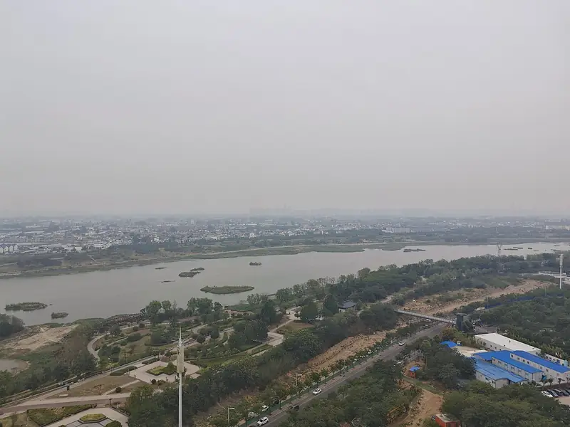
Photo adjustments
Full frame retained; EXIF orientation normalized, proportionally resized to at most 800 pixels and converted to WebP. No generated pixels or subject changes. Cards may crop the display.
- Administrative area
- District · 市辖区
- Part of
- Luoyang
- Chinese name
- 瀍河回族区
- Local areas
- District guide
Area & population
- Area in the source
- 29.00 km²
- Population · 2019
- 200,100
Source: cited geographic source, as of the dates shown.
Setting and landscape
The north of the district is loess hill country belonging to Mount Mang (邙山), cut by gullies, while the south is river flood plain. The ground falls from north to south, from 158.1 metres to 129.1 metres above sea level.
History
The Beiyao Palaeolithic site (北窑旧石器时代遗址) holds cultural layers spanning about 200,000 to 20,000 years ago. When the Duke of Zhou (周公) laid out Luoyi (洛邑) in the early Western Zhou, the banks of the Chan lay in the core area of Chengzhou (成周城). A stele reading "Confucius came here to the Zhou to ask about rites and music" (孔子入周问礼乐至此) marks the tradition that Confucius visited the Zhou capital. Jiamaying (夹马营) in the district is given as the birthplace of the first Song emperor, Zhao Kuangyin (赵匡胤).
Arab and Persian merchants who reached Luoyang along the Silk Road in the Tang settled around Dongguan (东关) and were the earliest ancestors of Luoyang's Hui; Hui soldiers sent to farm the area settled along the Chan in the Yuan. In December 1921 the Communist Party's Luoyang group, the first party organisation in Henan, was founded here; a memorial hall marks the site.
What to see
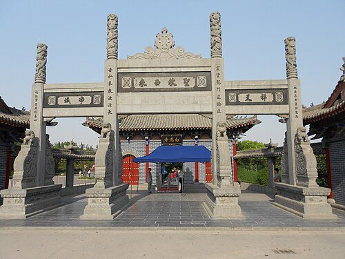
White Horse Temple (白马寺), in Baimasi town (白马寺镇), was founded in AD 68 under the Eastern Han; the district government calls it China's first government-built Buddhist temple. Besides old steles and statues, it now has an international hall area in Thai, Burmese and Indian styles. The site of the Huiluo Granary (回洛仓), a Sui state granary where more than 300 storage pits have been identified, is part of the Grand Canal World Heritage property. The Luoyang Folk Customs Museum (洛阳民俗博物馆) occupies the Luze Guild Hall (潞泽会馆), a Qing guild hall of merchants from Luze and a National Key Cultural Relics Protection Unit, known for its wood, brick and stone carving and its displays on western Henan wedding and longevity customs.
Food and living traditions
The district lists more than 80 intangible-heritage items. Among them are the Pingle Guo family bone-setting method (平乐郭氏正骨法), the Daliwang lion dance (大里王狮舞), the forging of the Luoyang spade (洛阳铲) and the making of Majieshan beef soup (马杰山牛肉汤).
Highlights
- White Horse Temple 白马寺: Founded in AD 68 under the Eastern Han, in Baimasi town; now with an international hall area in Thai, Burmese and Indian styles.
- Huiluo Granary site 回洛仓遗址: Sui state granary with more than 300 identified storage pits, part of the Grand Canal World Heritage property.
- Luoyang Folk Customs Museum 洛阳民俗博物馆: In the Qing Luze Guild Hall, a National Key Cultural Relics Protection Unit noted for wood, brick and stone carving.
- Majieshan beef soup 马杰山牛肉汤: Its making is on the district's intangible-heritage list.
Sources for this guide
瀍河概况 · Chanhe Hui District People's Government (洛阳市瀍河回族区人民政府)
瀍河历史 · Chanhe Hui District People's Government (洛阳市瀍河回族区人民政府)
瀍河文化 · Chanhe Hui District People's Government (洛阳市瀍河回族区人民政府)
地理环境 · Chanhe Hui District People's Government (洛阳市瀍河回族区人民政府)
Original English written from the listed sources and checked sentence by sentence against quoted extracts by a separate reviewer. Updated 2026-09-24.
Explore Chanhe Hui District
Core places to explore, with English and Chinese names.
Places to explore around Chanhe Hui District
 White Horse Temple ·
 Plan your visit
Getting there
Chanhe Hui District is about 10 km in a straight line from central Luoyang. Search for 瀍河回族区 in a map app to find stations and your accommodation.
Where to stay →Build your route
Start with White Horse Temple. The linked place guides have entrance and visit details.
Continue with Luoyang →More in Luoyang
Sources & geographic information
Administrative names and parent areas: Official geographic directory · Reference date 2026-09-06.
Photo: White Horse Temple · Randy Rambo · CC BY 3.0. Wikimedia thumbnail; fitted to the ranking-card frame.

Map data © OpenStreetMap contributors. Pins mark approximate centres, not entrances or boundaries.