


Get to know Luanchuan County
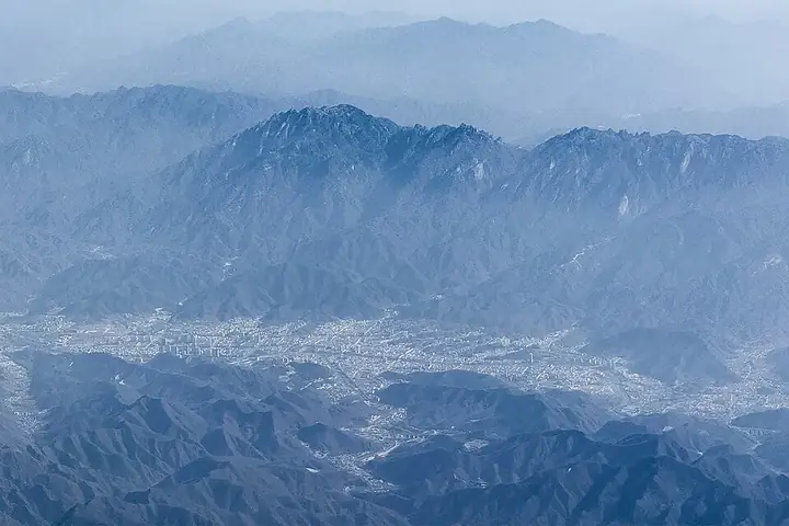
Photo adjustments
Full frame retained; resized proportionally to a maximum dimension of 960 pixels and converted to WebP quality 88. No crop, retouch, generated elements, or subject alteration. Final website rendition: full frame retained, proportionally resized to at most 720 pixels and converted to WebP. No additional retouching or subject alteration. Card displays may crop the view.
- Administrative area
- County · 县
- Part of
- Luoyang
- Chinese name
- 栾川县
- Local areas
- County guide
Area & population
- Area in the source
- 2,478.00 km²
- Population · 2019
- 351,400
Source: cited geographic source, as of the dates shown.
Setting and landscape
Mountains ring the county on all sides. The Funiu range along the south, also called Laojieling (老界岭), forms the boundary with Xixia (西峡) and runs for more than 100 kilometres through the county; the Xiong'er Mountains (熊耳山) run along the north. The Eyu Ridge (遏遇岭) splits the county in two, with the valley of the Yi River (伊河) to the south. The land falls to 450 metres where the Yi leaves the county, and Jijiaojian (鸡角尖) in Longyuwan (龙峪湾) reaches 2,212.2 metres. The county government puts forest cover at 83.51 per cent and quotes a local saying that the land is 'nine parts mountain, half a part water and half a part fields'.
History
A market town named Luanchuan after its valley was set up in 1087 under the Northern Song, and it first became a county in 1104. The Jin reduced it to a town again in 1154, and the present county was re-created in 1947 from parts of Song County (嵩县) and Lushi County (卢氏县). Two Palaeolithic sites, Qiliping (七里坪遗址) and Sunjiadong (孙家洞遗址), are on the national list of major protected sites.
What to see
Laojun Mountain (老君山), a 5A scenic area, is described by the county government as the main peak of the Funiu Mountains, with elevations from 750 to 2,217 metres. It was once called Jingshi Mountain (景室山) and was renamed after Laozi (老子), who is said to have lived here as a recluse. Worship began with a Northern Wei temple, and more than 20 temple halls now stand on it, among them the Laojun Temple (老君庙) and the Golden Hall of the Queen Mother (王母金殿).
Jiguan Cave (鸡冠洞), also 5A, is a karst cave three kilometres west of the county town. Surveyors have traced 5,600 metres of passage on five levels with a vertical range of 138 metres, of which 1,800 metres are open, and the temperature stays at 18°C all year.
Chongdugou (重渡沟), a 4A area about 50 kilometres north-east of the county town, takes its name from the story that the Eastern Han emperor Liu Xiu (刘秀) crossed the Yi River twice here to escape Wang Mang (王莽). It is a valley of bamboo and waterfalls in three sections, the Jinji River (金鸡河), the Dicui River (滴翠河) and the Water Curtain Palace (水帘仙宫). The county's other 4A areas include Longyuwan, Yangzigou (养子沟), the Tianhe Grand Canyon (天河大峡谷) and the Funiu Mountain ski resort (伏牛山滑雪场).
Highlights
- Laojun Mountain 老君山: 5A area of Taoist temples on a Funiu peak, from 750 to 2,217 m.
- Jiguan Cave 鸡冠洞: 5A karst cave 3 km west of the county town, 5,600 m surveyed on five levels, 18°C all year.
- Chongdugou 重渡沟: 4A bamboo-and-waterfall valley named for Liu Xiu's two crossings of the Yi River.
- Longyuwan 龙峪湾: 4A area containing the 2,212.2 m peak Jijiaojian.
Sources for this guide
栾川概况_栾川概况_栾川县人民政府 · Luanchuan County People's Government
老君山_奇境栾川_栾川县人民政府 · Luanchuan County People's Government
鸡冠洞_奇境栾川_栾川县人民政府 · Luanchuan County People's Government
重渡沟_奇境栾川_栾川县人民政府 · Luanchuan County People's Government
栾川县 - 维基百科,自由的百科全书 · Chinese Wikipedia · CC BY-SA 4.0
Original English written from the listed sources and checked sentence by sentence against quoted extracts by a separate reviewer. Updated 2026-09-25.
Explore Luanchuan County
Core places to explore, with English and Chinese names.
Places to explore around Luanchuan County
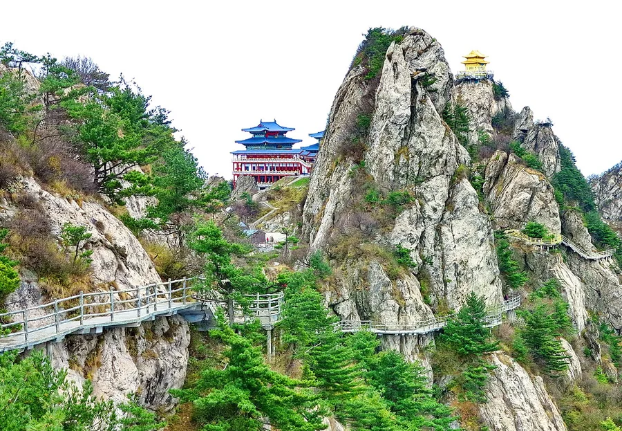 A cliffside walkway and summit buildings on Laojun Mountain in Henan, October 2013.
Laojun Mountain (Henan)老君山
Laojun Mountain rises above Luanchuan with a combination of rocky peaks, elevated paths and Taoist buildings. The Shili Huaping sector follows a landscape of closely spaced rock pinnacles, while the Golden Summit temples give…
Read the place guide → A hillside hamlet with rising smoke in the Chongdugou scenic valley, Luanchuan County · 洛阳市栾川县重渡沟山村炊烟 Source-recorded photograph date: Taken on 18 October 2013.
Chongdugou Valley重渡沟
Chongdugou is a wooded stream valley in the Xiong'er Mountains, about ten kilometres southwest of Tantou town in Luanchuan County, Luoyang, run as a national AAAA-rated scenic area.
Read the place guide →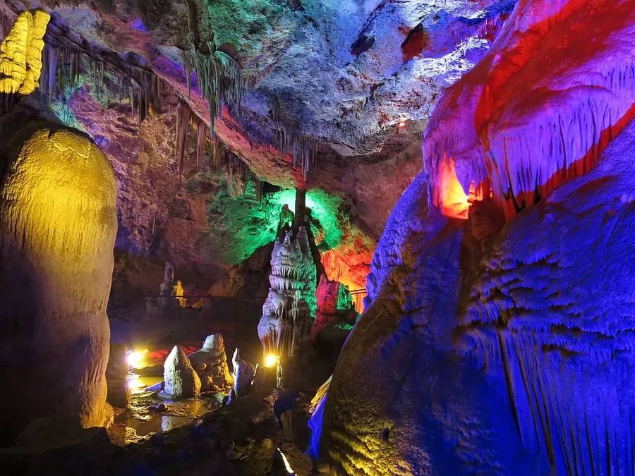 Illuminated cave formations inside Jiguan Cave, Luanchuan County, Henan; 15 October 2013.
Jiguan Cave鸡冠洞
Jiguan Cave lies on Jiguan Mountain west of Luanchuan county town in the Funiu Mountains. It is a limestone cave shaped by karst processes.
Read the place guide →Plan your visit
Getting there
Luanchuan County is about 120 km in a straight line from central Luoyang. Search for 栾川县 in a map app to find stations and your accommodation.
Where to stay →Build your route
Laojun Mountain (Henan) and Chongdugou Valley are both listed here. The linked place guides have entrance and visit details.
Continue with Luoyang →More in Luoyang
Sources & geographic information
Administrative names and parent areas: Official geographic directory · Reference date 2026-09-06.
Some facts checked against 栾川县 — Wikipedia contributors, CC BY-SA 4.0.
Photo: Laojun Mountain (Henan) · Nyx Ning · CC BY-SA 3.0. Proportionally resized and converted to WebP without cropping, retouching or changing the photographed subject.

Photo: Chongdugou Valley · Nyx Ning · CC BY-SA 3.0. Full frame retained; proportionally resized and converted to WebP. No retouching or changes to the photographed subject. Card displays may crop the view.

Photo: Jiguan Cave · Nyx Ning · CC BY-SA 3.0. Proportionally resized and converted to WebP without cropping, retouching or changing the photographed subject.

Map data © OpenStreetMap contributors. Pins mark approximate centres, not entrances or boundaries.