


Get to know Xigong District
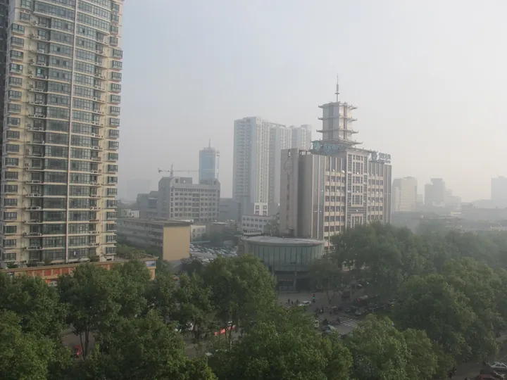
Photo adjustments
Full frame retained; proportionally resized and converted to WebP. No retouching or changes to the photographed subject. Card displays may crop the view.
- Administrative area
- District · 市辖区
- Part of
- Luoyang
- Chinese name
- 西工区
- Local areas
- District guide
Area & population
- Area in the source
- 56.00 km²
- Population · 2019
- 367,500
Source: cited geographic source, as of the dates shown.
History
The district is named after a barracks: Yuan Shikai (袁世凯), then president of the Republic of China, had a new-style barracks built here in 1914, 2.5 kilometres west of the old city, and people called the building site "Xigongdi" (西工地, "the western works"), later shortened to Xigong. The warlord Wu Peifu (吴佩孚) moved in in September 1920 and greatly enlarged it, and from 1937 it held the headquarters of the First War Zone under Cheng Qian (程潜). Wei Lihuang (卫立煌), who took over that command in 1939, added the Xiyin Study (惜阴书室), five brick cave-style rooms copied from those he had seen in Yan'an (延安).
The surviving Xigong Barracks (西工兵营) buildings stand at No. 401 Zhongzhou Middle Road (中州中路): north and south halls and east and west wings around a closed courtyard, with a reviewing stand and the ruined "Old Wu Bridge" (老吴桥) that Wu Peifu built over the Luo in 1921. In December 2019 the barracks entered the fourth list of China's 20th-century architectural heritage. The State Council set up Xigong District in 1956; it was merged into Luobei District (洛北区) two years later and separated again in 1975.
What to see
The sites of two ancient capitals lie here: the Eastern Zhou royal city (东周王城) and the Sui-Tang city of Luoyang (隋唐洛阳城). Zhou Royal City Square (周王城广场), the district's largest public square, is split by Zhongzhou Road and holds a sculpture of the Duke of Zhou (周公) building the city of Luoyi (洛邑) and the "Tianzi Jia Liu" (天子驾六, "the Son of Heaven drives six") chariot-and-horse pit, shown in the Tianzi Jia Liu Museum (周王城天子驾六博物馆).
The Yingtian Gate site (应天门遗址), south of the junction of Zhongzhou Middle Road and Dingding Road (定鼎路), marks the main southern gate of the Ziwei Palace (紫微城); the district government dates the gate to 605 and records it as the first palace-gate site excavated at the two Sui-Tang capitals. Jiuzhou Pond (九洲池) was the largest royal garden inside the Sui-Tang palace. The Sui-Tang Luoyang City National Heritage Park (隋唐洛阳城国家遗址公园) is rated a national 4A scenic area.
Getting oriented
The Luo and Jian (涧河) rivers are among six waterways that cross the district. Luoyang's airport and railway station lie within it, the Longhai Railway (陇海铁路) and the city's ring expressway pass through, and Metro Lines 1 and 2 meet here. Xigong Xiaojie (西工小街) and Hantun Road (汉屯路) are laid out as themed culture and shopping streets. Hongshan (红山), in the west, has hosted a cherry festival and has a cherry-valley leisure park.
Highlights
- Xigong Barracks 西工兵营: Barracks begun in 1914 that gave the district its name; on the fourth list of China's 20th-century architectural heritage (2019).
- Yingtian Gate site 应天门遗址: Main southern gate of the Sui-Tang Ziwei Palace, begun in 605.
- Tianzi Jia Liu Museum 周王城天子驾六博物馆: Museum showing the "Tianzi Jia Liu" chariot-and-horse pit at Zhou Royal City Square.
- Jiuzhou Pond 九洲池: The largest royal garden of the Sui-Tang palace at Luoyang.
Sources for this guide
今日西工_西工区人民政府 · Xigong District People's Government, Luoyang
西工兵营 - 西工名片_西工区人民政府 · Xigong District People's Government, Luoyang
应天门遗址 - 西工名片_西工区人民政府 · Xigong District People's Government, Luoyang
周王城广场 - 西工名片_西工区人民政府 · Xigong District People's Government, Luoyang
隋唐九洲池 - 西工名片_西工区人民政府 · Xigong District People's Government, Luoyang
Original English written from the listed sources and checked sentence by sentence against quoted extracts by a separate reviewer. Updated 2026-09-24.
Explore Xigong District
Core places to explore, with English and Chinese names.
Xigong District 西工区
Plan your visit
Getting there
Xigong District is about 5 km in a straight line from central Luoyang. Search for 西工区 in a map app to find stations and your accommodation.
Where to stay →More in Luoyang
Sources & geographic information
Administrative names and parent areas: Official geographic directory · Reference date 2026-09-06.
Map data © OpenStreetMap contributors. Pins mark approximate centres, not entrances or boundaries.