


Get to know Jianxi District
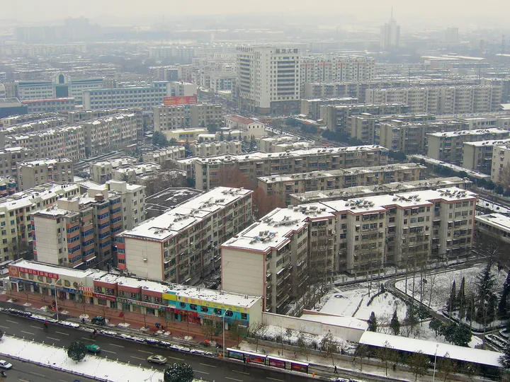
Photo adjustments
Full frame retained; proportionally resized and converted to WebP. No retouching or changes to the photographed subject. Card displays may crop the view.
- Administrative area
- District · 市辖区
- Part of
- Luoyang
- Chinese name
- 涧西区
- Local areas
- District guide
Area & population
- Area in the source
- 89.00 km²
- Population · 2019
- 699,300
Source: cited geographic source, as of the dates shown.
History
The district government counts the area as part of the imperial capital zone through the ages: the Zhou royal city, Han palaces, the Western Garden (西苑) of the Sui and the Tang eastern capital. The modern district grew from industry. Of the 156 key projects of the first Five-Year Plan period, seven went to Luoyang and six of those to Jianxi, among them First Tractor (一拖), Luoyang Bearing (洛轴), Luoyang Copper (洛铜) and the Henan diesel works (河柴). The government describes Jianxi as an old industrial base for farm machinery, mining machinery, copper, bearings and refractory materials, and it also points to relics connected with Xi Zhongxun (习仲勋), Ji Dengkui (纪登奎) and Jiao Yulu (焦裕禄).
What to see
The Jianxi Soviet-style buildings (涧西苏式建筑群) were begun in 1954 for the Soviet-aided projects: factory halls of First Tractor and Luoyang Copper and residential quarters such as blocks No. 2 and No. 10, in Soviet neoclassical style with Chinese touches such as cloud motifs. They were listed in 2013 in the seventh batch of national key cultural relics protection sites.
In Zhoushan Forest Park (周山森林公园), south of Tuqiaogou village (土桥沟村), three joined earth mounds known locally as "the Three Hills" (三山) are traditionally held to be tombs of the Eastern Zhou kings Jing, Dao and Ding; the Zhou Three Kings' Tombs (周三王陵) became a Luoyang municipal protected site in February 1981. The district government calls the Zhoushan royal tombs the earliest surviving royal tomb area in China, holding four Eastern Zhou kings and 335 years older than the First Emperor's tomb.
Getting oriented
The Zhengzhou–Xi'an high-speed railway crosses the district, and the Lianhuo (连霍), Erguang (二广), Ningluo (宁洛) and Luolu (洛卢) expressways crisscross the area. Luoyang Metro Line 1 meets the planned Line 3 at Peony Square (牡丹广场). The district government lists three undergraduate universities in Jianxi.
Highlights
- Jianxi Soviet-style buildings 涧西苏式建筑群: 1950s factory halls and residential blocks built for Soviet-aided projects; national key cultural relics protection site since 2013.
- Zhou Three Kings' Tombs 周三王陵: Three joined earth mounds in Zhoushan Forest Park traditionally attributed to Eastern Zhou kings; Luoyang municipal protected site since 1981.
Sources for this guide
涧西区情简介_涧西概览_涧西区人民政府 · Jianxi District People's Government, Luoyang
涧西区 - 维基百科,自由的百科全书 · Wikipedia (Chinese) · CC BY-SA 4.0
涧西苏式建筑群 - 维基百科,自由的百科全书 · Wikipedia (Chinese) · CC BY-SA 4.0
周三王陵 - 维基百科,自由的百科全书 · Wikipedia (Chinese) · CC BY-SA 4.0
Original English written from the listed sources and checked sentence by sentence against quoted extracts by a separate reviewer. Updated 2026-09-24.
Explore Jianxi District
Core places to explore, with English and Chinese names.
Jianxi District 涧西区
Plan your visit
Getting there
Jianxi District is about 8 km in a straight line from central Luoyang. Search for 涧西区 in a map app to find stations and your accommodation.
Where to stay →More in Luoyang
Sources & geographic information
Administrative names and parent areas: Official geographic directory · Reference date 2026-09-06.
Some facts checked against 涧西区 — Wikipedia contributors, CC BY-SA 4.0.
Some facts checked against 涧西苏式建筑群 — Wikipedia contributors, CC BY-SA 4.0.
Some facts checked against 周三王陵 — Wikipedia contributors, CC BY-SA 4.0.
Map data © OpenStreetMap contributors. Pins mark approximate centres, not entrances or boundaries.