


Get to know Ruyang County
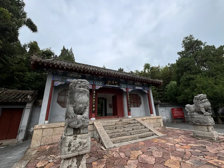
Photo adjustments
Full frame retained; proportionally resized and converted to WebP. No retouching or changes to the photographed subject. Card displays may crop the view.
- Administrative area
- County · 县
- Part of
- Luoyang
- Chinese name
- 汝阳县
- Local areas
- County guide
Area & population
- Area in the source
- 1,325.00 km²
- Population · 2019
- 428,900
Source: cited geographic source, as of the dates shown.
Setting and landscape
The county is long and narrow. Mountains fill the south, where Jiguan Mountain (鸡冠山), between Wangping (王坪乡) and Fudian (付店镇), rises to 1,602.4 metres; the north is plain and low hills, falling to 220 metres in the bed of the Dukang River (杜康河). The Dahu ridge (大虎岭) north of the county town splits it in two: south of the ridge the Ru River carries water to the Huai, while the Dukang and other northern streams flow to the Yellow River. The county government calls Qianping Reservoir (前坪水库) the first dam on the Huai.
History
The Tang set up Yiyang County (伊阳县) here under Ruzhou (汝州); it was abolished in the Five Dynasties and re-established in 1476. In 1959 it was renamed Ruyang, since the Yi valley had passed to neighbouring counties, the seat lay north of the North Ru River, and "Yiyang" was easily confused with nearby Yiyang (宜阳). The county government lists Yangshao culture sites, the reputed home of Guiguzi (鬼谷子) at Yunmeng (云梦) and the Gaoping tomb of Emperor Ming of Wei (魏明帝高平陵) among its relics.
What to see
Dinosaur fossils have turned up in the county since 2005, with six fairly complete skeletons and more than 90 fossil sites. They include Huanghetitan ruyangensis (汝阳黄河巨龙), dug up at Liufugou village (刘富沟村) and 18 metres long, and the five-metre armoured Zhongyuansaurus luoyangensis (洛阳中原龙). A provincial dinosaur-fossil geopark completed in September 2008 has two areas, the fossil beds and Xitaishan (西泰山); its scenery is mainly dinosaur fossils and granite landforms.
Food and local products
A Qing county gazetteer records the folk belief that Du Kang (杜康) made wine here, and the county government calls Ruyang the home of Du Kang culture (杜康文化之乡). The Dukang Spring (杜康泉) is in Caidian township (蔡店乡); Yichuan, also in Luoyang, and Baishui in Shaanxi also claim Du Kang. Ruyang sweet potatoes, eucommia bark (杜仲), Luli mugwort (甪里艾), shiitake and peanuts carry national geographical-indication status. Plum-blossom jade (梅花玉), or Ru jade, comes only from Shangdian town (上店镇): a black stone with scattered coloured markings like fallen petals, carved into bangles, tea sets and exercise balls.
Getting oriented
The county lies 74 kilometres from Luoyang city. The Jiaozuo–Zhicheng railway crosses the northeast of the county, and the Ningluo and Erguang expressways pass through.
Highlights
- Huanghetitan ruyangensis 汝阳黄河巨龙: An 18-metre dinosaur dug up at Liufugou village; one of six fairly complete skeletons from the county.
- Xitaishan 西泰山: One of the two areas of the Ruyang dinosaur-fossil provincial geopark, completed in 2008.
- Plum-blossom jade 梅花玉: Black stone with petal-like coloured markings, found only in Shangdian town.
- Dukang Spring 杜康泉: Spring in Caidian township tied to the Du Kang wine legend.
Sources for this guide
汝阳概况_汝阳县人民政府 · Ruyang County People's Government, Luoyang
自然地理_汝阳县人民政府 · Ruyang County People's Government, Luoyang
汝阳县 - 维基百科,自由的百科全书 · Wikipedia (Chinese) · CC BY-SA 4.0
Original English written from the listed sources and checked sentence by sentence against quoted extracts by a separate reviewer. Updated 2026-09-24.
Explore Ruyang County
Core places to explore, with English and Chinese names.
Places to explore around Ruyang County
 AI illustration · AI
 Plan your visit
Getting there
Ruyang County is about 50 km in a straight line from central Luoyang. Search for 汝阳县 in a map app to find stations and your accommodation.
Where to stay →Build your route
Start with Xitai Mountain. The linked place guides have entrance and visit details.
Continue with Luoyang →More in Luoyang
Sources & geographic information
Administrative names and parent areas: Official geographic directory · Reference date 2026-09-06.
Some facts checked against 汝阳县 — Wikipedia contributors, CC BY-SA 4.0.
Map data © OpenStreetMap contributors. Pins mark approximate centres, not entrances or boundaries.