


Get to know Yiyang County
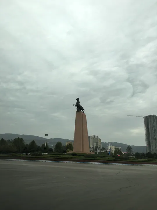
Photo adjustments
Full frame retained; proportionally resized and converted to WebP. No retouching or changes to the photographed subject. Card displays may crop the view.
- Administrative area
- County · 县
- Part of
- Luoyang
- Chinese name
- 宜阳县
- Local areas
- County guide
Area & population
- Area in the source
- 1,666.00 km²
- Population · 2019
- 608,300
Source: cited geographic source, as of the dates shown.
Setting and landscape
The county government describes the land as mountains to the south, ridges to the north and river flats in the middle, with hills taking up six parts in ten. It counts 22 named mountains and peaks. Jinping Mountain (锦屏山), rising straight up at the southern edge of the county seat, is a faulted limestone ridge about 2 kilometres long whose twelve peaks stand in a row like hanging brocade panels; Empress Wu Zetian (武则天) is credited with naming it and writing the inscription "Jinping Qiguan" (锦屏奇观, "the brocade-screen wonder"). Xianglu Mountain (香鹿山) on the north side of town became a provincial forest park in December 2010. Fourteen bridges cross the Luo at the county seat, and a riverside park runs 25 kilometres from Lingshan to the edge of Luoyang's high-tech zone.
History
The county government dates the county to the Eastern Zhou, more than 2,400 years ago, and places it on the old road between Luoyang and Xi'an, the Han and Tang capitals. Under the Tang and Song the area was split between Fuchang (福昌县) and Shou'an (寿安县) counties; the Jin renamed Shou'an as Yiyang in 1166, and Fuchang was merged into it in 1337. Yiyang is the home town of the Tang poet Li He (李贺), known as the "ghost of poetry" (诗鬼).
What to see
Six sites in the county are national key protected sites. One is the old city of Yiyang (宜阳韩都故城), a capital of the Warring States kingdom of Han (韩). The others are the Xianling tomb of the Later Jin (后晋显陵); Wuhua Temple Pagoda (五花寺塔); Lingshan Temple (灵山寺), whose buildings date from the Jin to the Qing; the Neolithic Suyang site (苏羊遗址); and the Qing-era Fuchang Pavilion (宜阳福昌阁). The Hutou Temple Grottoes (虎头寺石窟) are protected at provincial level.
Huaguo Mountain (花果山), whose main peak reaches 1,831.8 metres, became a national forest park in 1991 and is a 3A scenic area; the county government cites experts who identify it as the model for the Flower and Fruit Mountain of Journey to the West (西游记). The Lingshan scenic area (灵山风景区) lies on the south bank of the Luo 7 kilometres west of the county seat. At Sanxiang (三乡镇), a Li He memorial stele survives, and a Han-Tang culture park has a Li He square and memorial hall.
Highlights
- Old city of Yiyang 宜阳韩都故城: Warring States capital of the kingdom of Han; national key protected site.
- Lingshan Temple 灵山寺: National key protected site with buildings from the Jin to the Qing.
- Huaguo Mountain 花果山: National forest park since 1991, main peak 1,831.8 metres, linked by the county to Journey to the West.
- Jinping Mountain 锦屏山: Twelve-peak limestone ridge beside the county seat, named by Wu Zetian.
Sources for this guide
宜阳概况_宜阳县人民政府 · Yiyang County People's Government
宜游宜阳_宜阳县人民政府 · Yiyang County People's Government
宜阳县 - 维基百科,自由的百科全书 · Wikipedia (Chinese) · CC BY-SA 4.0
宜阳县各级文物保护单位列表 - 维基百科,自由的百科全书 · Wikipedia (Chinese) · CC BY-SA 4.0
Original English written from the listed sources and checked sentence by sentence against quoted extracts by a separate reviewer. Updated 2026-09-24.
Explore Yiyang County
Core places to explore, with English and Chinese names.
Yiyang County 宜阳县
Plan your visit
Getting there
Yiyang County is about 30 km in a straight line from central Luoyang. Search for 宜阳县 in a map app to find stations and your accommodation.
Where to stay →More in Luoyang
Sources & geographic information
Administrative names and parent areas: Official geographic directory · Reference date 2026-09-06.
Some facts checked against 宜阳县 — Wikipedia contributors, CC BY-SA 4.0.
Some facts checked against 宜阳县各级文物保护单位列表 — Wikipedia contributors, CC BY-SA 4.0.
Map data © OpenStreetMap contributors. Pins mark approximate centres, not entrances or boundaries.