


Get to know Weidong District
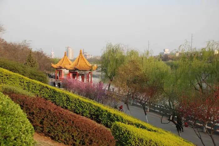
Photo adjustments
EXIF orientation normalized; resized without changing aspect ratio; converted to WebP. No subject edits.
- Administrative area
- District · 市辖区
- Part of
- Pingdingshan
- Chinese name
- 卫东区
- Local areas
- District guide
Area & population
- Area in the source
- 103.00 km²
- Population · 2019
- 321,700
Source: cited geographic source, as of the dates shown.
Setting and landscape
The district slopes from north to south. A chain of low hills runs across the north, among them Luofu Mountain (落凫山), whose 493.7-metre summit is the district's highest point, and Pingdingshan, 427 metres high, which has a level top and no peak. The south is low, flat land along the Zhan River (湛河), and around Pucheng (蒲城) in the southeast the ground is an alluvial plain laid down by the Sha River (沙河).
Summers are hot and bring 51 percent of the year's rain, and July is the wettest month, while winters are dry and cold with northwest winds and only 4.8 percent of the rain. The annual mean temperature is 15°C.
History
According to the district's chronicle office, the area never had a government of its own before modern times. Under the Shang and Zhou it belonged to the state of Ying (应), and from 627 until the early People's Republic most of it lay in Ye County (叶县). After the Pingdingshan coalfield was opened in the mid-1950s, the State Council created Pingdingshan city on 26 March 1957. Weidong District was set up on 21 February 1969, merged with Xinhua into a Central District in 1970, and restored on 9 May 1977.
What to see
The 1957 Northern Ring-Mountain Ecological Road (1957北部环山生态路) runs through the hills of northern Weidong. Summit Park (山顶公园), which the Henan Daily rural edition calls the spiritual home of Pingdingshan residents, sits midway along it and has been upgraded with three leisure plazas and flower beds. On Jinniu Mountain (金牛山), Shangxu village (上徐村) grows soft-seeded pomegranates that are listed as a national geographical indication product. Songjiazhuang (宋家庄) in Zhuyuan village (竹园村) has 3D murals on its farmyard walls, and Tuzhaigou (土寨沟村) lies next to the 3A-rated Xiaoyao Miaojing homestay culture park (逍窑妙境).
Getting oriented
Ye County lies to the east and southeast, Zhanhe District (湛河区) faces Weidong across the Zhan River, and Xinhua District (新华区) adjoins it to the west. The Xuchang–Nanyang road runs north–south through the east of the district and the Luohe–Baofeng railway crosses the south. The district seat is 135 kilometres from Zhengzhou (郑州).
Highlights
- Pingdingshan hill 平顶山: 427-metre flat-topped hill in the district's north that gave the city its name.
- Summit Park 山顶公园: Hilltop park midway along the northern ring-mountain road, upgraded with leisure plazas and flower beds.
- Jinniu Mountain pomegranates 金牛山石榴: Soft-seeded pomegranates from Shangxu village, a national geographical indication product.
Sources for this guide
[地理位置]-卫东区人民政府门户网站 · Weidong District People's Government (Weidong District Local Chronicles Office)
[政区沿革]-卫东区人民政府门户网站 · Weidong District People's Government (Weidong District Local Chronicles Office)
[自然条件]-卫东区人民政府门户网站 · Weidong District People's Government (Weidong District Local Chronicles Office)
河南日报农村版-一路环山 生态富民 · Henan Daily Rural Edition (河南日报农村版)
Original English written from the listed sources and checked sentence by sentence against quoted extracts by a separate reviewer. Updated 2026-09-24.
Explore Weidong District
Core places to explore, with English and Chinese names.
Weidong District 卫东区
Plan your visit
Getting there
Weidong District is about 15 km in a straight line from central Pingdingshan. Search for 卫东区 in a map app to find stations and your accommodation.
Where to stay →More in Pingdingshan
Sources & geographic information
Administrative names and parent areas: Official geographic directory · Reference date 2026-09-06.
Map data © OpenStreetMap contributors. Pins mark approximate centres, not entrances or boundaries.