


Get to know Xinhua District
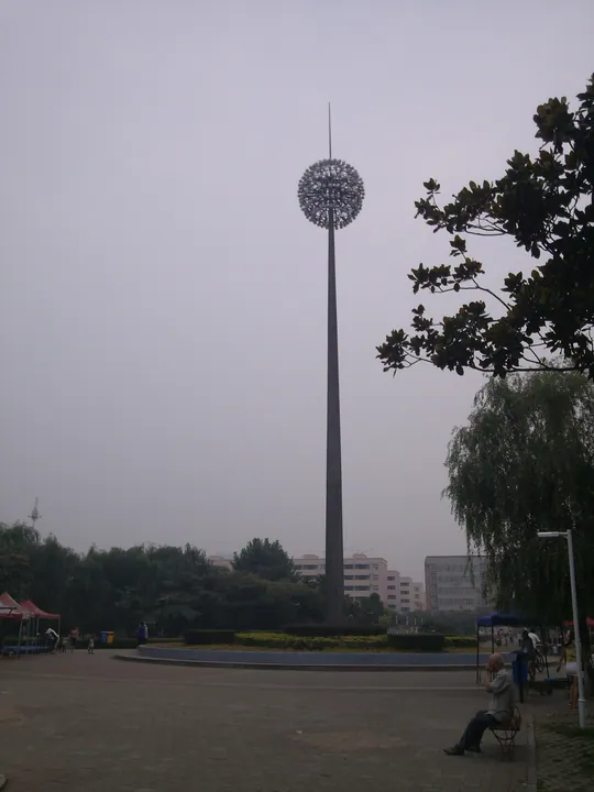
Photo adjustments
Full frame retained; proportionally resized and converted to WebP. No retouching or changes to the photographed subject. Card displays may crop the view.
- Administrative area
- District · 市辖区
- Part of
- Pingdingshan
- Chinese name
- 新华区
- Local areas
- District guide
Area & population
- Area in the source
- 157.00 km²
- Population · 2019
- 409,800
Source: cited geographic source, as of the dates shown.
Setting and landscape
The ground is higher in the northwest and southwest and falls away to the east. A belt of low mountains runs along the north, among them Xiangshan (香山) and Leigutai Mountain (擂鼓台山), whose 505-metre summit is the district's highest point. Low hills in the south form the natural north bank of the Baiguishan Reservoir (白龟山水库), with a narrow lowland corridor between. The Zhan River (湛河) and five tributaries flow through the city. The district lies in what Pingdingshan calls the 'coal bin of the Central Plains', and the Pingmei Shenma Group (平煤神马集团) has its headquarters and seven large mines in the district.
History
People lived here as early as 8,000 years ago. In the Shang period the area belonged to the Ying (应) people, and early in the Western Zhou King Wu made a royal kinsman Marquis of Ying, with his capital at present-day Zhiyang (滍阳). The district was created in February 1969, merged with Weidong into a Central District in February 1970 and restored in May 1977. In 2019 the China Quyi Artists Association named it a 'home of quyi', China's storytelling and ballad-singing arts.
What to see
Xiangshan Temple (香山寺) stands on the summit of Huozhu Hill (火珠山) in the northwest and was founded at the end of the Eastern Han. Its Dabei Guanyin Pagoda (大悲观音大士塔), an octagonal nine-storey brick pagoda 33 metres high, was built by imperial order in 1068. A stele of the Xiangshan Dabei Bodhisattva biography, written by Jiang Zhiqi (蒋之奇) in the hand of Cai Jing (蔡京), tells of Guanyin as Miaoshan, daughter of King Zhuang; the pagoda and the stele are national key protected relics. The temple became a 4A scenic area in 2016.
Egret Isle National Urban Wetland Park (白鹭洲国家城市湿地公园) east of Jiaodian (焦店镇) was approved in 2009 and has reed beds, lotus and water lilies. Yingcheng Square (鹰城广场) on Changqing Road covers 16 hectares with a lake and four large sculptures. The Yigoucheng–Mingmen cultural tourism park (怡购城—名门文创旅游园区), a 3A area since 2020, holds a snack street and the Yingcheng Impressions Museum (鹰城印象博物馆).
Getting oriented
Kaiyuan Road divides Xinhua from Weidong District (卫东区) to the east; the Zhan River and the reservoir separate it from Zhanhe District (湛河区) to the south, and the northern hills mark the border with Baofeng County (宝丰县). The Mengmiao–Baofeng railway crosses the district from southeast to northwest, and the Nanjing–Luoyang Expressway (宁洛高速) passes through.
Highlights
- Xiangshan Temple 香山寺: Hilltop temple founded in the late Eastern Han, with a 33-metre brick pagoda built in 1068; a 4A scenic area since 2016.
- Egret Isle National Urban Wetland Park 白鹭洲国家城市湿地公园: Wetland park east of Jiaodian approved in 2009, with reeds, lotus and water lilies.
- Yingcheng Square 鹰城广场: 16-hectare square on Changqing Road with a lake and four large sculptures.
- Yigoucheng–Mingmen cultural tourism park 怡购城—名门文创旅游园区: Shopping and culture park with a snack street and the Yingcheng Impressions Museum; 3A since 2020.
Sources for this guide
走进新华 - 区域位置 · Xinhua District People's Government, Pingdingshan
新华区 (平顶山市) - 维基百科 · Wikipedia (Chinese) · CC BY-SA 4.0
平顶山市市情简介 - 新华区区情介绍 · Pingdingshan Municipal Human Resources and Social Security Bureau
走进新华 - 风景名胜 · Xinhua District People's Government, Pingdingshan
走进新华 - 地形地貌 · Xinhua District People's Government, Pingdingshan
走进新华 - 建置区划 · Xinhua District People's Government, Pingdingshan
Original English written from the listed sources and checked sentence by sentence against quoted extracts by a separate reviewer. Updated 2026-09-24.
Explore Xinhua District
Core places to explore, with English and Chinese names.
Xinhua District 新华区
Plan your visit
Getting there
Xinhua District is about 10 km in a straight line from central Pingdingshan. Search for 新华区 in a map app to find stations and your accommodation.
Where to stay →More in Pingdingshan
Sources & geographic information
Administrative names and parent areas: Official geographic directory · Reference date 2026-09-06.
Some facts checked against 新华区 (平顶山市) — Wikipedia contributors, CC BY-SA 4.0.
Map data © OpenStreetMap contributors. Pins mark approximate centres, not entrances or boundaries.