


Get to know Wugang
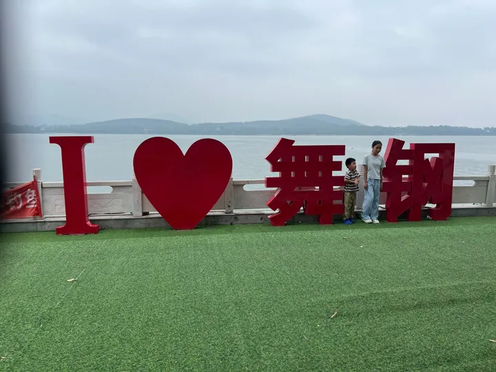
Photo adjustments
Full frame retained; proportionally resized and converted to WebP. No retouching or changes to the photographed subject. Card displays may crop the view.
- Administrative area
- County-level city · 县级市
- Part of
- Pingdingshan
- Chinese name
- 舞钢市
- Local areas
- County-level city guide
Area & population
- Area in the source
- 640.00 km²
- Population · 2019
- 321,800
Source: cited geographic source, as of the dates shown.
Setting and landscape
The ground is high in the northwest and southeast and low in the northeast and southwest; plains below 100 metres cover under a third of it and rolling uplands of 100 to 200 metres cover 43 percent. Its rivers, among them the Gun (滚河), Wei (韦河) and Ganjiang (甘江河), belong to the Huai system. The mean annual temperature is 14.9°C, rainfall is around 1,000 millimetres, and winds blow mostly from the southwest.
History
The Wugang government traces the area to Bozi (柏子国), a Western Zhou fief, which Chu absorbed late in the Spring and Autumn period. In the Warring States period it belonged to Han (韩) under the name Hebo (合伯) and was known for smelting iron and casting swords; Su Qin (苏秦) listed Hebo among the places that supplied Han's swords and halberds. Iron-smelting sites found at Xugou (许沟), Jianshan (尖山) and other places date from the Warring States to the Han dynasty.
After the 1951 call to harness the Huai, the state chose this area for Shimantan Reservoir, the first reservoir on the upper Huai. In 1970 the state also sited the Wuyang extra-thick steel plate works; its rolling mill went into full production in 1981, which the city history says ended China's inability to make extra-wide, extra-thick plate. The dams of Shimantan and Tiangang (田岗水库) reservoirs failed in the flood of August 1975. A Wugang District was formed in November 1977 and became Wugang city in September 1990.
What to see
Erlang Mountain (二郎山) rises on the south shore of Shimantan Reservoir as one of the core areas of Shimantan National Forest Park (石漫滩国家森林公园). It is named after a legend in which the god Erlang Shen carried mountains on a pole to chase the sun, and three of its seven peaks, Jianshan (尖山), Pingshan (平山) and Changlingshan (长岭山), have been opened to visitors. The waterside route passes a suspension bridge, a plank walk over the water and the reservoir dam, and a water-lantern festival is held at the Mid-Autumn Festival.
Dengtaijia (灯台架), a national 4A scenic area about 20 kilometres southeast of the city centre, is named after its 801.7-metre main peak, which is shaped like an old lamp stand and is Wugang's second-highest summit. Its shale, conglomerate, basalt and quartz sandstone show ripple marks and mud-cracked rock left from an ancient sea floor; the Tianchi waterfall (天池大瀑布) and the Qingtan canyon (青檀大峡谷) are among its main sights.
Highlights
- Erlang Mountain 二郎山: Seven-peaked hill on the south shore of Shimantan Reservoir, named after the Erlang Shen legend.
- Dengtaijia 灯台架: National 4A scenic area with an 801.7-metre lamp-stand-shaped peak and ancient sea-floor rock features.
- Shimantan Reservoir 石漫滩水库: Chosen after the 1951 Huai River campaign as the first reservoir on the upper Huai; its dam failed in the 1975 flood.
Sources for this guide
舞钢市 - 维基百科,自由的百科全书 · Wikipedia (Chinese) · CC BY-SA 4.0
地理位置 · Wugang Municipal People's Government
历史文化 · Wugang Municipal People's Government (Wugang History and Chronicles Office)
二郎山 · Wugang Municipal People's Government
灯台架 · Wugang Municipal People's Government
Original English written from the listed sources and checked sentence by sentence against quoted extracts by a separate reviewer. Updated 2026-09-24.
Explore Wugang
Core places to explore, with English and Chinese names.
Places to explore around Wugang
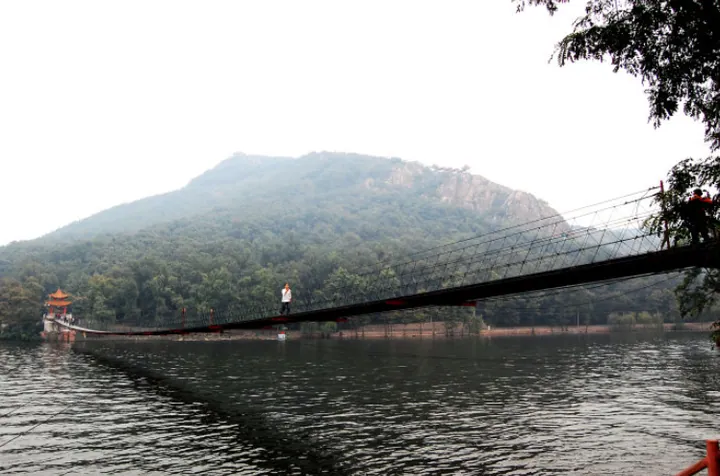 A long suspension footbridge crossing grey water toward a forested hill, with a small pavilion at its far end, a single walker mid-span, willow foliage at the right edge and a hazy white sky.
Plan your visit
Getting there
Wugang is about 60 km in a straight line from central Pingdingshan. Search for 舞钢市 in a map app to find stations and your accommodation.
Where to stay →Build your route
Start with Erlang Mountain. The linked place guides have entrance and visit details.
Continue with Pingdingshan →More in Pingdingshan
Sources & geographic information
Administrative names and parent areas: Official geographic directory · Reference date 2026-09-06.
Some facts checked against 舞钢市 — Wikipedia contributors, CC BY-SA 4.0.
Photo: Erlang Mountain · Xuczhisheng · CC BY-SA 3.0. Full frame retained; proportionally resized and converted to WebP. No retouching or changes to the photographed subject. Card displays may crop the view.

Map data © OpenStreetMap contributors. Pins mark approximate centres, not entrances or boundaries.