


Get to know Pingqiao District
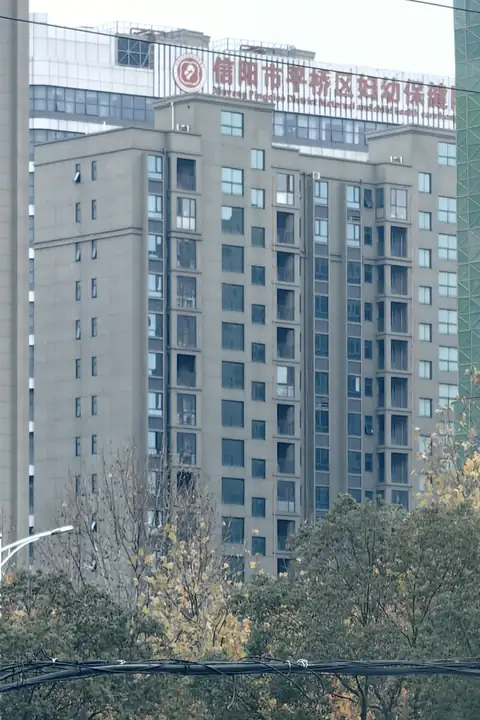
Photo adjustments
EXIF orientation normalized; resized without changing aspect ratio; converted to WebP. No subject edits.
- Administrative area
- District · 市辖区
- Part of
- Xinyang
- Chinese name
- 平桥区
- Local areas
- District guide
Area & population
- Area in the source
- 1,889.00 km²
- Population · 2019
- 747,600
Source: cited geographic source, as of the dates shown.
Setting and landscape
Above the Chushandian Reservoir (出山店水库), the main stream of the Huai runs for about 18.87 km in the district, from the mouth of the Maoji River (毛集河) at Niuwan village in Wanggang township (王岗乡) down to Yongdun village in Pingchangguan town (平昌关镇), where the reservoir's managed area begins.
What to see
The Chengyang city site (城阳城址), the remains of an Eastern Zhou city, is the district's only national key protected site; it and the Beihu (北湖) scenic area are each run as a separate administrative zone. Provincially protected sites include the Biandan Society revolutionary site (扁担会革命旧址) from 1935, the Red Army Bridge (红军桥) and the old city of Pingchang (平昌故城). The National Development and Reform Commission lists Haotang village (郝堂村) in Pingqiao among the rural-tourism destinations Xinyang has made known nationwide.
Xinyang Agriculture and Forestry University (信阳农林学院) built its Yangshan campus in Yangshan subdistrict (羊山街道) in 2004, and its Nanwan campus moved there in 2011.
Food and local products
Pingqiao is part of the historic home of Xinyang Maojian (信阳毛尖) green tea. Lu Yu's Classic of Tea (茶经), written between 760 and 780, placed Yiyang commandery (义阳郡), now Pingqiao and Shihe, in the Huainan tea region, and the tea was historically grown mainly in today's Shihe, Pingqiao and Luoshan (罗山).
Getting oriented
Xinyang East (信阳东站), in Pingqiao subdistrict, opened on 28 September 2012 on the Beijing–Guangzhou high-speed railway, and a second high-speed station, Minggang East (明港东站), serves Minggang town (明港镇). Xinyang Minggang Airport (信阳明港机场) sits where Minggang meets Queshan County (确山县) of Zhumadian (驻马店). The conventional Beijing–Guangzhou and Nanjing–Xi'an railways, the Beijing–Hong Kong–Macau and Shanghai–Shaanxi expressways, and national highways 107 and 312 also pass through.
Highlights
- Chengyang city site 城阳城址: Eastern Zhou city site; national key protected site run as its own administrative zone.
- Haotang village 郝堂村: Listed by the National Development and Reform Commission among Xinyang's nationally known rural-tourism destinations.
- Xinyang Maojian tea 信阳毛尖: Green tea historically grown mainly in today's Shihe, Pingqiao and Luoshan.
Sources for this guide
文字解读:《淮河干流信阳市平桥区(出山店水库上游段)2026年度河道采砂实施方案》-平桥区人民政府 · Pingqiao District People's Government, Xinyang
红色旅游在老区扬帆起航——河南省信阳市红色旅游发展典型案例 · National Development and Reform Commission
平桥区 - 维基百科,自由的百科全书 · Wikipedia (Chinese) · CC BY-SA 4.0
平桥区各级文物保护单位列表 - 维基百科,自由的百科全书 · Wikipedia (Chinese) · CC BY-SA 4.0
信阳东站 - 维基百科,自由的百科全书 · Wikipedia (Chinese) · CC BY-SA 4.0
明港镇 - 维基百科,自由的百科全书 · Wikipedia (Chinese) · CC BY-SA 4.0
信阳农林学院 - 维基百科,自由的百科全书 · Wikipedia (Chinese) · CC BY-SA 4.0
信阳毛尖 - 维基百科,自由的百科全书 · Wikipedia (Chinese) · CC BY-SA 4.0
Original English written from the listed sources and checked sentence by sentence against quoted extracts by a separate reviewer. Updated 2026-09-24.
Explore Pingqiao District
Core places to explore, with English and Chinese names.
Pingqiao District 平桥区
Plan your visit
Getting there
Pingqiao District is about 6 km in a straight line from central Xinyang. Search for 平桥区 in a map app to find stations and your accommodation.
Where to stay →More in Xinyang
Sources & geographic information
Administrative names and parent areas: Official geographic directory · Reference date 2026-09-06.
Some facts checked against 平桥区 — Wikipedia contributors, CC BY-SA 4.0.
Some facts checked against 平桥区各级文物保护单位列表 — Wikipedia contributors, CC BY-SA 4.0.
Some facts checked against 信阳东站 — Wikipedia contributors, CC BY-SA 4.0.
Some facts checked against 明港镇 — Wikipedia contributors, CC BY-SA 4.0.
Some facts checked against 信阳农林学院 — Wikipedia contributors, CC BY-SA 4.0.
Some facts checked against 信阳毛尖 — Wikipedia contributors, CC BY-SA 4.0.
Map data © OpenStreetMap contributors. Pins mark approximate centres, not entrances or boundaries.