


Get to know Shangcheng County
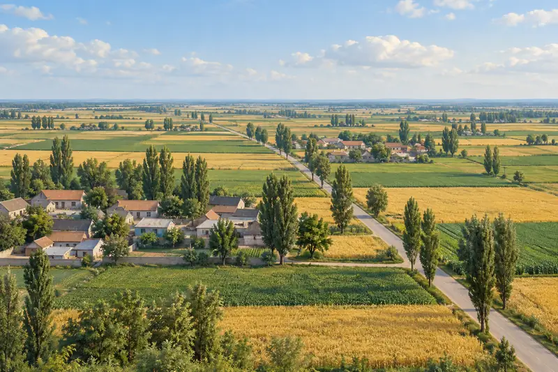
- Administrative area
- County · 县
- Part of
- Xinyang
- Chinese name
- 商城县
- Local areas
- County guide
Area & population
- Area in the source
- 2,117.00 km²
- Population · 2019
- 527,300
Source: cited geographic source, as of the dates shown.
Setting and landscape
The land rises from north to south. Jingang Terrace (金刚台), at 1,584 metres, is the highest peak of the Dabie Mountains within Henan. The whole county drains to the Huai (淮河): the Guan River (灌河) crosses it from south to north and joins the Shi River (史河) as the Shiguan River (史灌河), with the Nianyushan Reservoir (鲇鱼山水库) on its upper course. Jingang Terrace is a national geopark, and the county also holds a Dabie Mountains national nature reserve.
History
The area passed from Wu (吴) to Chu (楚) in the Spring and Autumn and Warring States periods, hence the old label "head of Wu, tail of Chu" (吴头楚尾). Called Yincheng (殷城) from the Sui, it became Shangcheng in 960, when the Song banned the character yin (殷) from the name of Zhao Hongyin (赵弘殷), father of the founding emperor. The Shangcheng Uprising (商城起义) of May 1929 was Henan's first successful armed uprising and set up the province's first county soviet; after the Red Army took the town for the third time in 1932 it was renamed Chicheng (赤城, "Red City"). The song "Osmanthus Blooms Everywhere in August" (八月桂花遍地开) spread nationwide from here.
What to see
Ming buildings include the Chongfu Pagoda (崇福塔) and Fayan Temple (法眼寺). Revolutionary sites include the former Chicheng County Soviet government, the forward headquarters of the Liu–Deng army (刘邓大军) and the Red Army caves on Jingang Terrace (金刚台红军洞群).
Huangbai Mountain (黄柏山), a national forest park in the south of the county, spans the Henan–Hubei–Anhui border. From its bus station one route climbs east to Tianchi (天池), also called Dicui Lake (滴翠湖), and the Huangbai Grand Canyon (黄柏山大峡谷); a second heads south-west past Fayan Temple to Shizi Peak (狮子峰) in Macheng (麻城); a third, also south-west, leads to the Huangbai Mountain Waterfall (黄柏山大瀑布), formerly Wanzhang Cliff (万丈崖).
Food and local products
Shangcheng is billed as China's home of stews (中国炖菜之乡), and its stew-cooking technique is on the Henan intangible-heritage list. Shangcheng bamboo-tube fish (商城筒鲜鱼) is made after the Frost's Descent (霜降) from bighead carp of over a kilogram caught in the Nianyushan Reservoir: the pieces are salted with ginger and dried red chilli, packed into fresh bamboo tubes sealed with lotus or bamboo leaves, and fermented for seven to fifteen days. The classic way to eat it is as a hotpot cooked in plain water with ginger and spring onion. Shangcheng poria (商茯苓), balloon-flower root (商桔梗), Shangcheng camellia oil (商城茶油) and Dabie Mountains tianxiang greens (大别山天香菜) are Chinese geographical-indication products.
Highlights
- Jingang Terrace 金刚台: 1,584-metre peak, the highest of the Dabie Mountains in Henan; a national geopark with Red Army caves.
- Huangbai Mountain 黄柏山: National forest park on the three-province border, with a lake, gorge, waterfall and a route to Fayan Temple.
- Shangcheng bamboo-tube fish 商城筒鲜鱼: Reservoir carp salted and fermented in fresh bamboo tubes for 7 to 15 days, eaten as a hotpot.
- Chongfu Pagoda 崇福塔: Ming-dynasty building named by the county government.
Sources for this guide
商城概况-商城县人民政府 · Shangcheng County People's Government
商城黄柏山:大别山深处的清凉避暑胜地-商城县人民政府 · Shangcheng County People's Government (from the Huangbai Mountain Shizi Peak tourist area)
竹筒藏鲜韵 山野千年香——非遗美味商城筒鲜鱼-商城县人民政府 · Shangcheng County People's Government (Shangcheng County Media Centre)
商城县 - 维基百科,自由的百科全书 · Wikipedia (Chinese) · CC BY-SA 4.0
Original English written from the listed sources and checked sentence by sentence against quoted extracts by a separate reviewer. Updated 2026-09-24.
Explore Shangcheng County
Core places to explore, with English and Chinese names.
Places to explore around Shangcheng County
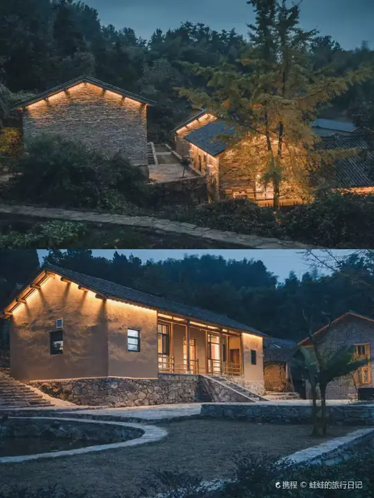 Huangbai Mountain ·
 Plan your visit
Getting there
Shangcheng County is about 130 km in a straight line from central Xinyang. Search for 商城县 in a map app to find stations and your accommodation.
Where to stay →Build your route
Start with Huangbai Mountain. The linked place guides have entrance and visit details.
Continue with Xinyang →More in Xinyang
Sources & geographic information
Administrative names and parent areas: Official geographic directory · Reference date 2026-09-06.
Some facts checked against 商城县 — Wikipedia contributors, CC BY-SA 4.0.
Photo: Huangbai Mountain · Source photographer · License not provided. EXIF orientation normalized; resized without changing aspect ratio; converted to WebP. No subject edits.
Map data © OpenStreetMap contributors. Pins mark approximate centres, not entrances or boundaries.