


Get to know Chuanhui District
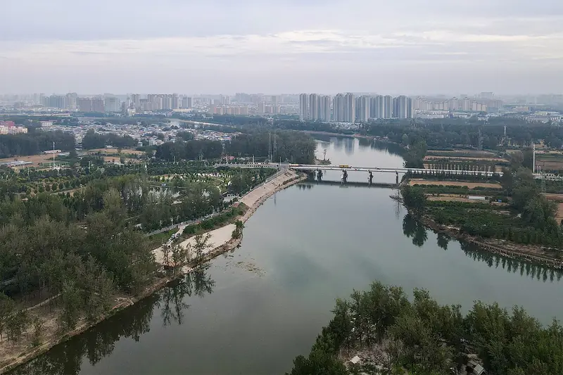
Photo adjustments
Full frame retained; EXIF orientation normalized, proportionally resized to at most 800 pixels and converted to WebP. No generated pixels or subject changes. Cards may crop the display.
- Administrative area
- District · 市辖区
- Part of
- Zhoukou
- Chinese name
- 川汇区
- Local areas
- District guide
Area & population
- Area in the source
- 141.00 km²
- Population · 2019
- 721,300
Source: cited geographic source, as of the dates shown.
History
Between the 17th and 19th centuries the town was a major stop on the inland waterways between the Huai and the Yellow River, and in the Ming and Qing dynasties boats and carts converged here and merchants gathered. The three rivers split the city into three banks facing one another, in earlier times it was a hub of grain shipping by water, and it has long been called 'Little Wuhan' (小武汉). Traders from Shanxi and Shaanxi living in Zhoukou pooled funds for their own guild hall and temple to Guan Yu (关羽), which still stands.
What to see
The Zhoukou Guandi Temple (周口关帝庙), on Fuqiang Street (富强街) in Renhe subdistrict (人和街道), was also known as the Shanxi–Shaanxi Guild Hall (山陕会馆). Work began in 1693 and, after enlargements under successive Qing emperors, the complex was completed in 1852, 159 years later. It faces south and has three courtyards covering more than 21,600 square metres, with over 140 bays of halls, galleries and pavilions still standing. The buildings on the central axis include the gate, iron flagpoles, a stone archway, a stele pavilion, the main hall, an opera stage and the Spring and Autumn Pavilion (春秋阁). Side halls are dedicated to the river god, the Yan Emperor (炎帝), the god of medicine and the god of wealth, and a garden fills the rear court. It is known for its woodcarving, stone carving and painted decoration. The temple became a national key protected site in 1996, has housed a museum since 1986, and is listed by the Zhoukou city government among the city's national 4A scenic areas.
Getting oriented
Chuanhui is one of two districts among Zhoukou's ten county-level divisions, alongside Huaiyang (淮阳区). The district government sits in Laojie (老街, 'Old Street'), and the district also contains the Chenzhou Hui ethnic subdistrict (陈州回族街道).
Highlights
- Zhoukou Guandi Temple 周口关帝庙: Shanxi–Shaanxi merchants' guild hall built 1693–1852; national key protected site since 1996 and a 4A scenic area.
Sources for this guide
周口关帝庙 - 维基百科 · Chinese Wikipedia · CC BY-SA 4.0
Chuanhui, Zhoukou - Wikipedia · English Wikipedia · CC BY-SA 4.0
川汇区 - 维基百科 · Chinese Wikipedia · CC BY-SA 4.0
周口市情 - 周口市人民政府 · Zhoukou Municipal People's Government
Original English written from the listed sources and checked sentence by sentence against quoted extracts by a separate reviewer. Updated 2026-09-24.
Explore Chuanhui District
Core places to explore, with English and Chinese names.
Places to explore around Chuanhui District
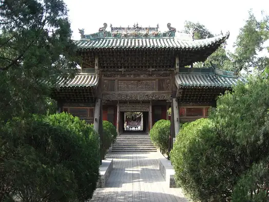 Zhoukou Guandi Temple ·
 Plan your visit
Getting there
Chuanhui District is about 5 km in a straight line from central Zhoukou. Search for 川汇区 in a map app to find stations and your accommodation.
Where to stay →Build your route
Start with Zhoukou Guandi Temple. The linked place guides have entrance and visit details.
Continue with Zhoukou →More in Zhoukou
Sources & geographic information
Administrative names and parent areas: Official geographic directory · Reference date 2026-09-06.
Some facts checked against 周口关帝庙 — Wikipedia contributors, CC BY-SA 4.0.
Some facts checked against Chuanhui, Zhoukou — Wikipedia contributors, CC BY-SA 4.0.
Some facts checked against 川汇区 — Wikipedia contributors, CC BY-SA 4.0.
Photo: Zhoukou Guandi Temple · Gomeying · Public domain. EXIF orientation normalized; resized without changing aspect ratio; converted to WebP. No subject edits.

Map data © OpenStreetMap contributors. Pins mark approximate centres, not entrances or boundaries.