


Get to know Shangshui County
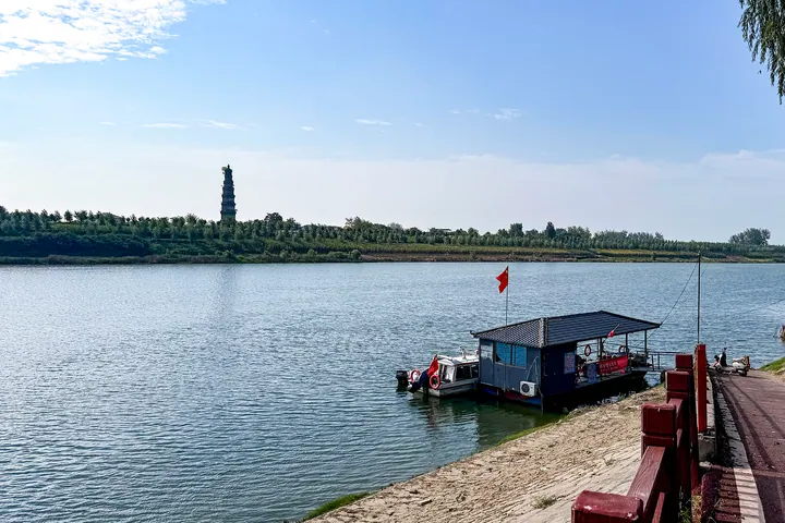
Photo adjustments
Full frame retained; proportionally resized and converted to WebP. No retouching or changes to the photographed subject. Card displays may crop the view.
- Administrative area
- County · 县
- Part of
- Zhoukou
- Chinese name
- 商水县
- Local areas
- County guide
Area & population
- Area in the source
- 1,325.00 km²
- Population · 2019
- 880,000
- Administrative seat
- Chengguan
Source: cited geographic source, as of the dates shown.
History
A county called Yangcheng was first created here under the Qin. The Sui renamed it Yinshui (殷水), after a large river of that name, and in 960 the new Song emperor Zhao Kuangyin (赵匡胤) changed Yin to Shang (商) to avoid the name of his father, Zhao Hongyin (赵弘殷). The county has been called Shangshui ever since.
The Yangcheng city site lies north of Fusu village (扶苏村) in Shuzhuang (舒庄乡) and is regarded as the birthplace of Chen Sheng, remembered as the leader of China's first peasant uprising, in the last years of the Qin. It has a rammed-earth outer city about 800 by 500 metres with a smaller inner city that local people still call the "Golden Throne Hall". Pieces of pottery bases marked "Fusu Sigong" (扶苏司工) have been found in the inner city. The site is on the eighth national list.
What to see
The Shoushengsi Pagoda (寿圣寺塔) faces Xiaoyao (逍遥镇) across the river. Built of brick on a six-sided plan, it rises nine storeys to 41.5 metres; four lines carved on the first-storey door lintel date it to 1033, and a spiral passage inside climbs to the top under a cast-iron gourd finial. It became a national key site in 2006.
The Ye Family Manor stands in Dengcheng, a town named after the Wei general Deng Ai (邓艾), who garrisoned troops there in the Three Kingdoms period. With the Sha River (沙河) to the north, the Ye family grew rich from river transport. Ye Fangke (叶方科) and his descendants built the manor from the Kangxi reign until it was largely complete under Xianfeng, over more than a century. The manor is laid out mainly around three large courtyards, with carved brick, wood and stone; the hall of the first courtyard is an open two-storey pavilion on a high base. The Zhoukou city government describes it as the largest and best-preserved Qing residential manor in eastern Henan. It became a provincial protected site in 1986, a national key site in 2013 and a 4A scenic area in December 2023.
Highlights
- Shoushengsi Pagoda 寿圣寺塔: Nine-storey hexagonal brick pagoda of 1033, 41.5 metres tall; national key site 2006.
- Ye Family Manor 叶氏庄园: Qing merchant family manor at Dengcheng; national key site 2013, 4A scenic area 2023.
- Yangcheng ancient city site 阳城故城遗址: Rammed-earth city regarded as Chen Sheng's birthplace.
Sources for this guide
叶氏庄园——AAAA_周口市人民政府 · Zhoukou Municipal People's Government
商水县 - 维基百科,自由的百科全书 · Wikipedia (Chinese) · CC BY-SA 4.0
商水县各级文物保护单位列表 - 维基百科,自由的百科全书 · Wikipedia (Chinese) · CC BY-SA 4.0
Original English written from the listed sources and checked sentence by sentence against quoted extracts by a separate reviewer. Updated 2026-09-24.
Explore Shangshui County
Core places to explore, with English and Chinese names.
Shangshui County 商水县
Plan your visit
Getting there
Shangshui County is about 15 km in a straight line from central Zhoukou. Search for 商水县 in a map app to find stations and your accommodation.
Where to stay →More in Zhoukou
Sources & geographic information
Administrative names and parent areas: Official geographic directory · Reference date 2026-09-06.
Some facts checked against 商水县 — Wikipedia contributors, CC BY-SA 4.0.
Some facts checked against 商水县各级文物保护单位列表 — Wikipedia contributors, CC BY-SA 4.0.
Map data © OpenStreetMap contributors. Pins mark approximate centres, not entrances or boundaries.