


Get to know Changyang Tujia Autonomous County

Photo adjustments
Full frame retained; proportionally resized and converted to WebP. No retouching or changes to the photographed subject. Card displays may crop the view.
- Administrative area
- Autonomous county · 自治县
- Part of
- Yichang
- Chinese name
- 长阳土家族自治县
- Local areas
- Autonomous county guide
Area & population
- Area in the source
- 3,430.00 km²
- Population · 2020
- 305,740
Source: cited geographic source, as of the dates shown.
History
Changyang Man (长阳人) lived in caves here about 185,000 years ago, in the Middle Palaeolithic. In the late Neolithic, Linjun (廪君), a famous chief of the Ba (巴) people, became leader of a tribal alliance. The Han created Henshan County (佷山县), the first county here. In 588 the Sui set up Changyang County and moved the seat to Longzhouping (龙舟坪), which is still the county seat. The name Changyang appears in Tang records and is still in use. The State Council approved the change to a Tujia autonomous county on 13 July 1984.
Tujia songs, dances and stories
Sayier'he (撒叶儿嗬), on the first national intangible-heritage list in 2006, is a Tujia funeral song and dance of the middle Qing River. Neighbours gather before the coffin in the family's main hall and the men sing and dance, often through the night. The Tujia treat the death of an elder after a full life as something to celebrate. A song master beats a drum to call the song, and the dancers follow in 24 set routines with names such as "phoenix spreads its wings".
Changyang mountain songs (长阳山歌), listed in 2008 with the weeding gong-and-drum songs, are field songs sung loud and free; in the weeding season two singers, one with a drum and one with a gong, face the workers and lead the singing. The Duzhenwan stories (都镇湾故事), listed in 2008, are told in villages around Duzhenwan (都镇湾) and are known for their tiger tales. The storytellers are not professionals or apprentices; the tales pass down within families and the community.
Food and local products
The Yichang city government lists high-mountain vegetables among Changyang's specialities and calls it a home of konjac (魔芋) and of medicinal quince (药用木瓜).
Highlights
- Sayier'he 土家族撒叶儿嗬: National intangible heritage (2006); all-night Tujia funeral dance with 24 routines.
- Changyang mountain songs 长阳山歌: National intangible heritage (2008); field songs led by drum and gong in the weeding season.
- Duzhenwan stories 都镇湾故事: National intangible heritage (2008); oral tales known for their tiger stories.
Sources for this guide
长阳土家族自治县 - 重点产业园区 - 宜昌市人民政府 · Yichang Municipal People's Government (Investment Promotion Bureau)
长阳土家族自治县 - 维基百科,自由的百科全书 · Chinese Wikipedia · CC BY-SA 4.0
土家族撒叶儿嗬 - 中国非物质文化遗产网·中国非物质文化遗产数字博物馆 · China Intangible Cultural Heritage Network (Ministry of Culture and Tourism)
薅草锣鼓(长阳山歌) - 中国非物质文化遗产网·中国非物质文化遗产数字博物馆 · China Intangible Cultural Heritage Network (Ministry of Culture and Tourism)
都镇湾故事 - 中国非物质文化遗产网·中国非物质文化遗产数字博物馆 · China Intangible Cultural Heritage Network (Ministry of Culture and Tourism)
Original English written from the listed sources and checked sentence by sentence against quoted extracts by a separate reviewer. Updated 2026-09-24.
Explore Changyang Tujia Autonomous County
Core places to explore, with English and Chinese names.
Places to explore around Changyang Tujia Autonomous County
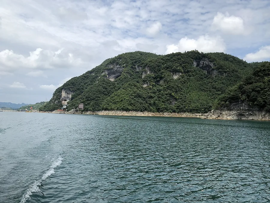 The Qing River and wooded hills in the Qingjiang Gallery scenic area of Changyang, August 2019.
Plan your visit
Getting there
Changyang Tujia Autonomous County is about 45 km in a straight line from central Yichang. Search for 长阳土家族自治县 in a map app to find stations and your accommodation.
Where to stay →Build your route
Start with Qing River. The linked place guides have entrance and visit details.
Continue with Yichang →More in Yichang
Sources & geographic information
Administrative names and parent areas: Official geographic directory · Reference date 2026-09-06.
Some facts checked against 长阳土家族自治县 — Wikipedia contributors, CC BY-SA 4.0.
Photo: Qing River · Fxqf · CC BY-SA 4.0. Proportionally resized and converted to WebP without cropping, retouching or changing the photographed subject.

Map data © OpenStreetMap contributors. Pins mark approximate centres, not entrances or boundaries.