


Get to know Xingshan County
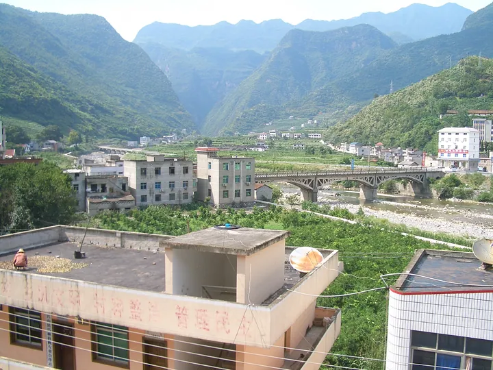
Photo adjustments
Full frame retained; proportionally resized and converted to WebP. No retouching or changes to the photographed subject. Card displays may crop the view.
- Administrative area
- County · 县
- Part of
- Yichang
- Chinese name
- 兴山县
- Local areas
- County guide
Area & population
- Area in the source
- 2,316.00 km²
- Population · 2020
- 133,886
Source: cited geographic source, as of the dates shown.
History
In the Han the area belonged to Nan Commandery (南郡). Xingshan was created in AD 260, under Emperor Jing of Wu (吴景帝), by splitting off the northern part of Zigui. The county seat is now Gufu (古夫镇). The legend of Wang Zhaojun, told mainly in Xingshan and in Hohhot, went onto the national intangible-heritage list in 2008; the local stories explain place names and recall her character.
Xingshan folk songs (兴山民歌), on the national list since 2006, use an interval that falls between a major and a minor third, known as the "Xingshan third"; some scholars see the songs as survivals of the ancient songs of the Jingchu (荆楚) region. Xingshan weigu (兴山围鼓) is a band form that alternates sung narration with wind and percussion. Its forerunner, the "dahuopao" (打火炮) of the area around the Wudang Mountains (武当山), reached Xingshan around 1855 and has more than 300 tunes, and bands play in all eight townships.
What to see
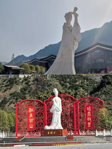
Zhaojun Village (昭君村) stands on the Xiangxi River (香溪河) and was renamed after Wang Zhaojun, who was born there in the Western Han. The county government counts more than 20 sites in the village, among them the Niangniang Spring (娘娘泉), a dressing terrace and a statue of Zhaojun, and the village was named one of China's most beautiful villages in 2019.
The Chaotianhou rafting run (朝天吼漂流) is a national AAAA scenic area. The run is 6.5 km long with a total drop of 148 m, past rock features such as Reclining Buddha Mountain (卧佛山) and General's Pillar (将军柱). Its exit on the Shanghai–Chengdu Expressway is at Gaolan (高岚).
Highlights
- Zhaojun Village 昭君村: Birthplace of Wang Zhaojun on the Xiangxi River, with more than 20 named spots.
- Chaotianhou Rafting 朝天吼漂流: National AAAA scenic area; a 6.5 km run with a 148 m drop.
- Xingshan folk songs 兴山民歌: National intangible heritage (2006), known for the "Xingshan third" interval.
- Xingshan weigu 兴山围鼓: Sung and instrumental band music whose forerunner came from the Wudang area around 1855, with more than 300 tunes.
Sources for this guide
兴山概况 - 兴山概况 - 兴山县人民政府 · Xingshan County People's Government
昭君村 - 历史文化 - 兴山县人民政府 · Xingshan County People's Government
朝天吼漂流 - 历史文化 - 兴山县人民政府 · Xingshan County People's Government
兴山围鼓 - 历史文化 - 兴山县人民政府 · Xingshan County People's Government
兴山民歌 - 中国非物质文化遗产网·中国非物质文化遗产数字博物馆 · China Intangible Cultural Heritage Network (Ministry of Culture and Tourism)
王昭君传说 - 中国非物质文化遗产网·中国非物质文化遗产数字博物馆 · China Intangible Cultural Heritage Network (Ministry of Culture and Tourism)
Original English written from the listed sources and checked sentence by sentence against quoted extracts by a separate reviewer. Updated 2026-09-24.
Explore Xingshan County
Core places to explore, with English and Chinese names.
Places to explore around Xingshan County
 Zhaojun Village ·
 Plan your visit
Getting there
Xingshan County is about 90 km in a straight line from central Yichang. Search for 兴山县 in a map app to find stations and your accommodation.
Where to stay →Build your route
Start with Zhaojun Village. The linked place guides have entrance and visit details.
Continue with Yichang →More in Yichang
Sources & geographic information
Administrative names and parent areas: Official geographic directory · Reference date 2026-09-06.
Photo: Zhaojun Village · Source photographer · License not provided. EXIF orientation normalized; resized without changing aspect ratio; converted to WebP. No subject edits.
Map data © OpenStreetMap contributors. Pins mark approximate centres, not entrances or boundaries.