


Get to know Shimen County
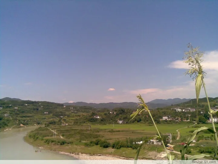
Photo adjustments
Full frame retained; proportionally resized and converted to WebP. No retouching or changes to the photographed subject. Card displays may crop the view.
- Administrative area
- County · 县
- Part of
- Changde
- Chinese name
- 石门县
- Local areas
- County guide
Area & population
- Area in the source
- 3,970.13 km²
Source: cited geographic source, as of the dates shown.
Setting and landscape
The county is shaped like a gourd with a bent handle. Ground falls from the massed mountains of the northwest to the low ridges and plains of the southeast, from the summit of Mount Huping (壶瓶山) at 2,098.7 metres down to 42.5 metres where the Caijia stream (蔡家溪) joins the Li River (澧水). Seven rivers rise in or cross the county; the Tuo (沱水), Li and Dao (道水) run west to east through its north, centre and south on their way to Dongting, while the Xie (渫水) cuts about 165 kilometres from northwest to southeast. The valley plains at Ziliang (子良), Moshi (磨市), Yanchi (雁池), Erdu (二都), Yijiadu (易家渡) and Mengquan (蒙泉) are its best farmland.
History
A Shimen commandery was set up in the Southern and Northern Dynasties, and in 589 it was replaced by Shimen County under Lizhou (澧州); the name has not changed since. "Shimen" means "stone gate", and local accounts tie it to one of several rock formations near the county town that stand like a gateway. He Long (贺龙) led the Red Army through Shimen three times during the Land Revolution period.
What to see
Jiashan Temple (夹山寺) dates from the Tang dynasty. Legend holds that its early-Qing abbot Fengtianyu (奉天玉) was the rebel leader Li Zicheng (李自成) living in hiding, a story many scholars doubt. Mount Huping is a national nature reserve with many streams and waterfalls, including the Huping falls (壶瓶飞瀑). Other sites are the Zaoshi site (皂市遗址), an important Neolithic find, the Shang-dynasty site at Shijiaping (十家坪), and Xianyang Lake (仙阳湖), also called the Zaoshi Reservoir.
Food and local products
Farms grow rice, maize, cotton, rapeseed, citrus and tea. The county has been named a "home of Chinese citrus" and a "home of famous Chinese tea", and is also known for gallnut honey (五倍子蜜). Shimen native chicken (石门土鸡) and the Shimen Matou goat (石门马头山羊) are national geographical-indication products.
Getting oriented
The Jiaozuo-Liuzhou railway (焦柳线) crosses the county, and the Shimen-Changsha line (石长线) meets it in a T-junction at the county town; the Luoyang-Zhanjiang line (洛湛线) also passes through. Stations include Shimenxian and Shimenxian North.
Highlights
- Mount Huping 壶瓶山: The county's highest point at 2,098.7 metres; a national nature reserve with waterfalls such as the Huping falls.
- Jiashan Temple 夹山寺: A Tang-founded temple linked by legend, doubted by many scholars, to the rebel Li Zicheng.
- Zaoshi site 皂市遗址: An important Neolithic site.
- Xianyang Lake 仙阳湖: The Zaoshi reservoir.
- Shimen Matou goat 石门马头山羊: A national geographical-indication product.
Sources for this guide
石门概况_走进石门_石门县人民政府 · Shimen County People's Government
石门县 - 维基百科,自由的百科全书 · Wikipedia (Chinese) · CC BY-SA 4.0
Original English written from the listed sources and checked sentence by sentence against quoted extracts by a separate reviewer. Updated 2026-09-24.
Explore Shimen County
Core places to explore, with English and Chinese names.
Places to explore around Shimen County
 AI illustration · AI 示意图(仅供参考,非该地点实拍)
Hupingshan Scenic Area壶瓶山开放景区
Hupingshan (壶瓶山) is a mountain in Shimen County, Changde, Hunan, at the northeastern end of the Wuling range; its main peak reaches 2,098.7 m, and the provincial government's account records that it is known as the roof of Hunan. Most of the massif lies inside a national nature reserve; the sections open to visitors are gorges and an old tea town on its lower slopes.
Read the place guide →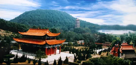 Jiashan Temple · 夹山寺
Jiashan Temple夹山寺
Chan monastery in Shimen County, Hunan, founded in 870, where Yuanwu Keqin, author of the Blue Cliff Record, lectured; national heritage site since 2013.
Read the place guide →Plan your visit
Getting there
Shimen County is about 100 km in a straight line from central Changde. Search for 石门县 in a map app to find stations and your accommodation.
Where to stay →Build your route
Hupingshan Scenic Area and Jiashan Temple are both listed here. The linked place guides have entrance and visit details.
Continue with Changde →More in Changde
Sources & geographic information
Administrative names and parent areas: Official geographic directory · Reference date 2026-09-06.
Some facts checked against 石门县 — Wikipedia contributors, CC BY-SA 4.0.
Photo: Jiashan Temple · Source photographer · License not provided. EXIF orientation normalized; resized without changing aspect ratio; converted to WebP. No subject edits.
Map data © OpenStreetMap contributors. Pins mark approximate centres, not entrances or boundaries.