


Get to know Wuling District
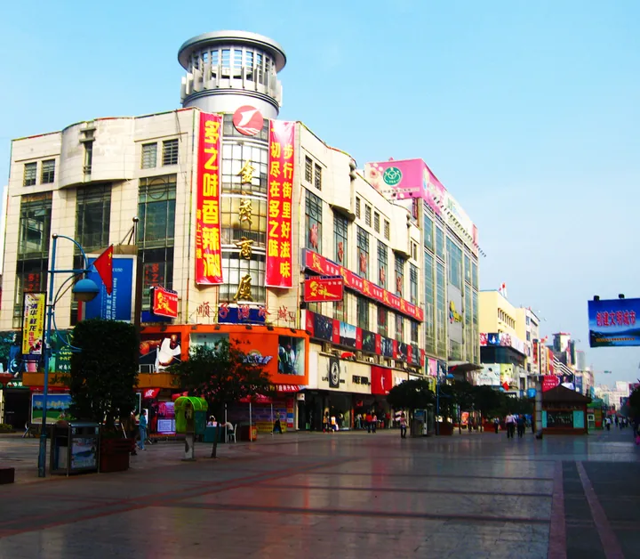
Photo adjustments
Full frame retained; proportionally resized and converted to WebP. No retouching or changes to the photographed subject. Card displays may crop the view.
- Administrative area
- District · 市辖区
- Part of
- Changde
- Chinese name
- 武陵区
- Local areas
- District guide
Area & population
- Area in the source
- 412.42 km²
Source: cited geographic source, as of the dates shown.
History
The walled city dates from 277 BC, when the Qin commander Zhang Ruo (张若), governor of Shu, took the area from Chu and built a city here, long known as Zhang Ruo City (张若城). In AD 50 the seat of Wuling Commandery (武陵郡) moved to Linyuan (临沅), today's district, and the town has housed a commandery, prefecture or county seat ever since. Wuling County was formed in 589, renamed Changde County in 1913, and its urban area became Changde city in 1949; that city took the name Wuling District in July 1988.
The district government counts more than 130 recorded battles here. In the Battle of Changde in November and December 1943, Japanese bombing and fire left only two buildings with roofs among nearly ten thousand houses: two Catholic churches of neutral Spain that flew identifying flags.
Setting and landscape
The land is mostly low hills and flat ground; Hefu Mountain (河洑山) in the west is the only sizeable upland. The Chuanzi River (穿紫河) system is a 17.3-kilometre ring of waterways in the north of the city, running through Baima Lake (白马湖) and a chain of channels, ponds and inlets, and the Yinyuan (姻缘河) and Sanlü (三闾河) rivers also cross the district.
What to see
The district government lists the Changde Poetry Wall (常德诗墙), Baima Lake Culture Park (白马湖文化公园), Ding Ling Park (丁玲公园), the Wulingge pedestrian quarter (武陵阁步行城), Bijia City (笔架城), the Changde Museum (常德博物馆) and Hefu National Forest Park (河洑国家森林公园) among its sights.
Getting oriented
National Highways 207 and 319 cross the district, and Taohuayuan Airport (桃花源机场) lies close by. Rail links include the Shimen-Changsha railway and the Qianjiang-Zhangjiajie-Changde and Changde-Yiyang-Changsha high-speed lines, with the Changsha-Changde and Changde-Zhangjiajie expressways by road.
Highlights
- Changde Poetry Wall 常德诗墙: Listed by the district government among Wuling's main sights.
- Changde Museum 常德博物馆: One of the sights the district government names.
- Chuanzi River 穿紫河: A 17.3-kilometre ring of waterways around the north of the city, passing Baima Lake.
- Hefu National Forest Park 河洑国家森林公园: Named by the district government among its sights; Hefu Mountain in the west is the district's only large upland.
Sources for this guide
武陵概况_走进武陵_武陵区人民政府 · Wuling District People's Government, Changde
历史沿革_走进武陵_武陵区人民政府 · Wuling District People's Government, Changde
武陵区 - 维基百科,自由的百科全书 · Wikipedia (Chinese) · CC BY-SA 4.0
Original English written from the listed sources and checked sentence by sentence against quoted extracts by a separate reviewer. Updated 2026-09-24.
Explore Wuling District
Core places to explore, with English and Chinese names.
Places to explore around Wuling District
 Exterior view of the Changde Museum building, Wuling District, Changde · 湖南省常德市武陵区常德博物馆建筑外观 Source-recorded photograph date: 2024-02-28 16:56:17.
Changde Museum常德博物馆
Changde Museum (常德博物馆) is the municipal museum of Changde in Wuling District, Hunan, founded in 1990 as a comprehensive regional museum for the northwest of the province and as the city's centre for collecting, researching and conserving cultural relics.
Read the place guide →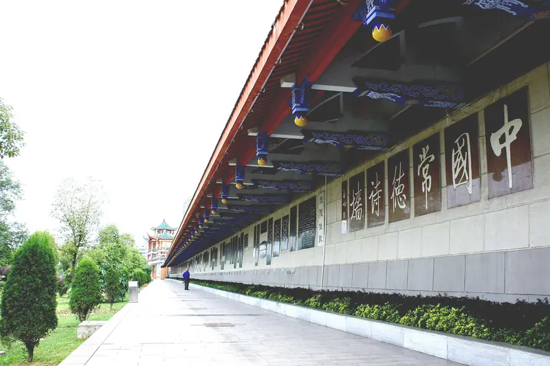 Changde Poetry Wall and Yuan River Waterfront · 常德诗墙与沅江岸线
Changde Poetry Wall and Yuan River Waterfront常德诗墙与沅江岸线
The Changde Poetry Wall (常德诗墙) is a continuous run of carved poetry, calligraphy and relief pictures set into the concrete flood-defence wall along the Yuan River in Wuling District, Changde, Hunan. The park along the embankment is open to the public, and the city treats it as its principal attraction for receiving visitors.
Read the place guide →Plan your visit
Getting there
Wuling District covers the centre of Changde. Search for 武陵区 in a map app to find stations and your accommodation.
Where to stay →Build your route
Changde Museum and Changde Poetry Wall and Yuan River Waterfront are both listed here. The linked place guides have entrance and visit details.
Continue with Changde →More in Changde
Sources & geographic information
Administrative names and parent areas: Official geographic directory · Reference date 2026-09-06.
Some facts checked against 武陵区 — Wikipedia contributors, CC BY-SA 4.0.
Photo: Changde Museum · Uuongkinghe · CC BY-SA 4.0. Full frame retained; proportionally resized and converted to WebP. No retouching or changes to the photographed subject. Card displays may crop the view.

Photo: Changde Poetry Wall and Yuan River Waterfront · Source photographer · License not provided. EXIF orientation normalized; resized without changing aspect ratio; converted to WebP. No subject edits.
Map data © OpenStreetMap contributors. Pins mark approximate centres, not entrances or boundaries.