


Get to know Longhui County
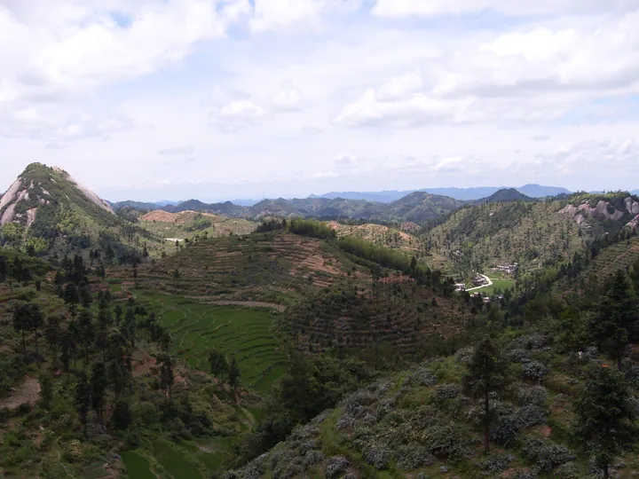
Photo adjustments
Full frame retained; proportionally resized and converted to WebP. No retouching or changes to the photographed subject. Card displays may crop the view.
- Administrative area
- County · 县
- Part of
- Shaoyang
- Chinese name
- 隆回县
- Local areas
- County guide
Area & population
- Area in the source
- 2,855.86 km²
- Population · 2009
- 110,000
Source: cited geographic source, as of the dates shown.
Setting and landscape
The county government divides Longhui into three zones: low hills in the south, an upland plateau in the northwest and mountains in the north. Its hills belong to the Xuefeng Mountains (雪峰山), and all 73 of its peaks above 1,500 metres stand in the northwest and north. Longhui borders Xinshao (新邵县) to the east, Shaoyang County and Wugang (武冈) to the south, Dongkou (洞口县) to the west, and Xupu (溆浦) and Xinhua (新化县) to the north; the county town is 56 kilometres from Shaoyang.
History
For centuries the area was part of Shaoyang County under Baoqing Prefecture (宝庆府). In 1372 the Ming set up the Longhui patrol post (隆回巡检司) here. After the war against Japan the local townships petitioned for a county of their own, and Longhui County was approved on 31 January 1947, with its first offices in the Liu family ancestral hall at Liuduzhai (六都寨).
What to see
The Huxingshan Huayao scenic area (虎形山花瑶景区), 118.4 square kilometres in the northwest, became a national scenic area in 2009; the county notes it is the only one named after an ethnic group. Its core is Chongmudang (崇木凼村), which the county calls the largest Huayao settlement in China and which joined the first list of Chinese Traditional Villages in 2012. At the Wangxi waterfalls (旺溪瀑布), five falls and their pools follow one another along a 1.5-kilometre gorge.
Wei Yuan's former residence (魏源故居), a Qing house in Xuetangwan village (学堂湾村) of Simenqian town (司门前镇), is a national protected site. Wei Yuan wrote the Illustrated Treatise on the Maritime Kingdoms (海国图志) and argued that China should "learn the superior techniques of the foreigners in order to control them".
Food, crafts and local products
Four national intangible heritage items come from Longhui: Huayao cross-stitch embroidery (花瑶挑花), Huayao wuwa mountain songs (花瑶呜哇山歌), Tantou New Year woodblock prints (滩头年画) and Tantou handmade paper (滩头手工抄纸). The county is known for its "three hot things": chilli, garlic and ginger, along with honeysuckle and dragon-tooth lily (龙牙百合).
Highlights
- Huxingshan Huayao scenic area 虎形山花瑶景区: National scenic area since 2009 in the Huayao uplands of the northwest.
- Chongmudang 崇木凼村: Huayao village on the first list of Chinese Traditional Villages (2012).
- Wei Yuan's former residence 魏源故居: Qing house in Xuetangwan village, Simenqian town, linked to Wei Yuan; national protected site.
- Tantou New Year prints 滩头年画: Woodblock prints on the national intangible heritage list.
Explore Longhui County
Core places to explore, with English and Chinese names.
Places to explore around Longhui County
 The snow-covered entrance archway to the Hua Yao (Flower Yao) old village, Huxingshan, Longhui County · 隆回县虎形山花瑶古寨雪景牌坊 Source-recorded photograph date: Taken on 15 January 2006.
Huayao Ancient Villages花瑶古寨
Huayao Guzhai (花瑶古寨) is a collective name for the mountain villages of the Huayao, a branch of the Yao people, on Huxingshan in Longhui County, Shaoyang, Hunan, of which Chongmudang is the one the local authorities single out.
Read the place guide →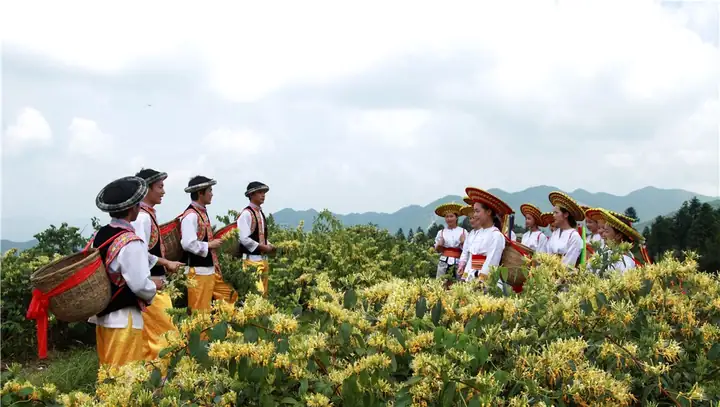 Dahuayao Huxing Mountain · 大花瑶虎形山
Dahuayao Huxing Mountain大花瑶虎形山
Dahuayao Huxingshan (大花瑶虎形山) is a scenic area in Longhui County, Shaoyang, Hunan, centred on Huxingshan at an average elevation of about 1,350 metres and on the villages of the Huayao, a branch of the Yao people.
Read the place guide →Plan your visit
Getting there
Longhui County is about 45 km in a straight line from central Shaoyang. Search for 隆回县 in a map app to find stations and your accommodation.
Where to stay →Build your route
Huayao Ancient Villages and Dahuayao Huxing Mountain are both listed here. The linked place guides have entrance and visit details.
Continue with Shaoyang →More in Shaoyang
Sources & geographic information
Administrative names and parent areas: Official geographic directory · Reference date 2026-09-06.
Photo: Huayao Ancient Villages · kiwifruit168 · CC BY 3.0. Full frame retained; proportionally resized and converted to WebP. No retouching or changes to the photographed subject. Card displays may crop the view.

Photo: Dahuayao Huxing Mountain · Source photographer · License not provided. EXIF orientation normalized; resized without changing aspect ratio; converted to WebP. No subject edits.
Map data © OpenStreetMap contributors. Pins mark approximate centres, not entrances or boundaries.