


Get to know Shuangqing District
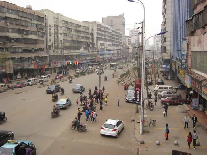
Photo adjustments
Full frame retained; proportionally resized and converted to WebP. No retouching or changes to the photographed subject. Card displays may crop the view.
- Administrative area
- District · 市辖区
- Part of
- Shaoyang
- Chinese name
- 双清区
- Local areas
- District guide
Setting and landscape
The meeting of the two rivers was one of the eight classic views of old Baoqing (宝庆), known as "Autumn Moon at Shuangqing" (双清秋月). The Shao separates the district from Daxiang District (大祥区) to the south and west, and the Zi separates it from Beita District (北塔区) and Xinshao (新邵) to the north-west; Shaodong (邵东) lies to the east.
The district lies in the hill country of central Hunan and is higher in the centre and east. Its highest point, Longkouling (龙口岭), reaches 346.7 metres, and the lowest is a sandbar in the Zi at 204 metres. About 13 km of the Zi and about 24.6 km of the Shao run through the district.
What to see
The Shuifu Temple (水府庙) stands where the Zi and Shao meet, beside Shuangqing Road. The district government dates its first building to 1614 and a rebuilding from 1841, when the temple, an opera stage and a river embankment were completed in turn. It is an all-timber, three-storey building. Boatmen and merchants once prayed there before sailing to Yiyang, Dongting Lake, Hankou and Shanghai. It is a Hunan provincial protected monument.
Qinglong Bridge (青龙桥) crosses the Shao. A wooden bridge stood here in the Tang dynasty, and a stone-pier bridge was built under Emperor Lizong of the Song; in the Qing two iron rhinoceroses were set on the piers to hold down water monsters. Both sank in a Daoguang-era flood, and one, raised from the river in 1968, now sits in a fountain pool inside the gate of Shuangqing Park (双清公园).
The Shaoyang Museum (邵阳市博物馆), in the city's Culture and Arts Centre, opened on 22 January 2017. Its floors cover Shaoyang history, local resources, notable people and merchants, and intangible heritage.
Ailian Pond Park (爱莲池公园), finished in December 2019, is a wetland park with boardwalks and a lake island. In suburban Chengdong township (城东乡), Little Shehu Mountain (小佘湖山) got its name in the Tang, when a shrine to the Taoist Shen Taizhi (申泰芝) was built there because his retreat on Mount Shehu, in today's Shaodong, lay too far from the prefectural seat. The scenic area is called "Shehu Clearing after Snow" (佘湖雪霁), and the Pilu Pavilion (毗卢阁) stands on the summit. In 2025 the Yue family ancestral hall (岳氏宗祠), or Yue Fei Memorial Hall, was raised to a provincial protected monument.
Getting oriented
The district forms the south-eastern part of central Shaoyang. According to the district government, two high-speed railways, one conventional railway and two expressways pass through it.
Highlights
- Shuifu Temple 水府庙: All-timber temple and opera stage at the Zi–Shao confluence; a Hunan provincial protected monument.
- Qinglong Bridge iron rhinoceros 青龙桥铁犀: Qing iron rhinoceros raised from the river in 1968, now in a pool inside the Shuangqing Park gate.
- Shaoyang Museum 邵阳市博物馆: Opened in 2017, with history galleries and a floor on intangible heritage.
- Ailian Pond Park 爱莲池公园: Wetland park completed in 2019, with boardwalks and a lake island.
Sources for this guide
自然地理_双清区人民政府 · Shuangqing District People's Government
双清概况_双清区人民政府 · Shuangqing District People's Government
水府庙_双清区人民政府 · Shuangqing District People's Government
青龙桥_双清区人民政府 · Shuangqing District People's Government
邵阳市博物馆_双清区人民政府 · Shuangqing District People's Government
爱莲池公园_双清区人民政府 · Shuangqing District People's Government
佘湖雪霁_双清区人民政府 · Shuangqing District People's Government
Original English written from the listed sources and checked sentence by sentence against quoted extracts by a separate reviewer. Updated 2026-09-24.
Explore Shuangqing District
Core places to explore, with English and Chinese names.
Shuangqing District 双清区
Plan your visit
Getting there
Shuangqing District covers the centre of Shaoyang. Search for 双清区 in a map app to find stations and your accommodation.
Where to stay →More in Shaoyang
Sources & geographic information
Administrative names and parent areas: Official geographic directory · Reference date 2026-09-06.
Map data © OpenStreetMap contributors. Pins mark approximate centres, not entrances or boundaries.