


Get to know Shaoyang County
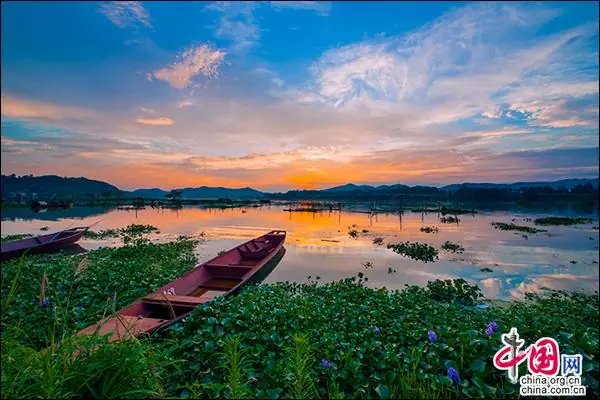
Photo adjustments
EXIF orientation normalized; resized without changing aspect ratio; converted to WebP. No subject edits.
- Administrative area
- County · 县
- Part of
- Shaoyang
- Chinese name
- 邵阳县
- Local areas
- County guide
Setting and landscape
The county government places Shaoyang County where the Hengyang–Shaoyang hill basin gives way to mountains. The Hebo range (河伯岭) in the south joins the Siming Mountains (四明山) in the east to form a south-eastern barrier, and Mount Hebo, at 1,454.9 metres, is the highest point. In the centre-north, the limestone hills of Huangjingling (黄荆岭) show karst landforms. The Fuyi River (夫夷水) and the Nan River (赧水) meet at Shuangjiangkou (双江口) and flow north as the Zi in a Y-shaped pattern, while the Tan River (檀江) runs through the east of the county.
Rain is concentrated from April to June, when the county government counts almost half the year's rainfall; July to September is the main dry season.
History
The county's official history begins with Zhaoling county (昭陵县) in the early Western Han and a Zhaoyang marquisate (昭阳侯国) created in 5 AD. In 280, under the Jin, Zhaoling and Zhaoyang were renamed Shaoling and Shaoyang, and the Shaoyang name has been kept since. In 1225 the Southern Song raised Shaozhou to Baoqing prefecture (宝庆府), with Shaoyang as its seat county. After Shaodong and Xinshao were carved out of its north-east in the early 1950s, the county seat moved to Tangdukou (塘渡口).
What to see and understand
Historic sites in the county include the Jiangdong bridge pavilion (江东桥亭) from the Kangxi reign of the Qing dynasty, the Furong Peak rock inscriptions (芙蓉峰石刻), and a memorial to fallen soldiers at Xiahuaqiao (下花桥).
Shaoyang County's blue-and-white printed cloth (蓝印花布) is on the national intangible-heritage list. The county government describes it as resist-dyed cotton, printed through cut stencils with a paste of lime and bean flour and dyed indigo. Other folk arts are the Baicang stilt dance (白仓高跷), performed on long wooden stilts tied to the legs, and one-man bag puppetry (布袋戏) from Yanwoling (燕窝岭) in Baizhu village, in which a single performer works the puppets, sings and plays; its music follows Qi opera (祁剧) singing.
Getting oriented
The county seat is Tangdukou. Neighbours are Xinshao (新邵) and the Shaoyang city districts to the north, Shaodong (邵东) and Qidong (祁东) to the east, Dong'an (东安) and Xinning (新宁) to the south, and Wugang (武冈) and Longhui (隆回) to the west. China National Highway 207 passes through.
Highlights
- Shaoyang blue-and-white printed cloth 邵阳蓝印花布: Stencil-printed, indigo-dyed cotton on the national intangible-heritage list.
- Shuangjiangkou 双江口: Confluence where the Fuyi and Nan rivers join to form the Zi.
- Jiangdong bridge pavilion 江东桥亭: Bridge pavilion built in the Kangxi reign of the Qing dynasty.
- Mount Hebo 河伯岭: Highest point of the county at 1,454.9 metres.
Sources for this guide
邵阳县 - 维基百科,自由的百科全书 · Chinese Wikipedia · CC BY-SA 4.0
自然地理_邵阳县人民政府 · Shaoyang County People's Government
风土人情_邵阳县人民政府 · Shaoyang County People's Government
历史沿革_邵阳县人民政府 · Shaoyang County People's Government
Original English written from the listed sources and checked sentence by sentence against quoted extracts by a separate reviewer. Updated 2026-09-24.
Explore Shaoyang County
Core places to explore, with English and Chinese names.
Shaoyang County 邵阳县
Plan your visit
Getting there
Shaoyang County is about 35 km in a straight line from central Shaoyang. Search for 邵阳县 in a map app to find stations and your accommodation.
Where to stay →More in Shaoyang
Sources & geographic information
Administrative names and parent areas: Official geographic directory · Reference date 2026-09-06.
Some facts checked against 邵阳县 — Wikipedia contributors, CC BY-SA 4.0.
Map data © OpenStreetMap contributors. Pins mark approximate centres, not entrances or boundaries.