


Get to know Longshan County
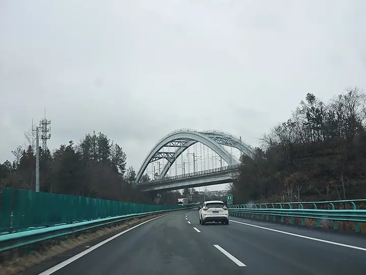
Photo adjustments
Full frame retained; resized proportionally to a maximum dimension of 960 pixels and converted to WebP quality 88. No crop, retouch, generated elements, or subject alteration. Final website rendition: full frame retained, proportionally resized to at most 720 pixels and converted to WebP. No additional retouching or subject alteration. Card displays may crop the view.
- Administrative area
- County · 县
- Part of
- Xiangxi Tujia and Miao Autonomous Prefecture
- Chinese name
- 龙山县
- Local areas
- County guide
Area & population
- Area in the source
- 3,127.16 km²
- Population · 2010
- 502,227
Source: cited geographic source, as of the dates shown.
Setting and landscape
Longshan sits at the eastern end of the Yunnan-Guizhou Plateau (云贵高原), with the Wuling Mountains (武陵山) crossing it from north-east to south-west, and it holds the southern source of the Li River (澧水). Ground rises from 218 m to 1,736 m on the main peak of Wanbao Mountain (万宝山). The Wulongshan National Geopark (乌龙山国家地质公园) covers 406 square kilometres in the centre-west, taking in the Wulongshan Grand Canyon, Luota (洛塔), Bamian Mountain and the Youshui; its karst features include stone forests, caves, gorges, waterfalls and underground rivers.
History
The area belonged to Youyang County (酉阳县) under the Han, and the name Longshan was fixed in the seventh year of the Qing Yongzheng reign. In June 2002, a rescue excavation at Liye (里耶) ahead of the Wanmipo hydropower station uncovered a walled town and wells of the Warring States period, built by Chu against Qin, and more than 36,000 bamboo slips. The Liye Qin slips are county archives from 222 to 210 BC, covering decrees, appointments, military supplies and even villagers' debts. In Qin times Liye was called Qianling (迁陵); one slip reading "迁陵以邮行洞庭" ("from Qianling, by post, to Dongting") is regarded as China's earliest posted letter, and the slips give the first known record of a Dongting Commandery (洞庭郡), a Qin name absent from transmitted texts.
What to see
Liye is listed as a Chinese Historical and Cultural Town. Bamian Mountain (八面山), also in Liye town, is a high tableland of about 52 square kilometres on the Chongqing border, averaging over 1,200 m, with peaks, caves, cliffs, sinkholes and natural bridges; China Daily puts its summer average at 20°C. Rebala (惹巴拉), at the meeting of the Xichehe (洗车河) and Dianfang (靛房河) rivers in Miao'ertan town (苗儿滩镇), joins three Tujia villages, Pengjiazhai, Rebala and Liangjiazhai, entered over a Y-shaped covered bridge; China News Service reports it is called "China's first Tujia village". Other A-rated sites include the Luota stone forest (洛塔石林) and the Ciyantang (茨岩塘) revolutionary base.
Crafts and festivals
The county records 209 intangible-heritage items, six of them national, including Tujia brocade weaving (土家织锦技艺) and the Tujia hand-waving dance (土家摆手舞). Rebala hands down the Maogusi (茅古斯), Dongdongkui (咚咚奎) and Xilankapu (西兰卡普) traditions. The Sheba Day festival (舍巴日) has been named one of China's most distinctive ethnic festivals by the National Ethnic Affairs Commission.
Highlights
- Liye Ancient Town 里耶古城: Warring States walled town where more than 36,000 Qin bamboo slips were excavated in 2002.
- Bamian Mountain 八面山: High tableland of about 52 square kilometres averaging over 1,200 m, with cliffs, sinkholes and natural bridges.
- Rebala 惹巴拉: Three Tujia villages at the meeting of the Xichehe and Dianfang rivers, linked by a Y-shaped covered bridge.
- Wulongshan National Geopark 乌龙山国家地质公园: 406 square kilometres of karst with stone forests, caves, gorges and underground rivers.
Sources for this guide
龙山县 - 维基百科,自由的百科全书 · Wikipedia (Chinese) · CC BY-SA 4.0
里耶秦简 - 维基百科,自由的百科全书 · Wikipedia (Chinese) · CC BY-SA 4.0
2022年湖南夏季乡村文旅节将在湘西龙山县八面山景区举行 - 中国日报网 · China Daily
“中国土家第一寨”惹巴拉5月邀你共赴春日之旅 - 中国新闻网湖南 · China News Service, Hunan
Original English written from the listed sources and checked sentence by sentence against quoted extracts by a separate reviewer. Updated 2026-09-25.
Explore Longshan County
Core places to explore, with English and Chinese names.
Places to explore around Longshan County
 Bamian Mountain · 八面山
Bamian Mountain八面山
Bamianshan (八面山) is a long, cliff-ringed mountain in the south of Longshan County, in the Xiangxi Tujia and Miao Autonomous Prefecture of Hunan, whose flat summit carries an expanse of high-altitude grassland above the town of Liye.
Read the place guide →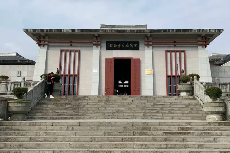 Liye Ancient City and Qin Bamboo Slips Museum · 里耶古城与秦简博物馆
Liye Ancient City and Qin Bamboo Slips Museum里耶古城与秦简博物馆
Liye (里耶古城与秦简博物馆) pairs an excavated walled town beside the You River in Liye Town, Longshan County, Hunan, with the museum that holds the tens of thousands of Qin-dynasty document slips found there.
Read the place guide → Rebala Tujia Villages · 惹巴拉
Rebala Tujia Villages惹巴拉
Rebala (惹巴拉) is a group of Tujia villages at the confluence of the Xiche and Dianfang rivers in Miao'ertan Town, Longshan County, in the Xiangxi Tujia and Miao Autonomous Prefecture of Hunan.
Read the place guide →Plan your visit
Getting there
Longshan County is about 100 km in a straight line from central Xiangxi Tujia and Miao Autonomous Prefecture. Search for 龙山县 in a map app to find stations and your accommodation.
Where to stay →Build your route
Bamian Mountain and Liye Ancient City and Qin Bamboo Slips Museum are both listed here. The linked place guides have entrance and visit details.
Continue with Xiangxi Tujia and Miao Autonomous Prefecture →More in Xiangxi Tujia and Miao Autonomous Prefecture
Sources & geographic information
Administrative names and parent areas: Official geographic directory · Reference date 2026-09-06.
Some facts checked against 龙山县 — Wikipedia contributors, CC BY-SA 4.0.
Some facts checked against 里耶秦简 — Wikipedia contributors, CC BY-SA 4.0.
Photo: Bamian Mountain · Source photographer · License not provided. EXIF orientation normalized; resized without changing aspect ratio; converted to WebP. No subject edits.
Photo: Liye Ancient City and Qin Bamboo Slips Museum · Source photographer · License not provided. EXIF orientation normalized; resized without changing aspect ratio; converted to WebP. No subject edits.
Photo: Rebala Tujia Villages · Source photographer · License not provided. EXIF orientation normalized; resized without changing aspect ratio; converted to WebP. No subject edits.
Map data © OpenStreetMap contributors. Pins mark approximate centres, not entrances or boundaries.