


Get to know Daoxian

Photo adjustments
Full frame retained; proportionally resized and converted to WebP. No retouching or changes to the photographed subject. Card displays may crop the view.
- Administrative area
- County · 县
- Part of
- Yongzhou
- Chinese name
- 道县
- Local areas
- County guide
Area & population
- Area in the source
- 2,441.03 km²
- Population · 2010
- 605,799
Source: cited geographic source, as of the dates shown.
Setting and landscape
Jiuyi Mountain (九嶷山) rises to the southeast, Tongshan Ridge (铜山岭) to the south, Dupang Ridge (都庞岭) to the west and Zijin Mountain (紫金山) to the north; the county counts more than 150 peaks over 1,000 metres, the highest being Jiucai Ridge (韭菜岭) at 2,009 metres. Inside the ring the ground falls to a central basin of low hills and plain. The Xiao runs 64.7 kilometres through the county and is navigable year-round below the county town. The Lianxi (濂溪) is a smaller permanent stream that is too shallow for boats. The frost-free season lasts 309 days, and the county government quotes provincial farm experts calling it a natural greenhouse.
History
Yingpu County (营浦县) was founded here in 221 BC under the Qin, named for its seat on the Ying River (营水). Under later dynasties the town was the seat of a commandery or prefecture for more than 1,500 years, known in Ming and Qing times as Daozhou, and it became Dao County in 1913. The Song Neo-Confucian thinker Zhou Dunyi (周敦颐, 1017 to 1073), author of the essay on loving the lotus, came from Yingdao (营道), now Daoxian, and the Qing calligrapher He Shaoji (何绍基) also came from the county. In 1967, early in the Cultural Revolution, mass killings took place in more than ten counties and cities of the Lingling area (零陵地区), Daoxian among them; Chinese Wikipedia records 7,696 people killed between 13 August and 17 October.
What to see
Yuchanyan (玉蟾岩), a cave in Baishizhai village (白石寨村) of Shouyan town (寿雁镇), is a national key cultural relics protection unit. Excavations by the Hunan Provincial Institute of Archaeology in 1993 and 1995 found nearly a thousand chipped stone tools. They also found four rice husks dated to more than 12,000 years ago and identified as cultivated rice, and pottery sherds dated to more than 14,000 years ago; the find was named one of China's ten major archaeological discoveries of 1997. Zhou Dunyi's home village (周敦颐故里), with a memorial hall, the Lianxi Academy (濂溪书院) and Lianxi Square, lies in Loutian village (楼田村) of Qingtang town (清塘镇). Chinese Wikipedia also lists the Daoxian Confucian Temple (道县孔庙) and a group of Ming and Qing buildings at Lianxi among the county's monuments.
Highlights
- Yuchanyan cave site 玉蟾岩遗址: Cave where 12,000-year-old cultivated rice husks and 14,000-year-old pottery were excavated in 1993 and 1995.
- Zhou Dunyi's home village 周敦颐故里: Memorial hall, Lianxi Academy and square in Loutian village, Qingtang town.
- Jiucai Ridge 韭菜岭: Highest peak in the county at 2,009 metres.
- Daoxian Confucian Temple 道县孔庙: Listed among the county's notable monuments.
Sources for this guide
道县 - 维基百科,自由的百科全书 · Chinese Wikipedia · CC BY-SA 4.0
道县地理环境_地理环境_道县人民政府网 · Dao County People's Government
【品读永州】玉蟾岩:远古文明的见证_古代文明_道县人民政府网 · Dao County People's Government (from Wenhua Yongzhou)
周敦颐 - 维基百科,自由的百科全书 · Chinese Wikipedia · CC BY-SA 4.0
Original English written from the listed sources and checked sentence by sentence against quoted extracts by a separate reviewer. Updated 2026-09-25.
Explore Daoxian
Core places to explore, with English and Chinese names.
Places to explore around Daoxian
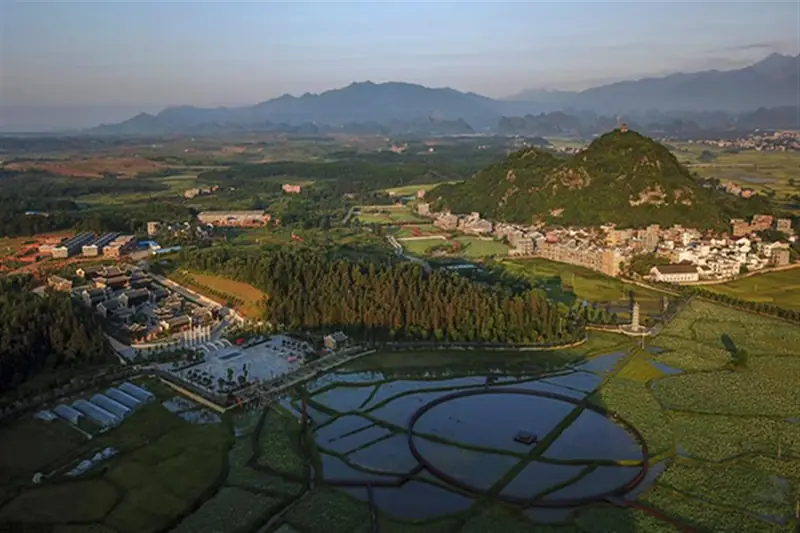 Zhou Dunyi's Hometown ·
 Plan your visit
Getting there
Daoxian is about 100 km in a straight line from central Yongzhou. Search for 道县 in a map app to find stations and your accommodation.
Where to stay →Build your route
Start with Zhou Dunyi's Hometown. The linked place guides have entrance and visit details.
Continue with Yongzhou →More in Yongzhou
Sources & geographic information
Administrative names and parent areas: Official geographic directory · Reference date 2026-09-06.
Some facts checked against 道县 — Wikipedia contributors, CC BY-SA 4.0.
Some facts checked against 周敦颐 — Wikipedia contributors, CC BY-SA 4.0.
Photo: Zhou Dunyi's Hometown · Source photographer · License not provided. EXIF orientation normalized; resized without changing aspect ratio; converted to WebP. No subject edits.
Map data © OpenStreetMap contributors. Pins mark approximate centres, not entrances or boundaries.