


Get to know Lengshuitan District
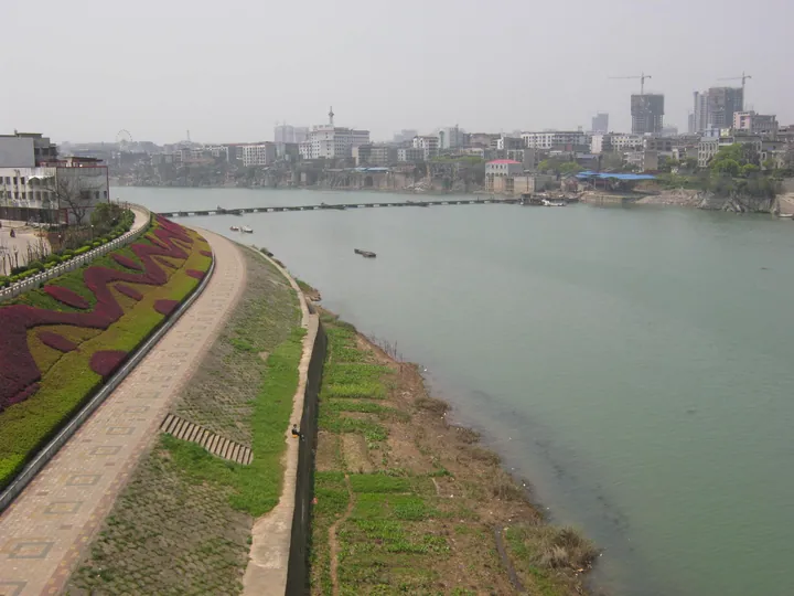
Photo adjustments
Full frame retained; proportionally resized and converted to WebP. No retouching or changes to the photographed subject. Card displays may crop the view.
- Administrative area
- District · 市辖区
- Part of
- Yongzhou
- Chinese name
- 冷水滩区
- Local areas
- District guide
Area & population
- Area in the source
- 1,218.16 km²
- Population · 2020 census
- 583,136
- Administrative seat
- Wutong Subdistrict
Source: cited geographic source, as of the dates shown.
Setting and landscape
The district has a humid subtropical monsoon climate, and its land is a mix of hills, low ridges and basins cut by river valleys. The district government sums up its position with two nicknames: "gateway to south-western Hunan" (湘西南门户) and "first city of Xiaoxiang" (潇湘第一城).
History
Under the Qin the area belonged to Changsha Commandery (长沙郡), under the Western Han to the Quanling marquisate (泉陵侯国), and from 589 to Lingling County (零陵县). A town named Tanshi (滩市镇) was set up in the 1940s and renamed Lengshui (冷水镇) after 1949. Lengshuitan was made a city in 1960, reduced to a town in 1962, made a city again in 1984 and became a district of the new prefecture-level Yongzhou in 1995. In July 1997 the Yongzhou government moved here from Lingling (零陵). Among older remains the district government lists a Five Dynasties site of stone oxen and horses (石牛石马遗址), the "Tang Sou Diao Ji" (唐叟钓矶, "an old man’s fishing rock") inscription and Song pottery kiln sites, and it names Liu Zongyuan (柳宗元), Huaisu (怀素) and Xu Xiake (徐霞客) among the writers who came through.
What to see
Lengshuitan is the home town of Li Da (李达), a founder of the Communist Party of China. His former residence (李达故居) in Youzhatou Village (油榨头村), Lanjiaoshan (岚角山), dates from 1890 and has been a national key protected site since 2013. In 2011 Hunan listed five more sites in the district as provincial protected sites. They are the old buildings of Xiabajing (下八井古建筑群) at Puliqiao (普利桥), the Wang ancestral hall (王氏宗祠) at Yangcundian (杨村甸), the Ming-to-Qing Huang family buildings of Mingtang (明塘黄家古建筑群) at Niujiaoba (牛角坝), the Laobutou buildings (老埠头古建筑群) at Caishi (蔡市), dated to the Tang and Five Dynasties, and the former residence of Tang Ke (唐克故居) at Lanjiaoshan.
Highlights
- Former Residence of Li Da 李达故居: House of 1890 in Youzhatou Village, Lanjiaoshan; national key protected site since 2013.
- Laobutou old buildings 老埠头古建筑群: Buildings at Caishi dated to the Tang and Five Dynasties; provincial protected site since 2011.
- Mingtang Huang family buildings 明塘黄家古建筑群: Ming-to-Qing buildings at Niujiaoba; provincial protected site since 2011.
- Xiabajing old buildings 下八井古建筑群: Old buildings at Puliqiao; provincial protected site since 2011.
Sources for this guide
冷水滩区情简介 · Lengshuitan District People's Government
冷水滩区 · Wikipedia (Chinese) · CC BY-SA 4.0
冷水滩区各级文物保护单位列表 · Wikipedia (Chinese) · CC BY-SA 4.0
Original English written from the listed sources and checked sentence by sentence against quoted extracts by a separate reviewer. Updated 2026-09-24.
Explore Lengshuitan District
Core places to explore, with English and Chinese names.
Lengshuitan District 冷水滩区
Plan your visit
Getting there
Lengshuitan District is about 4 km in a straight line from central Yongzhou. Search for 冷水滩区 in a map app to find stations and your accommodation.
Where to stay →More in Yongzhou
Sources & geographic information
Administrative names and parent areas: Official geographic directory · Reference date 2026-09-06.
Some facts checked against 冷水滩区 — Wikipedia contributors, CC BY-SA 4.0.
Some facts checked against 冷水滩区各级文物保护单位列表 — Wikipedia contributors, CC BY-SA 4.0.
Map data © OpenStreetMap contributors. Pins mark approximate centres, not entrances or boundaries.