


Get to know Chaling County
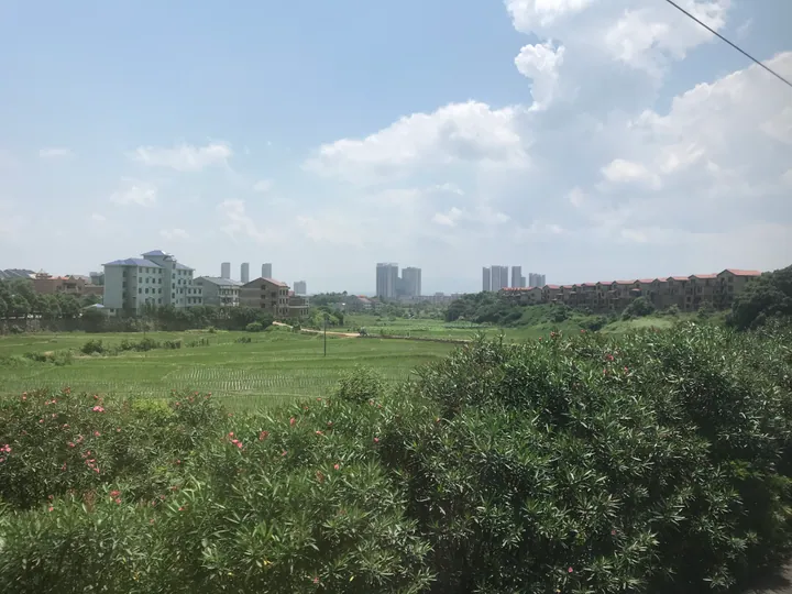
Photo adjustments
Full frame retained; proportionally resized and converted to WebP. No retouching or changes to the photographed subject. Card displays may crop the view.
- Administrative area
- County · 县
- Part of
- Zhuzhou
- Chinese name
- 茶陵县
- Local areas
- County guide
Area & population
- Administrative seat
- Yunyang Subdistrict
Source: cited geographic source, as of the dates shown.
History
Chaling was founded in 202 BC under the Han kingdom of Changsha (长沙国) and was moved from Xiangtan prefecture to Zhuzhou in 1983. The Yuanhe Junxian Zhi (元和郡县志) explains the name: the county faced Cha Mountain (茶山) to the south, a peak also called Jingyang Mountain (景阳山) at the county's southern end.
Mao's Autumn Harvest Uprising troops attacked Chaling in October and again in November 1927, and on 26 November he set up a workers', peasants' and soldiers' revolutionary government here with Tan Zhenlin (谭震林) as chairman. Its former site went on Hunan's provincial heritage list in 2011, and Voice of Hunan (华声在线) calls it a key stop on the eighth of China's 30 national red-tourism routes. Mao came back on 21 May 1965 and slept a night in the county Party office on the trip that produced his poem "Revisiting Jinggangshan" (重上井冈山).
What to see
The Chaling city wall (茶陵城墙) was begun in 1231 by the magistrate Liu Zimai (刘子迈) and finished in 1232. Of a circuit of 3,353 metres, the Yingxiang (迎湘门) and Yingxun (迎薰门) gates and four stretches totalling 1,536 metres survive, and the wall has been a national key protected site since 2013. The Chaling Iron Rhinoceros (茶陵铁犀) has been on the provincial list since 1983.
Mijiang Academy (洣江书院) was founded in 1504 on Shikou Hill (狮口山) south of the town, a site now inside Chaling No. 1 Middle School, and became a higher school in 1902. Across the river from the East Gate old town, the Bizhi Pagoda (笔支塔) in Shentang village was built in 1803 at the urging of the department magistrate Gao Shanggui (高上桂): 24.5 metres, six-sided, seven storeys, with "云州一柱" ("a pillar of Yunzhou") carved on the first storey. Chaling Media (茶陵融媒) describes it as the only surviving old pagoda in Hunan built entirely of red sandstone. The county also has Yunyang National Forest Park (云阳国家森林公园).
Food and local products
Ginger, garlic and Angelica dahurica root (白芷) are known together as the "three treasures of Chaling" (茶陵三宝). The county is also listed as a national base for commodity grain, tea and lean-meat pigs, and its climate gives about 286 frost-free days a year.
Getting oriented
Rail passengers use Chaling South Station (茶陵南站), and National Highways 106, 322 and 356 cross the county.
Highlights
- Chaling city wall 茶陵城墙: Southern Song wall of 1231-1232 with two surviving gates; national key protected site since 2013.
- Former site of the Chaling Workers', Peasants' and Soldiers' Government 茶陵县工农兵政府旧址: Government set up on 26 November 1927; on Hunan's provincial heritage list since 2011.
- Bizhi Pagoda 笔支塔: Red-sandstone pagoda of 1803, 24.5 metres and seven storeys, across the river from the East Gate old town.
- Mijiang Academy 洣江书院: Academy founded in 1504, turned into a higher school in 1902.
- Three treasures of Chaling 茶陵三宝: Ginger, garlic and Angelica dahurica root.
Sources for this guide
茶陵县 · Wikipedia (Chinese) · CC BY-SA 4.0
茶陵城墙 · Wikipedia (Chinese) · CC BY-SA 4.0
洣江书院 · Wikipedia (Chinese) · CC BY-SA 4.0
茶陵县各级文物保护单位列表 · Wikipedia (Chinese) · CC BY-SA 4.0
观山川美景、寻历史遗迹、看现代工业——大美株洲等您来 · Voice of Hunan (华声在线)
古塔流光映碧水 文化传承促发展——茶陵县思聪街道笔支塔亮化保护工程顺利竣工 · Chaling Media (茶陵融媒)
株洲市 · Wikipedia (Chinese) · CC BY-SA 4.0
Original English written from the listed sources and checked sentence by sentence against quoted extracts by a separate reviewer. Updated 2026-09-25.
Explore Chaling County
Core places to explore, with English and Chinese names.
Places to explore around Chaling County
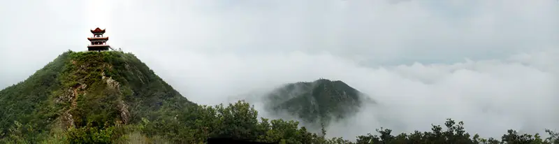 Yunyang Mountain ·
 Plan your visit
Getting there
Chaling County is about 125 km in a straight line from central Zhuzhou. Search for 茶陵县 in a map app to find stations and your accommodation.
Where to stay →Build your route
Start with Yunyang Mountain. The linked place guides have entrance and visit details.
Continue with Zhuzhou →More in Zhuzhou
Sources & geographic information
Administrative names and parent areas: Official geographic directory · Reference date 2026-09-06.
Some facts checked against 茶陵县 — Wikipedia contributors, CC BY-SA 4.0.
Some facts checked against 茶陵城墙 — Wikipedia contributors, CC BY-SA 4.0.
Some facts checked against 洣江书院 — Wikipedia contributors, CC BY-SA 4.0.
Some facts checked against 茶陵县各级文物保护单位列表 — Wikipedia contributors, CC BY-SA 4.0.
Some facts checked against 株洲市 — Wikipedia contributors, CC BY-SA 4.0.
Photo: Yunyang Mountain · Source photographer · License not provided. EXIF orientation normalized; resized without changing aspect ratio; converted to WebP. No subject edits.
Map data © OpenStreetMap contributors. Pins mark approximate centres, not entrances or boundaries.