


Get to know Lusong District
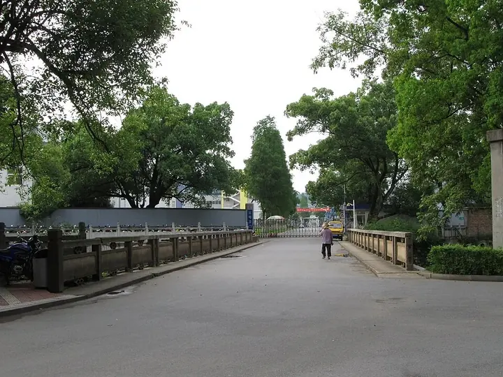
Photo adjustments
Full frame retained; proportionally resized and converted to WebP. No retouching or changes to the photographed subject. Card displays may crop the view.
- Administrative area
- District · 市辖区
- Part of
- Zhuzhou
- Chinese name
- 芦淞区
- Local areas
- District guide
History
Zhuzhou's first county, Jianning (建宁县), was set up by the state of Wu within today's Lusong in the Three Kingdoms period, and the office of Zhuzhou sub-prefecture (株洲厅) established in 1908 stood at Zhangshuping (樟树坪). The district's name is younger: in 1937 the former No. 11 Arsenal built a simple road down to the Xiang and called it Lusong Road, taking one character each from the Marco Polo Bridge (卢沟桥) Incident and the Battle of Shanghai (淞沪会战). The district itself took the name in the 1997 reorganisation, replacing Zhuzhou's South District.
What to see
Several of Lusong's listed sites date from its arsenal and factory years. The remains of the Nationalist government's No. 11 Arsenal defences on Fenghuang Hill (凤凰山), from 1936, and the fire lookout tower (1950) and Soviet experts' villas (1951) of State Factory 331 (国营三三一厂) all lie in Dongjiaduan subdistrict (董家塅街道). The Lu Ban Hall (鲁班殿), a Qing building in Jianning subdistrict, and the former site of the Communist Party's Badie branch (中共八叠支部, 1924) complete the group, all on Hunan's provincial heritage list since 2011.
According to the district government, Lusong was one of six major aviation bases built under China's first Five-Year Plan and produced the country's first aero-engine and first air-to-air missile. Its aviation town is a national industrial tourism demonstration base, and Voice of Hunan (华声在线) lists a Lusong low-altitude sightseeing zone among Zhuzhou's five industrial tourism areas. Zhuzhou's general-aviation airport is at Wulidun (五里墩).
Markets and local trades
The Lusong clothing market cluster began in the 1980s and now has 38 specialist markets trading with more than 20 provinces. It has been named one of China's top ten garment wholesale markets and given the title of China's women's-trousers city.
Highlights
- Lusong clothing markets 芦淞服饰市场群: Wholesale cluster begun in the 1980s, now 38 specialist markets.
- No. 11 Arsenal defences on Fenghuang Hill 民国政府第十一兵工厂凤凰山防御工事旧址: 1936 defences of the arsenal whose road gave Lusong its name; provincial heritage since 2011.
- State Factory 331 Soviet experts' villas 国营三三一厂苏联专家别墅: Villas of 1951 in Dongjiaduan, listed with the factory's 1950 fire lookout tower.
- Lu Ban Hall 鲁班殿: Qing-dynasty hall in Jianning subdistrict on the provincial list since 2011.
Sources for this guide
芦淞区基本情况介绍 · Lusong District People's Government, Zhuzhou
芦淞航空产业概况 · Lusong District People's Government, Zhuzhou
芦淞服饰产业概况 · Lusong District People's Government, Zhuzhou
芦淞区 · Wikipedia (Chinese) · CC BY-SA 4.0
芦淞区各级文物保护单位列表 · Wikipedia (Chinese) · CC BY-SA 4.0
株洲市 · Wikipedia (Chinese) · CC BY-SA 4.0
观山川美景、寻历史遗迹、看现代工业——大美株洲等您来 · Voice of Hunan (华声在线)
Original English written from the listed sources and checked sentence by sentence against quoted extracts by a separate reviewer. Updated 2026-09-25.
Explore Lusong District
Core places to explore, with English and Chinese names.
Lusong District 芦淞区
Plan your visit
Getting there
Lusong District is about 5 km in a straight line from central Zhuzhou. Search for 芦淞区 in a map app to find stations and your accommodation.
Where to stay →More in Zhuzhou
Sources & geographic information
Administrative names and parent areas: Official geographic directory · Reference date 2026-09-06.
Some facts checked against 芦淞区 — Wikipedia contributors, CC BY-SA 4.0.
Some facts checked against 芦淞区各级文物保护单位列表 — Wikipedia contributors, CC BY-SA 4.0.
Some facts checked against 株洲市 — Wikipedia contributors, CC BY-SA 4.0.
Map data © OpenStreetMap contributors. Pins mark approximate centres, not entrances or boundaries.