


Get to know Tianyuan District
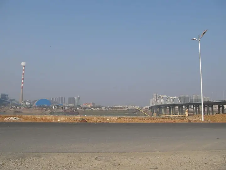
Photo adjustments
Full frame retained; proportionally resized and converted to WebP. No retouching or changes to the photographed subject. Card displays may crop the view.
- Administrative area
- District · 市辖区
- Part of
- Zhuzhou
- Chinese name
- 天元区
- Local areas
- District guide
Area & population
- Administrative seat
- Liyu Subdistrict
Source: cited geographic source, as of the dates shown.
History
The name joins the first syllables of two places that mattered when the district was drawn: Tiantai Mountain (天台山) and a horticultural farm, the Yuanyi Chang (园艺场). The new district took in Qunfeng town and Majiahe township from the old Zhuzhou County together with that farm, and the Xiang became its boundary to the east and north. Leidashi town (雷打石镇) in the south joined it in 2011; its name, "lightning-struck stone", recalls a millstone-like rock on Mopan Hill (磨盘山) by the river that was hit by lightning in the Jiajing reign of the Ming.
What to see
Kongling'an (空灵岸) is a stretch of Xiang riverbank in Leidashi with Kongling Temple (空灵寺) on its cliff. Li Daoyuan's Commentary on the Water Classic (水经注) calls it Kongling Gorge, and the place takes its present name from a poem Du Fu wrote when he moored here late in life, on his travels in Hunan. Kongzhou Island (空洲岛), once a sandbar in the river nearby, is now the site of the Zhuzhou navigation and power-generation hub. The 1928 tomb of Luo Zhe (罗哲墓) at Majiahe has been on Hunan's provincial heritage list since 2011.
Getting oriented
Zhuzhou West Station, in Qunfeng town, is a station on the Beijing–Guangzhou high-speed railway and opened on 26 December 2009. The Beijing–Zhuhai expressway passes through Leidashi, and the district borders Xiangtan County to the west.
Highlights
- Kongling'an and Kongling Temple 空灵岸: Xiang riverbank cliff named from a Du Fu poem, with Kongling Temple above the water.
- Tomb of Luo Zhe 罗哲墓: 1928 tomb at Majiahe on the provincial heritage list since 2011.
- Zhuzhou West Station 株洲西站: Beijing–Guangzhou high-speed railway station opened in 2009.
Sources for this guide
天元区 · Wikipedia (Chinese) · CC BY-SA 4.0
Tianyuan, Zhuzhou · Wikipedia (English) · CC BY-SA 4.0
空灵岸 · Wikipedia (Chinese) · CC BY-SA 4.0
雷打石镇 · Wikipedia (Chinese) · CC BY-SA 4.0
株洲西站 · Wikipedia (Chinese) · CC BY-SA 4.0
天元区各级文物保护单位列表 · Wikipedia (Chinese) · CC BY-SA 4.0
株洲市 · Wikipedia (Chinese) · CC BY-SA 4.0
Original English written from the listed sources and checked sentence by sentence against quoted extracts by a separate reviewer. Updated 2026-09-25.
Explore Tianyuan District
Core places to explore, with English and Chinese names.
Tianyuan District 天元区
Plan your visit
Getting there
Tianyuan District is about 5 km in a straight line from central Zhuzhou. Search for 天元区 in a map app to find stations and your accommodation.
Where to stay →More in Zhuzhou
Sources & geographic information
Administrative names and parent areas: Official geographic directory · Reference date 2026-09-06.
Some facts checked against 天元区 — Wikipedia contributors, CC BY-SA 4.0.
Some facts checked against Tianyuan, Zhuzhou — Wikipedia contributors, CC BY-SA 4.0.
Some facts checked against 空灵岸 — Wikipedia contributors, CC BY-SA 4.0.
Some facts checked against 雷打石镇 — Wikipedia contributors, CC BY-SA 4.0.
Some facts checked against 株洲西站 — Wikipedia contributors, CC BY-SA 4.0.
Some facts checked against 天元区各级文物保护单位列表 — Wikipedia contributors, CC BY-SA 4.0.
Some facts checked against 株洲市 — Wikipedia contributors, CC BY-SA 4.0.
Map data © OpenStreetMap contributors. Pins mark approximate centres, not entrances or boundaries.