


Get to know Hetang District
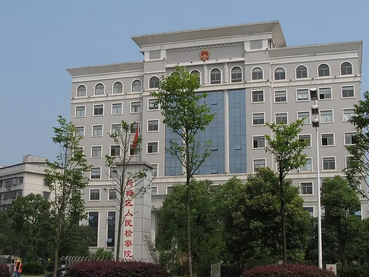
Photo adjustments
Full frame retained; proportionally resized and converted to WebP. No retouching or changes to the photographed subject. Card displays may crop the view.
- Administrative area
- District · 市辖区
- Part of
- Zhuzhou
- Chinese name
- 荷塘区
- Local areas
- District guide
Area & population
- Area in the source
- 143.00 km²
- Population · 2020 census
- 348,894
- Administrative seat
- Guihua Subdistrict
Source: cited geographic source, as of the dates shown.
History
The name comes from Hetangpu (荷塘铺), "lotus-pond post": an old post road ran through the area from Nanchang to Changsha, and one of its stations had a lotus pond of several dozen mu to the north. Travellers' inns grew into a settlement, recorded in the Guangxu-era Xiangtan county gazetteer. Zhuzhou set up a township-level Hetangpu district in 1959, and Hetang District was formally set up on 1 August 1997.
Setting and landscape
The land falls from north-east to south-west. The highest point is Poxian Ling (婆仙岭), 313.3 metres, in the south-east; the lowest, 31.4 metres, is on the Baishi Gang (白石港), which with the Jianning Gang (建宁港) drains straight into the Xiang. The district government calls Hetang the "green lungs" of urban Zhuzhou, with the Xianyu Ling (仙庾岭) provincial scenic area, the Poxian Ling provincial forest park and city parks at Mingzhao Lake (明照湖), Swan Lake (天鹅湖) and Shizi Lake (石子湖).
What to see
Xianyu Pagoda (仙庾塔), also called Wenchang Pavilion, stands on the main peak of Xianyu Ling. Built of granite in the Tang dynasty as an eight-sided, seven-storey tower, it lost its top to lightning in 1925 and 1987, was rebuilt to seven storeys in 2010 and has been a provincial protected site since 2002. Xianyu Temple (仙庾庙), moved down to the hillside in 1833, is the seat of the Zhuzhou Taoist Association; its legend says Shen Zhenzhu (沈珍珠), wife of the Tang prince Li Yu, hid here from the An Lushan rebellion and became an immortal. A three-day temple fair for her, from the ninth day of the ninth lunar month, is on Zhuzhou's intangible heritage list. The Xianyu Ling resort area in Xianyu town also has more than a thousand mu of lotus ponds, and local crafts include Hetang paper-cutting and the Yu family's seamless jointed bamboo carving.
On Poxian Ling, the highest point in the urban area, Jinlun Temple (金轮寺) sits on the summit. The Zhuzhou Martyrs' Memorial Park, opened in July 1991 as Liufang Park, traces its history to a cemetery for over 300 soldiers killed fighting the Japanese near Longtoupu (龙头铺) in September 1941. The Chidong 1958 creative park (齿动·1958文创园) reuses the old Zhuzhou Automobile Gear Factory, and its 68 Art Creative Centre displays more than 2,000 pieces of local industrial relics.
Getting oriented
The Beijing–Guangzhou and Zhejiang–Jiangxi railways and the Changsha–Zhuzhou–Xiangtan intercity line cross the district, and Zhuzhou's new railway station and main coach stations are here.
Highlights
- Xianyu Pagoda 仙庾塔: Tang-dynasty granite pagoda on Xianyu Ling, rebuilt to seven storeys in 2010; provincial protected site since 2002.
- Xianyu Temple fair 仙庾庙会: Three-day fair from the ninth day of the ninth lunar month; on Zhuzhou's intangible heritage list.
- Poxian Ling Provincial Forest Park 婆仙岭省级森林公园: Highest point of urban Zhuzhou at 313 metres, with Jinlun Temple on the summit.
- Zhuzhou Martyrs' Memorial Park 株洲市烈士纪念园: Grew from the 1941 graves of over 300 soldiers killed fighting Japanese troops.
- Chidong 1958 creative park 齿动·1958文创园: Former Zhuzhou Automobile Gear Factory with a display of over 2,000 industrial relics.
Explore Hetang District
Core places to explore, with English and Chinese names.
Hetang District 荷塘区
Plan your visit
Getting there
Hetang District is about 5 km in a straight line from central Zhuzhou. Search for 荷塘区 in a map app to find stations and your accommodation.
Where to stay →More in Zhuzhou
Sources & geographic information
Administrative names and parent areas: Official geographic directory · Reference date 2026-09-06.
Some facts checked against 荷塘区 — Wikipedia contributors, CC BY-SA 4.0.
Map data © OpenStreetMap contributors. Pins mark approximate centres, not entrances or boundaries.