


Get to know Lukou District
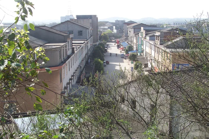
Photo adjustments
Full frame retained; proportionally resized and converted to WebP. No retouching or changes to the photographed subject. Card displays may crop the view.
- Administrative area
- District · 市辖区
- Part of
- Zhuzhou
- Chinese name
- 渌口区
- Local areas
- District guide
History
In 257 the Wu state moved the seat of Jianning county (建宁县) to Gantian (淦田), where remains of the old Jianning town survive in Gantian village. Lukou itself was long a military post: the Eastern Han general Ma Yuan (马援), sent south against Jiaozhi, is said to have camped here, and Fubo Temple (伏波庙) keeps his title. Li Daoyuan's Commentary on the Water Classic (水经注) calls the place Lupu (漉浦); the name Lukou first appears in the Book of Liang (梁书), and the Tang and Ming kept a garrison and an inspectorate here.
The town of Zhuting (朱亭) was first called Yiweidu (一苇渡), "one-reed ferry". During the Qiandao reign of the Song, Zhu Xi (朱熹) and Zhang Shi (张栻) passed through on their way to Mount Heng (衡山) and taught in a reed pavilion, and the town was renamed after Zhu. Zhuzhou County was split off from Zhuzhou city in 1965 and was replaced by Lukou District in 2018.
What to see
The Moshan site (磨山遗址), a Neolithic site, is a national key protected site. Fubo Temple and Guanwang Temple (关王庙) are listed together as places where Mao Zedong investigated the peasant movement in 1927. Zhuting keeps a group of Qing-dynasty river wharves (朱亭古码头群) and the Wang family well (汪家古井), dated to the Tang. The Nanyangqiao area (南阳桥) has Qing cliff inscriptions and the former residence of Yang Dezhi (杨得志), dated 1911. All five of these are on Hunan's provincial list, added in 2011. Lukou town's old streets include Jielong Bridge (接龙桥), Shaheli (沙河里) and Banbianjie (半边街).
Getting oriented
The Beijing–Guangzhou railway crosses the district from south to north, stopping at Lukou, Sanmen and Zhuting stations, and Provincial Road 211 runs through Lukou town. The Xiang is navigable upstream to Hengyang and down past Zhuzhou, Xiangtan and Changsha, and the Lu River once carried barges up to Liling (醴陵).
Highlights
- Moshan site 磨山遗址: Neolithic site, a national key protected site.
- Fubo Temple 伏波庙: Named for the Han general Ma Yuan; listed as a site of Mao's 1927 peasant-movement investigation.
- Zhuting old wharves 朱亭古码头群: Qing-dynasty wharves in the town named after Zhu Xi; provincial list since 2011.
- Yang Dezhi's former residence 杨得志故居: House of 1911 at Nanyangqiao; provincial list since 2011.
Sources for this guide
渌口区 · Wikipedia (Chinese) · CC BY-SA 4.0
渌口镇 · Wikipedia (Chinese) · CC BY-SA 4.0
朱亭镇 · Wikipedia (Chinese) · CC BY-SA 4.0
渌口区各级文物保护单位列表 · Wikipedia (Chinese) · CC BY-SA 4.0
株洲市 · Wikipedia (Chinese) · CC BY-SA 4.0
Original English written from the listed sources and checked sentence by sentence against quoted extracts by a separate reviewer. Updated 2026-09-25.
Explore Lukou District
Core places to explore, with English and Chinese names.
Lukou District 渌口区
Plan your visit
Getting there
Lukou District is about 15 km in a straight line from central Zhuzhou. Search for 渌口区 in a map app to find stations and your accommodation.
Where to stay →More in Zhuzhou
Sources & geographic information
Administrative names and parent areas: Official geographic directory · Reference date 2026-09-06.
Some facts checked against 渌口区 — Wikipedia contributors, CC BY-SA 4.0.
Some facts checked against 渌口镇 — Wikipedia contributors, CC BY-SA 4.0.
Some facts checked against 朱亭镇 — Wikipedia contributors, CC BY-SA 4.0.
Some facts checked against 渌口区各级文物保护单位列表 — Wikipedia contributors, CC BY-SA 4.0.
Some facts checked against 株洲市 — Wikipedia contributors, CC BY-SA 4.0.
Map data © OpenStreetMap contributors. Pins mark approximate centres, not entrances or boundaries.