


Get to know Rudong County
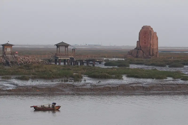
Photo adjustments
EXIF orientation normalized; resized without changing aspect ratio; converted to WebP. No subject edits.
- Administrative area
- County · 县
- Part of
- Nantong
- Chinese name
- 如东县
- Local areas
- County guide
Area & population
- Area in the source
- 1,972.00 km²
- Population · 2020
- 880,006
Source: cited geographic source, as of the dates shown.
Setting and landscape
The county is flat plain, with coastal wetlands, river mouths, sandbanks, fish ponds and salt pans. The county government puts its tidal flats at about one million mu and its sea area at 4,555 square kilometres. It has recorded 209 bird species, among them the red-crowned crane, black stork and spoon-billed sandpiper. Much of the land is new: between 1951 and 2013 Rudong enclosed tidal flats 24 times, adding nearly 600,000 mu. Engineers found hot springs three times while enclosing the Xiaoyangkou (小洋口) flats in the north-west, two of them now used for tourism.
History
The name is short for 'Rugao East' (如皋东乡): the area belonged to Rugao (如皋) until 1940, when New Fourth Army forces split the old county in two; the eastern half took the name Rudong in September 1945. In Song times its coast was a salt-making and coastal-defence area, with salt works at Bencha (栟茶), Fengli (丰利) and Matang (马塘) and a garrison at Juegang.
What to see
The site of Guoqing Temple (国清寺遗址) in Juegang, dating from the Tang, is the county's only provincial-level protected site; the temple was razed in the 1960s and rebuilt in 1991. Juegang also keeps a Qing-dynasty flagstone street (掘港石板街), and Fengli has a group of Qing buildings. The Xiaoyangkou area has been made a provincial tourist resort, with a national central fishing port, hot-spring resort and Haiyin Temple (海印寺). Stamping on the flats for clams, locally called the 'sea disco' (海上迪斯科), and kite-flying over the flats are well-known traditional activities for visitors.
Food and local products
Seafood dominates. Rudong clams (如东文蛤), with fan-shaped shells patterned in bright colours, became a geographical-indication trademark in 2014, as did Rudong striped laver (如东条斑紫菜); the county government calls Rudong the largest laver farming and processing base in China. Rudong mud snails (如东泥螺) are sold pickled in wine, and Bencha razor clams (栟茶竹蛏) are a Bencha speciality. The Langshan chicken (狼山鸡), black-feathered and red-combed, comes from Rudong and is named after Langshan near Nantong, once its export market.
Highlights
- Site of Guoqing Temple 国清寺遗址: Tang-dynasty temple site in Juegang, provincial protected site; temple rebuilt in 1991.
- Xiaoyangkou 小洋口: Provincial tourist resort on reclaimed flats, with hot springs, a fishing port and Haiyin Temple.
- Rudong clams 如东文蛤: Clams with colourful fan-shaped shells; geographical-indication trademark since 2014.
- Rudong striped laver 如东条斑紫菜: Laver from what the county calls China's largest laver base; geographical-indication trademark since 2014.
- Langshan chicken 狼山鸡: Black-feathered, red-combed local chicken from Rudong.
Sources for this guide
如东县 · Wikipedia (Chinese) · CC BY-SA 4.0
历史沿革 · Rudong County People's Government
环境资源 · Rudong County People's Government
文化遗存 · Rudong County People's Government
地方特产 · Rudong County People's Government
Original English written from the listed sources and checked sentence by sentence against quoted extracts by a separate reviewer. Updated 2026-09-25.
Explore Rudong County
Core places to explore, with English and Chinese names.
Places to explore around Rudong County
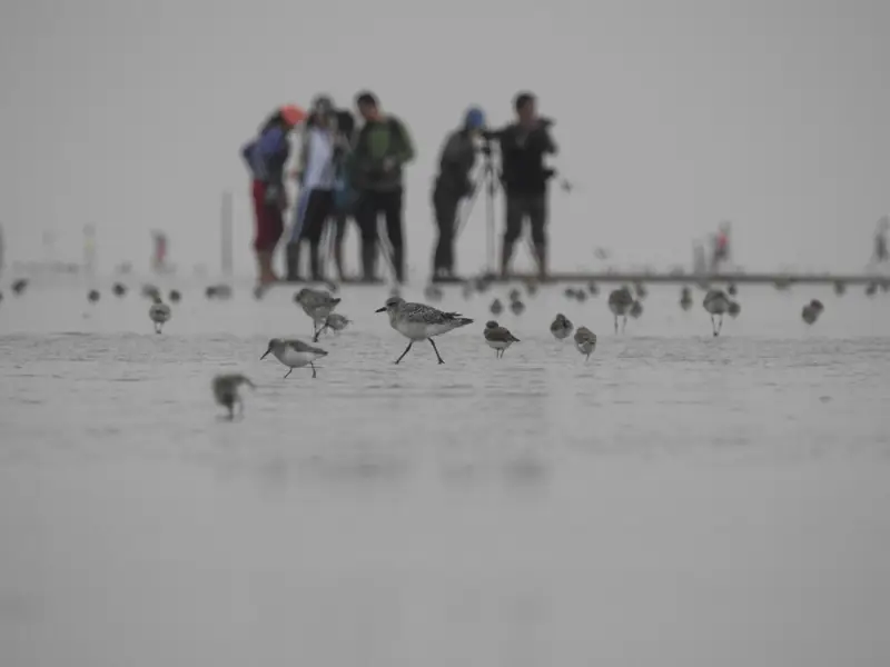 Xiaoyangkou Coastal Birdwatching Area ·
 Plan your visit
Getting there
Rudong County is about 50 km in a straight line from central Nantong. Search for 如东县 in a map app to find stations and your accommodation.
Where to stay →Build your route
Start with Xiaoyangkou Coastal Birdwatching Area. The linked place guides have entrance and visit details.
Continue with Nantong →More in Nantong
Sources & geographic information
Administrative names and parent areas: Official geographic directory · Reference date 2026-09-06.
Some facts checked against 如东县 — Wikipedia contributors, CC BY-SA 4.0.
Photo: Xiaoyangkou Coastal Birdwatching Area · Source photographer · License not provided. EXIF orientation normalized; resized without changing aspect ratio; converted to WebP. No subject edits.
Map data © OpenStreetMap contributors. Pins mark approximate centres, not entrances or boundaries.