


Get to know Rugao
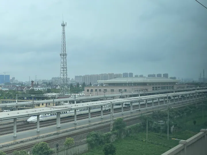
Photo adjustments
Full frame retained; proportionally resized and converted to WebP. No retouching or changes to the photographed subject. Card displays may crop the view.
- Administrative area
- County-level city · 县级市
- Part of
- Nantong
- Chinese name
- 如皋市
- Local areas
- County-level city guide
Area & population
- Area in the source
- 1,576.47 km²
- Population · 2018
- 1,241,700
Source: cited geographic source, as of the dates shown.
History
The Rugao city government dates the first record of a county here to 411. It was absorbed into Ninghai (宁海) under the Sui, re-established as a county in 952 under Taizhou (泰州), and placed under Tongzhou (通州) in 1724. In 1940–41, after the New Fourth Army arrived, the county was divided along the Tongyang Canal (通扬运河) into Ruxi (如西) and Rugao; when the town was retaken in September 1945 the western county took back the name Rugao and the eastern one became Rudong (如东). Rugao became a city on 1 June 1991.
Chinese Wikipedia notes that the old town's moats are round outside and square inside, like an old coin, and that in the Qianlong era Rugao was called the richest county north of the Yangtze in Jiangsu. The city government lists among its notable figures Mao Xiang (冒辟疆), one of the 'Four Young Masters' of the late Ming, and the Qing playwright Li Yu (李渔).
What to see
The Shuihui Garden, at 299 Bixia Road, was begun in the Wanli reign of the Ming for the Mao family, and Mao Xiang lived there at the fall of the Ming. In the Qianlong era Wang Zhiheng (汪之珩) built the Shuiming Pavilion (水明楼), a two-storey building shaped like a painted boat beside the Xibo Pond (洗钵池), which set the garden's present layout. It became a national key heritage site in 2001. Chinese Wikipedia also lists Dinghui Temple (定慧寺), whose gate faces north and which is ringed by water, and a Ming Dacheng Hall (大成殿) built entirely of nanmu wood.
Food and local products
Rugao bonsai (如派盆景) is counted by Chinese Wikipedia among the seven schools of Chinese bonsai, known for the shape summed up as 'cloud head, rain feet, beauty's waist'. The city government names white radish, pinellia (半夏) and Sanhuang chicken (三黄鸡) as local products, and Rugao ham (如皋火腿), made from the local Dongchuan pig (东串猪), is listed by Chinese Wikipedia as one of China's three great hams. The local speech, which the city government describes as a Jianghuai Mandarin dialect with a strong Wu influence, is spoken with different accents in the town, the western villages and the south.
Highlights
- Shuihui Garden 水绘园: Ming garden of the Mao family, home of Mao Xiang; national key heritage site since 2001.
- Shuiming Pavilion 水明楼: Two-storey boat-shaped pavilion by the Xibo Pond, built in the Qianlong era.
- Dinghui Temple 定慧寺: Temple with a north-facing gate, ringed by water.
- Rugao bonsai 如派盆景: School of Chinese bonsai known for 'cloud head, rain feet, beauty's waist'.
- Rugao ham 如皋火腿: Ham made from the local Dongchuan pig.
Sources for this guide
如皋市 · Wikipedia (Chinese) · CC BY-SA 4.0
历史沿革 · Rugao Municipal People's Government
人文环境 · Rugao Municipal People's Government
自然资源 · Rugao Municipal People's Government
水绘园 · Wikipedia (Chinese) · CC BY-SA 4.0
Original English written from the listed sources and checked sentence by sentence against quoted extracts by a separate reviewer. Updated 2026-09-25.
Explore Rugao
Core places to explore, with English and Chinese names.
Places to explore around Rugao
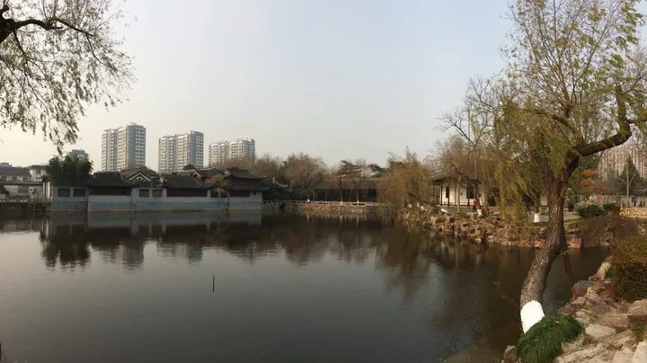 Garden pavilions beside the lake at Shuihui Garden, Rugao ·
 Plan your visit
Getting there
Rugao is about 40 km in a straight line from central Nantong. Search for 如皋市 in a map app to find stations and your accommodation.
Where to stay →Build your route
Start with Shuihui Garden. The linked place guides have entrance and visit details.
Continue with Nantong →More in Nantong
Sources & geographic information
Administrative names and parent areas: Official geographic directory · Reference date 2026-09-06.
Some facts checked against 如皋市 — Wikipedia contributors, CC BY-SA 4.0.
Some facts checked against 水绘园 — Wikipedia contributors, CC BY-SA 4.0.
Photo: Shuihui Garden · Howhowforever · CC BY-SA 3.0. Full frame retained; proportionally resized and converted to WebP. No retouching or changes to the photographed subject. Card displays may crop the view.

Map data © OpenStreetMap contributors. Pins mark approximate centres, not entrances or boundaries.