


Get to know Tongzhou District
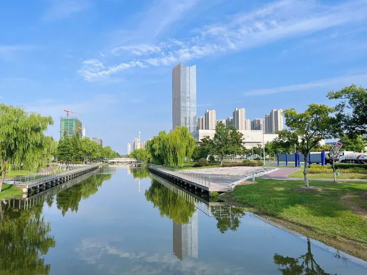
Photo adjustments
Full frame retained; proportionally resized and converted to WebP. No retouching or changes to the photographed subject. Card displays may crop the view.
- Administrative area
- District · 市辖区
- Part of
- Nantong
- Chinese name
- 通州区
- Local areas
- District guide
Area & population
- Area in the source
- 906.00 km²
- Population · 2019
- 1,675,000
Source: cited geographic source, as of the dates shown.
Setting and landscape
The district is low, fertile Yangtze delta land, generally 3.8 to 4.5 metres above sea level and as low as 2.2 metres near the coast. It has 16.27 kilometres of sea coast and 15 kilometres of Yangtze bank, and its waterways include the Tongyang (通扬运河), Tonglü (通吕运河) and Tongqi (通启运河) canals. Its river and sea mudflats are farmed for dried scallops, reeves shad and laver, and Chinese Wikipedia describes Tongzhou as the only national base for blood-clam seed; mint and lingzhi mushrooms are among its crops.
History
The land began as sandbanks in the Yangtze mouth that rose above the water in the middle of the Southern and Northern Dynasties. Its first settlers lived by boiling salt, and in the Tang it was a salt-making yard. Once the sandbanks joined the mainland at the end of the Tang, canals were dug to ship salt to Yangzhou (扬州), and farming spread. The Later Zhou founded Tongzhou in 958, a name explained by its links to the sea in the north-east and the Yangtze in the south-west. In 1912 the southern Tongzhou became Nantong County; it was renamed Tongzhou city in 1993 and became a district of Nantong in 2009.
Chinese Wikipedia calls the district the home of Zhang Jian (张謇), who came top in the late-Qing imperial examination (状元), and notes that it was named a home of quyi storytelling and ballad arts (曲艺) in 2019. Speech changes across the district: the west uses Nantong dialect, the centre the Wu-group Jinsha dialect (金沙话), and the south and east coast the Shadi dialect (沙地话).
Food and local products
Xiting crisp cake (西亭脆饼), also called Nantong crisp cake, carries the name of Xiting (西亭镇), one of the district's towns, and dates from 1866. Dough of flour, sugar, vegetable oil and a little sesame oil is rolled into thin rounds, stacked in dozens of layers into a rectangle, sprinkled with sesame and baked. The finished cake is under two centimetres thick; it is crisp and sweet when eaten dry, and keeps its layers when soaked.
Getting oriented
The district government sits in Jinxin subdistrict (金新街道). Nantong Xingdong International Airport (南通兴东国际机场), opened in 1993, is in the district. Nantong Metro Line 1 serves Pingchao (平潮) and Nantong West station, and Line 2 serves Xianfeng (先锋) and Nantong East station.
Highlights
- Xiting crisp cake 西亭脆饼: Layered baked sesame cake from Xiting, made since 1866.
Explore Tongzhou District
Core places to explore, with English and Chinese names.
Tongzhou District 通州区
Plan your visit
Getting there
Tongzhou District is about 20 km in a straight line from central Nantong. Search for 通州区 in a map app to find stations and your accommodation.
Where to stay →More in Nantong
Sources & geographic information
Administrative names and parent areas: Official geographic directory · Reference date 2026-09-06.
Some facts checked against 通州区 (南通市) — Wikipedia contributors, CC BY-SA 4.0.
Some facts checked against 西亭脆饼 — Wikipedia contributors, CC BY-SA 4.0.
Map data © OpenStreetMap contributors. Pins mark approximate centres, not entrances or boundaries.